
1957 Map of Cheatham Dam
USGS Topo · Published 1958About this map
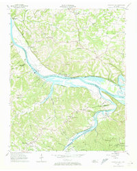
Cheatham Dam and the emerging Lake Cheatham anchor this late-1950s study of the Cumberland River valley where it forms the border between Dickson and Cheatham Counties. The landscape is defined by the sharp transition from the river bottomlands to the winding ridges of the Highland Rim, punctuated by rural communities like Chapmansboro and Bellsburg. This era captures the region as the Tennessee Central railroad still threads along the riverbanks, serving a rural economy of small settlements and isolated farmsteads. Local genealogy is well-represented through numerous country landmarks including Millers Chapel Ch, Jackson Chapel, and the Daniels Cem. Further south, the confluence of the Harpeth River at Johnson Bend provides a focal point for the Cheatham State Wildlife Management Area, showing the preservation of the river corridor amid the industrial progress represented by the dam.
Find a feature on this map
82 named features on this map. Tap any name to fly to it.
Don’t see what you’re looking for? This feature index may not catch every label — zoom into the map to look around manually.
Map Details
Editions of this 1957 Cheatham Dam Map
3 editions found
Other maps of this area

1930 · White Bluff
USGS Topo · 1:62,500

1933 · White Bluff
USGS Topo · 1:62,500

1956 · Nashville
USGS Topo · 1:250,000

1957 · Pleasant View
USGS Topo · 1:24,000

1957 · Henrietta
USGS Topo · 1:24,000

1957 · Ashland City
USGS Topo · 1:24,000

1958 · Charlotte
USGS Topo · 1:24,000

1958 · Cumberland Furnace
USGS Topo · 1:24,000
1958 · Excell
USGS Topo · 1:24,000

1959 · Nashville
USGS Topo · 1:250,000