
1957 Map of Ashland City
USGS Topo · Published 1958About this map
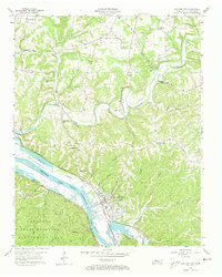
Ashland City sits at a significant bend in the Cumberland River during the late 1950s, a landscape defined by the recent creation of Cheatham Lake and its associated federal boundaries. The map documents the rural social fabric of Cheatham County through numerous community hubs like the Sweet Home Community Center and Triangle Community Center. Genealogy researchers will find significant value in the sheer density of family-named burial sites, including the Fannie Field Cem, Turner-Pardue Cem, and Hudgens Cem. The northern terrain is dissected by Sycamore Creek and its tributaries, where small settlements like Sycamore and Lockertsville remain centered around their respective churches. To the southwest, the Cheatham State Wildlife Management Area occupies the wooded bluffs, reflecting the transition from traditional river-valley farming to state-managed conservation and recreation areas.
Find a feature on this map
53 named features on this map. Tap any name to fly to it.
Don’t see what you’re looking for? This feature index may not catch every label — zoom into the map to look around manually.
Map Details
Editions of this 1957 Ashland City Map
4 editions found
Other maps of this area

1903 · Nashville
USGS Topo · 1:125,000

1930 · White Bluff
USGS Topo · 1:62,500

1931 · Ridgetop
USGS Topo · 1:62,500

1932 · Nashville
USGS Topo · 1:62,500

1933 · White Bluff
USGS Topo · 1:62,500

1935 · Ridgetop
USGS Topo · 1:62,500

1955 · Forest Grove
USGS Topo · 1:24,000

1955 · Scottsboro
USGS Topo · 1:24,000

1956 · Nashville
USGS Topo · 1:250,000

1957 · Cheatham Dam
USGS Topo · 1:24,000