1900s (20th Century) Maps of Chester County, Tennessee
Explore 27 historic maps of Chester County from the 1900s (20th Century). These maps offer a rare glimpse into what life looked like during the 1900s — showing old roads, neighborhoods, homes, and landmarks that have changed or disappeared over time.
Whether you're researching your family's past, planning a metal detecting trip, or studying how Chester County's landscape evolved across the 1900s, these high-resolution maps are a powerful tool for exploring the history of this region.
- Focus on a specific era: All maps on this page are from the 1900s, giving you a focused view of this time period.
- See what’s changed: Compare century-old streets, trails, and buildings to today's modern landscape using overlays and satellite layers.
- Research with precision: Use these maps for genealogy, historical research, land use analysis, or educational projects.
- View, download, or print: Maps are fully viewable online in high resolution, and can be downloaded or printed for your own records.
Start exploring Chester County's history through authentic maps from the 1900s. This is your window into the past.
Chester County, TN maps
(27)- 1936 Map of Leapwood
 1936 Leapwood1936 Print · USGSMcNairy County communities and Tennessee Valley Authority power projects are captured here in the mid-1930s. Trace local family history through numerous schools and churches like Leapwood Sch, Mars Hill Ch, and Hardin Beauty Sch.
 - 1936 Map of Sardis
 1936 Sardis1936 Print · USGSWest Tennessee rural life is documented here during the mid-1930s as the regional electrical grid began to expand across the landscape. Genealogists and local historians can locate early landmarks such as Taylors Store, New Hurricane Ch, and the Tri County Sch near the county lines.
 - 1936 Map of Milledgeville
 1936 Milledgeville1936 Print · USGSNear the Tennessee River in the mid-1930s, this area of West Tennessee reveals a landscape shaped by river landings and extensive drainage projects. Genealogists and historians can trace community roots through Sweeney Cem, Morris Chapel, and schools like Rock Spring Sch.
 - 1936 Map of Enville
 1936 Enville1936 Print · USGSThe crossroads of West Tennessee are captured here in the mid-1930s as rural life centered on local schools and churches. Researchers can pinpoint long-standing community hubs like Enville, Pleasant Hill Ch, and the Cherry Cem.
 - 1936 Map of Life
 1936 Life1936 Print · USGSHenderson and Chester counties appear here in the mid-thirties, showcasing a rural landscape defined by the Tennessee Basin Divide. Genealogists can trace family names through numerous sites like Patterson Cem, Sainte Chapel, and the community Poorhouse.
 - 1936 Map of Mt. Peter
 1936 Mt. Peter1936 Print · USGSMcNairy County was undergoing significant modernization in the mid-1930s as federal power projects reached rural Tennessee. Genealogists can trace family footprints near Beauty Hill Ch, Mackey Sch, and the local Cem at Mt Peter.
 - 1949 Map of Leapwood, 1952 Print
 1949 Leapwood1952 Print · USGSMcNairy County just before the mid-century mark shows a landscape of ridge-top farms and creek-bottom drainage projects. Genealogists can locate family landmarks like Baucum Cem, Hardin Beauty Church, and the Mud Creek Valley School.2 unique versions available
 - 1949 Map of Mt. Peter, 1952 Print
 1949 Mt. Peter1952 Print · USGSMcNairy and Chester Counties are captured here in the late 1940s, showing a rural landscape defined by the Tennessee Valley Divide. Researchers can trace old rail life in Finger or locate family sites like Mackey Sch and Mt Zion Ch.2 unique versions available
 - 1949 Map of Sardis, 1952 Print
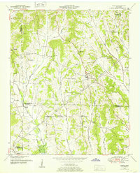 1949 Sardis1952 Print · USGSSardis and the borderlands of Henderson, Chester, and Hardin Counties are captured here at the end of the 1940s. Genealogists and historians can locate family landmarks such as Brazelton Cem, Maria Bluff Ch, and the rural Tri-County School among the area's many drainage canals.2 unique versions available
 - 1949 Map of Milledgeville, 1952 Print
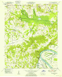 1949 Milledgeville1952 Print · USGSWest Tennessee rural life and river geography are captured here in the late forties at the junction of Chester, McNairy, and Hardin counties. Researchers can trace family history at Sweeney Cem or locate the rural crossroads of Morris Chapel and Coffee Landing.2 unique versions available
 - 1950 Map of Life, 1952 Print
 1950 Life1952 Print · USGSHenderson and Chester County rural life in the early fifties was centered around small crossroads settlements and family-named landmarks. Genealogists can trace local heritage through sites like the Poorhouse, the County Farm Cem, and schools like Sheppard Sch.
 - 1950 Map of Enville, 1952 Print
 1950 Enville1952 Print · USGSMid-century West Tennessee comes to life here along the Tennessee Valley Divide at the meeting of three counties. Genealogists and local historians can trace family locations through numerous rural landmarks like Grove Springs Cem, Bailey Chapel, and Roby Sch.3 unique versions available
 - 1950 Map of Hornsby, 1973 Print
 1950 Hornsby1973 Print · USGSHardeman County in the early fifties is captured here through its river-bottom landscapes and rural centers like Hornsby. Researchers can trace old family burial sites at Wyatt Cemetery, locate rural schools like Walnut Grove School, and follow the Gulf Mobile and Ohio rail line.3 unique versions available
 - 1951 Map of Hornsby
 1951 Hornsby1951 Print · USGSThe area around Hornsby in the early fifties was a landscape of river bottoms and rail-side settlements. Researchers can trace family roots at Brints Chapel and Grantham Cem or follow the old Gulf Mobile and Ohio line.
 - 1951 Map of Rose Creek, 1952 Print
 1951 Rose Creek1952 Print · USGSMcNairy County hill country life is captured here in the early fifties, showing a landscape of small farms and creek-bottom timber. Researchers can trace rural community foundations at Prices Chapel, New Bethel Ch, and the Red Oak Sch site.3 unique versions available
 - 1953 Map of Beech Bluff, 1955 Print
 1953 Beech Bluff1955 Print · USGSMadison and Chester Counties are captured here in the early 1950s, centered on the river-fed agricultural lands of West Tennessee. Genealogists can trace family roots at numerous rural landmarks, from Potts Chapel and Beech Bluff Sch to the crossroads at Five Points.3 unique versions available
 - 1955 Map of Luray, 1956 Print
 1955 Luray1956 Print · USGSHenderson and Chester counties are captured here in the mid-fifties, showing a landscape defined by the Nashville Chattanooga and St Louis rail line. Genealogists can trace family names through numerous landmarks like Buckley Cem, Jackson Range Sta, and the New Friendship Sch.2 unique versions available
 - 1956 Map of Blytheville, 1964 Print
 1956 Blytheville1964 Print · USGSWest Tennessee and the Arkansas Delta come alive in this mid-century survey of the river-and-rail corridor connecting Memphis to Jackson. Genealogists and historians can trace the rail lines of the Louisville and Nashville RR and locate landmarks like Western State Hospital or Fort Pillow State Prison Farm.2 unique versions available
 - 1959 Map of Blytheville
 1959 Blytheville1959 Print · USGSWest Tennessee and Northeast Arkansas meet along the river in the late fifties, during a period of steady industrial and agricultural growth. Genealogists can trace the rail corridors of the Illinois Central through Jackson or explore landmarks like Shiloh National Military Park and Fort Pillow State Prison.
 - 1961 Map of Medon, 1964 Print
 1961 Medon1964 Print · USGSThe West Tennessee borderlands of Madison, Chester, and Hardeman counties are captured here in the early sixties as a network of rail lines and rural parishes. Genealogists can locate family landmarks like the Rosenwald Sch, Farlow Cem, and Big Springs Ch.3 unique versions available
 - 1961 Map of Silerton, 1964 Print
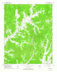 1961 Silerton1964 Print · USGSThe Tennessee countryside along the Hardeman and Chester county line is shown here in the early sixties as a region of deep creek bottoms and rail-side hamlets. Researchers can trace rural family sites through numerous landmarks like Coopers Chapel Cem, Old Center Ch, and the small siding at Todd Siding.2 unique versions available
 - 1961 Map of Henderson, 1964 Print
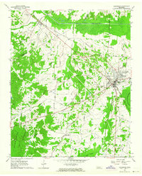 1961 Henderson1964 Print · USGSChester County at the dawn of the 1960s shows a landscape of established rail towns and significant archaeological sites. Researchers can locate family landmarks such as Montezuma Cem and Rogers Cem or trace the early campus footprint of Freed Hardeman College.3 unique versions available
 - 1961 Map of Masseyville, 1964 Print
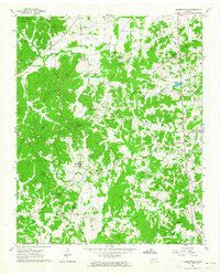 1961 Masseyville1964 Print · USGSThe rural borderlands of Chester and McNairy Counties are captured here in the early 1960s, showing a landscape of timbered hills and creek bottoms. Genealogists can trace family landmarks across Hickory Corners, find Warble Cem, or locate the Old Friendship Sch near the Hatchie River.
 - 1961 Map of Jacks Creek, 1964 Print
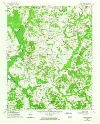 1961 Jacks Creek1964 Print · USGSWest Tennessee hill country and river bottoms are captured here in the early sixties, showing the rural crossroads of Chester and Henderson Counties. Genealogists can trace family footprints at Holly Springs Ch, the Gibson Rosenwald Sch, or the small settlement of Sweet Lips.2 unique versions available
 - 1971 Map of Teague
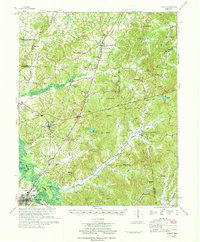 1971 Teague1971 Print · USGSThe Hatchie River lowlands and the uplands of Chickasaw State Park are captured here in the early seventies. Genealogists and historians can trace rail-side communities like Medon and Toone or locate family sites like Maple Springs Cem and Toone Sch.
Showing maps 1-25 of 27
Top cities of Chester County
Frequently asked questions
- What are the different types of historical maps available for Chester County?
- What is the oldest map of Chester County?
- Where can I purchase historical maps of Chester County for my home or office?
- Where can I download high-res historical maps of Chester County?
- Are there historical topographic maps available for Chester County?
- Is there historical aerial imagery available for Chester County?
- Where are historical maps of Chester County sourced from?