1900s (20th Century) Maps of Claiborne County, Tennessee
Explore 58 historic maps of Claiborne County from the 1900s (20th Century). These maps offer a rare glimpse into what life looked like during the 1900s — showing old roads, neighborhoods, homes, and landmarks that have changed or disappeared over time.
Whether you're researching your family's past, planning a metal detecting trip, or studying how Claiborne County's landscape evolved across the 1900s, these high-resolution maps are a powerful tool for exploring the history of this region.
- Focus on a specific era: All maps on this page are from the 1900s, giving you a focused view of this time period.
- See what’s changed: Compare century-old streets, trails, and buildings to today's modern landscape using overlays and satellite layers.
- Research with precision: Use these maps for genealogy, historical research, land use analysis, or educational projects.
- View, download, or print: Maps are fully viewable online in high resolution, and can be downloaded or printed for your own records.
Start exploring Claiborne County's history through authentic maps from the 1900s. This is your window into the past.
Claiborne County, TN maps
(58)- 1900 Map of Maynardville
 1900 Maynardville1900 Print · USGSEast Tennessee was a world of river fords and mountain gaps at the turn of the century, dominated by the winding Clinch and Powell rivers. Genealogists can trace family roots through specific landmarks like Massongills Mill, Church Grove, and Sharps Chapel.4 unique versions available
 - 1903 Map of Middlesboro
 1903 Middlesboro1903 Print · USGSMiddlesboro sits at the gateway to the mountains in this early century survey of the Kentucky, Tennessee, and Virginia borders. Researchers can trace early migration routes and mountain passes like the famous Cumberland Gap, Baptist Gap, and Yellow Slip Gap.
 - 1927 Map of Middlesboro, 1955 Print
 1927 Middlesboro1955 Print · USGSThe Cumberland Gap region comes alive in this survey from the late 1920s, showing the intersection of three states and the rugged rail networks that shaped it. Trace family roots and local industry at Gibson Station PO, Lincoln Memorial University, and Ellison Mill.
 - 1930 Map of Middlesboro
 1930 Middlesboro1930 Print · USGSThe tri-state border region comes alive in the late 1920s, centered on the strategic mountain pass at Cumberland Gap. Genealogists and historians can trace family locations near Middlesboro, early campus sites at Lincoln Memorial University, and rural landmarks like Ellison Mill.4 unique versions available
 - 1932 Map of Hagan
 1932 Hagan1932 Print · USGSThe rugged borderlands of Kentucky and Virginia come to life in this early 1930s survey of the high gaps and hollows. Researchers can locate remote mountain landmarks like Hensley Sch, Feepee Store, and the scattered cabins at Alva.3 unique versions available
 - 1935 Map of Tate Springs
 1935 Tate Springs1935 Print · USGSThe river valleys of Grainger County are captured here in the mid-1930s as the Tennessee Valley Authority began planning the reservoir. Trace family history through local landmarks like Lawson Mill, Swan Island Ferry, and the community at Tate Springs.
 - 1935 Map of Mingo Mountains
 1935 Mingo Mountains1935 Print · USGSClaiborne County, Tennessee, is captured in the mid-1930s as the Tennessee Valley Authority began its work in the region. Researchers can locate family landmarks like Alexander Cem, the Powell Valley Sch, and the waters of Van Babber Spring.
 - 1935 Map of Colman
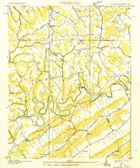 1935 Colman1935 Print · USGSThe Tennessee-Virginia borderlands in the mid-1930s show a landscape defined by the winding Powell River and the steep slopes of Wallen Ridge. Genealogists and historians can trace family locations near Brooks Cem, follow old river crossings like Brooks Ferry, or locate rural landmarks like Yeary Mill.2 unique versions available
 - 1935 Map of Cumberland Gap
 1935 Cumberland Gap1935 Print · USGSThe tri-state corner of Tennessee, Kentucky, and Virginia comes alive in the mid-1930s as the Tennessee Valley Authority begins transforming the Powell River valley. Trace the legendary Wilderness Trail past Lincoln Memorial University or locate family sites like Minton Mill and Sproles Chapel Sch.
 - 1935 Map of Howard Quarter
 1935 Howard Quarter1935 Print · USGSClaiborne and Hancock counties are captured here in the mid-1930s as the Tennessee Valley Authority began its work on the Clinch River. Genealogists can trace family landmarks like Turner Cem, St Elmo Ch, and the site of CCC Camp No 27.
 - 1935 Map of Swan Island
 1935 Swan Island1935 Print · USGSHancock County life in the mid-1930s was defined by the ridges and the river, showing a landscape of small farms and vital ferry crossings. Researchers can trace ancestral footprints at Leffew Store, Ida Chapel, and the river landings at Swan Island Ferry.
 - 1935 Map of Avondale
 1935 Avondale1935 Print · USGSGrainger County is captured here in the mid-1930s as the rising Norris Reservoir began to reshape the landscape. Local historians can locate vanished landmarks like Avondale Sch, Shields Cem, and the original crossing at Turley Bridge.
 - 1935 Map of Wheeler
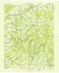 1935 Wheeler1935 Print · USGSClaiborne County in the mid-thirties shows a landscape of deep river bends and historic migration trails along the Virginia border. Genealogists can locate family-named sites like Crain Cem, Nash Mill, and the riverside crossing at Cosby Ford.
 - 1935 Map of Well Spring
 1935 Well Spring1935 Print · USGSMid-1930s Tennessee life is documented here as the rising waters of the Norris Reservoir began to reshape the valleys of Campbell County. Researchers can trace ancestral community landmarks including Speedwell Academy, Well Spring, and the Bethlehem Ch.
 - 1936 Map of Powder Springs
 1936 Powder Springs1936 Print · USGSNortheast of Knoxville in the mid-1930s, this area shows a landscape of deep valleys and rising water as the Norris Reservation took shape. Researchers can trace family sites like Haynes Store, rural schools including Lay Sch, and the Southern Railway line through Powder Springs.
 - 1936 Map of Ausmus
 1936 Ausmus1936 Print · USGSThe Powell River valley was undergoing a massive transformation in the mid-1930s as the new reservoir began to fill. Local historians can trace old homesteads, rural schools like Shipley Sch, and family landmarks including Stiner Store and the CCC Camp TVA No 15.
 - 1936 Map of Clouds
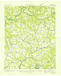 1936 Clouds1936 Print · USGSClaiborne County sits at a crossroads of change in the mid-1930s as the TVA reservoir transforms the Powell River valley. Researchers can trace ancestral footprints through numerous rural landmarks like Kecks Store, the Straight Creek Mines, and Ford Chapel Cem.2 unique versions available
 - 1936 Map of Rutledge
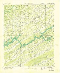 1936 Rutledge1936 Print · USGSClinch River communities faced a major transformation in the mid-1930s as the new reservoir began to fill the valley. You can trace the pre-inundation landscape through landmarks like Beeler Mill, the Straight Creek Mines Sch, and Lone Mountain.
 - 1936 Map of Mc Lean Rock
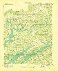 1936 Mc Lean Rock1936 Print · USGSUnion and Claiborne counties appear just as the Tennessee Valley Authority was reshaping the land in the mid-1930s. Researchers can locate family roots at Rose Hill Ch & Cem, trace the early operations of Lead Mine, or find the historic Speedwell Academy.
 - 1936 Map of Dutch Valley
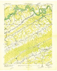 1936 Dutch Valley1936 Print · USGSGrainger County emerges in the mid-1930s as the Tennessee Valley Authority reshapes the landscape with the rising waters of Norris Reservoir. Genealogists and local historians can trace the foundations of Rutledge and Washburn alongside rural landmarks like Beeler Mill and Noe Chapel.
 - 1936 Map of Tazewell
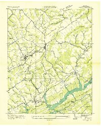 1936 Tazewell1936 Print · USGSClaiborne County appears in the mid-1930s just as the Tennessee Valley Authority began filling the Norris Reservoir. Genealogists and researchers can locate numerous family-named landmarks like Oak Cem, the Greer Tunnel, and rural centers such as Memorial Consolidated Sch.
 - 1938 Map of Avondale, 1954 Print
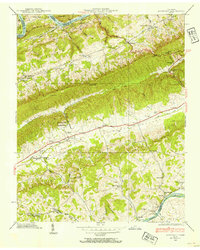 1938 Avondale1954 Print · USGSEast Tennessee's ridge-and-valley landscape is frozen in time during the late 1930s as the Tennessee Valley Authority began transforming the region's river systems. Researchers can trace ancestral locations through the Avondale Cem, local schools like Prospect Sch, and landmarks including Turley Mill and Idol Cross Roads.
 - 1939 Map of Avondale
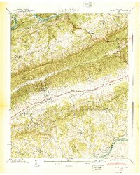 1939 Avondale1939 Print · USGSGrainger County in the late thirties shows a landscape shaped by the new Norris Reservoir and ancient Appalachian ridges. Family historians can locate dozens of specific sites including Avondale Cem, Turley Mill, and schools like Clinch Mtn Sch.2 unique versions available
 - 1941 Map of Dutch Valley, 1963 Print
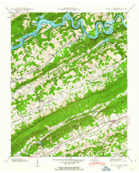 1941 Dutch Valley1963 Print · USGSGrainger County is captured here in the early 1940s, just as the regional landscape was being reshaped by the Clinch River Reservoir. Genealogists and historians can locate numerous family sites like Bunchtown Cem and Rooker Cem alongside rural landmarks like Beeler Mill and Noe Chapel Sch.4 unique versions available
 - 1941 Map of Swan Island, 1965 Print
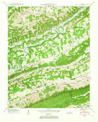 1941 Swan Island1965 Print · USGSHancock County in the early 1940s is captured in this survey of the river-carved ridges along the Clinch River. Researchers can locate dozens of family landmarks, from Lawson Mill and Manning Ferry to the Barnard Cem and Williams Cem.2 unique versions available
Showing maps 1-25 of 58
Top cities of Claiborne County
- Harrogate historical maps
- New Tazewell historical maps
- Tazewell historical maps
- Cumberland Gap historical maps
Frequently asked questions
- What are the different types of historical maps available for Claiborne County?
- What is the oldest map of Claiborne County?
- Where can I purchase historical maps of Claiborne County for my home or office?
- Where can I download high-res historical maps of Claiborne County?
- Are there historical topographic maps available for Claiborne County?
- Is there historical aerial imagery available for Claiborne County?
- Where are historical maps of Claiborne County sourced from?