Old Maps of Crockett County, Tennessee for Genealogy
Trace your family roots with 75 historic maps of Crockett County. These high-res maps reveal old neighborhoods, homesites, landmarks, and streets — helping you uncover where your ancestors lived and how the area evolved over time.
- Explore historic neighborhoods: Identify where your relatives may have lived in the 1800s or 1900s.
- Compare maps over time: Trace the changes in streets, buildings, and landmarks for multi-generational research.
- Perfect for genealogy & ancestry research: Used by family historians and researchers to map out lineage and migration.
These maps are an incredible resource for exploring your personal connection to Crockett County's past.
Crockett County, TN maps
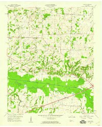
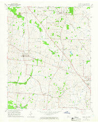
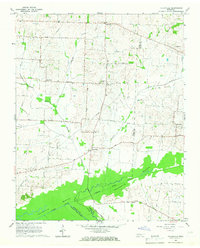
(75)- 1939 Map of Halls, 1943 Print
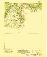 1939 Halls1943 Print · USGSLauderdale and Dyer Counties are mapped here during the late 1930s as the river-and-rail economy shaped West Tennessee life. Genealogists and researchers can trace the rural communities of Unionville, Fowlkes, and Key Corner, alongside landmark sites like Charles Chapel and the Nankipoo Sch.
 - 1952 Map of Bonicord, 1953 Print
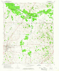
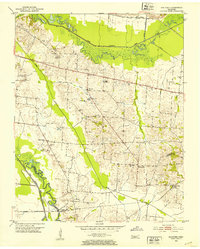 1952 Bonicord1953 Print · USGSDyer and Crockett counties are captured here in the early fifties, showing a rural landscape defined by the river forks and small country crossroads. Genealogists can trace family names through numerous burial sites like St Peter Cem and churches such as Palestine Ch or Zion Hill Ch.2 unique versions available
 - 1952 Map of Chestnut Bluff, 1953 Print
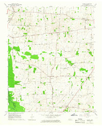
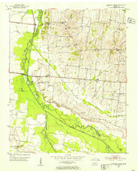 1952 Chestnut Bluff1953 Print · USGSCrockett County and its river-carved borders are captured here in the early fifties, before modern highway expansion altered the rural landscape. Researchers can locate family landmarks and community anchors like Hellens Bluff Sch, Archer Chapel, and the Young Cem.2 unique versions available
 - 1956 Map of Dyersburg, 1960 Print
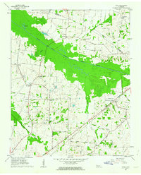
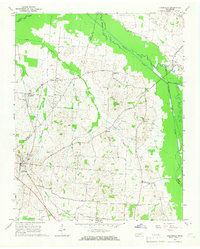
 1956 Dyersburg1960 Print · USGSThe Four Rivers region comes alive in the mid-fifties, capturing the intricate borderlands of Tennessee, Kentucky, and Missouri. Genealogists and historians can trace the rail-and-river networks connecting Dyersburg, Caruthersville, and the shoreline of Reelfoot Lake.4 unique versions available
 - 1956 Map of Blytheville, 1964 Print
 1956 Blytheville1964 Print · USGSWest Tennessee and the Arkansas Delta come alive in this mid-century survey of the river-and-rail corridor connecting Memphis to Jackson. Genealogists and historians can trace the rail lines of the Louisville and Nashville RR and locate landmarks like Western State Hospital or Fort Pillow State Prison Farm.2 unique versions available
 - 1959 Map of Blytheville
 1959 Blytheville1959 Print · USGSWest Tennessee and Northeast Arkansas meet along the river in the late fifties, during a period of steady industrial and agricultural growth. Genealogists can trace the rail corridors of the Illinois Central through Jackson or explore landmarks like Shiloh National Military Park and Fort Pillow State Prison.
 - 1959 Map of Bells, 1960 Print
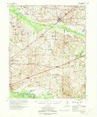
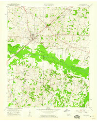 1959 Bells1960 Print · USGSWest Tennessee agriculture and rail transport intersect in the late fifties where the Gulf Mobile and Ohio meets the L&N at Bells. Local researchers can trace family roots through several rural landmarks, including Morris Hill Sch, Belleview Cem, and East Haywood Ch.2 unique versions available
 - 1959 Map of Adair, 1960 Print
 1959 Adair1960 Print · USGSWest Tennessee’s rural landscape is captured here in the late fifties, centered on the Adair community and the South Fork Forked Deer River. Researchers can trace old family burial sites at Jewette Cem and McLemore Cem or locate the historic Gulf Mobile and Ohio rail line.4 unique versions available
 - 1959 Map of Humboldt, 1960 Print
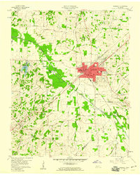 1959 Humboldt1960 Print · USGSHumboldt and the surrounding West Tennessee countryside are captured here in the late fifties, during a period of steady growth and rail-side industry. Genealogists can locate family landmarks like Mason Grove or trace ancestors at Rose Hill Cemetery and New Shiloh Ch.2 unique versions available
 - 1961 Map of Jones, 1963 Print
 1961 Jones1963 Print · USGSHaywood and Crockett counties are captured here in the early sixties, a landscape defined by the winding South Fork Forked Deer River. Family researchers can trace ancestral locations near Owl City, Wortham Chapel Cemetery, and the Louisville and Nashville rail line.2 unique versions available
 - 1961 Map of Halls, 1965 Print
 1961 Halls1965 Print · USGSLauderdale and Dyer counties are shown in the early sixties as the West Tennessee landscape hummed with activity along the Illinois Central tracks. Researchers can trace rural lineages through dozens of named sites like Miller Chapel Cem, Benton Sch, and the U. S. Military Reservation.
 - 1964 Map of Maury City, 1966 Print
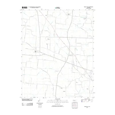
 1964 Maury City1966 Print · USGSCrockett County life in the mid-1960s is centered on rural crossroads and the rail line connecting Maury City to Alamo. Researchers can trace family history through a network of local landmarks like Hamlett Robertson Sch and the Pond Creek Cem.2 unique versions available
 - 1964 Map of Alamo, 1966 Print
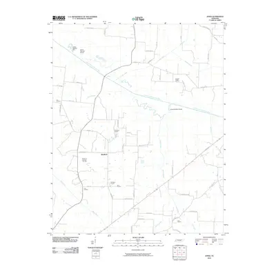
 1964 Alamo1966 Print · USGSCrockett County in the mid-1960s was a landscape defined by its rail-connected town centers and fertile river bottoms. Local historians can trace the legacy of small communities like Coxville or find family roots at Quincy Cem and Mt Olive Ch.2 unique versions available
 - 1964 Map of Brazil, 1966 Print
 1964 Brazil1966 Print · USGSWest Tennessee rural life in the mid-sixties centered on crossroads communities and small parish churches across the Gibson and Crockett county lines. Genealogists can locate family landmarks like Walnut Grove Cem, the community of Frog Jump, and Doris Chapel.
 - 1965 Map of Friendship, 1967 Print
 1965 Friendship1967 Print · USGSCrockett County farm life and river-bottom landscapes are captured here in the mid-1960s. Genealogists can trace family connections through rural landmarks like Bethesda Ch, the rail siding at Tigrett, and the settlement of Elizabeth.2 unique versions available
 - 1965 Map of Tatumville, 1967 Print
 1965 Tatumville1967 Print · USGSDyer and Gibson Counties are shown here during the mid-1960s, defined by the winding course of the Forked Deer River. Researchers can trace ancestral locations near Tatumville, Churchton, and Atkins Cem, or locate rural churches such as Mt Tirzah Ch.2 unique versions available
 - 1970 Map of Bells
 1970 Bells1970 Print · USGSWest Tennessee river bottoms and upland farms come alive in this 1970s survey of the Haywood and Crockett county border. Researchers can trace historic family burial sites at Magnolia Cem and Hess Cem or locate vanished local schools such as Bradford Sch.
 - 1983 Map of Dyersburg
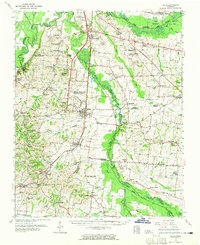
 1983 Dyersburg1983 Print · USGSSpanning the Mississippi River at the start of the 1980s, this area shows the vital river-and-rail connections between Tennessee and Missouri. Researchers can trace family sites at Mount Pisgah Cemetery or study the evolving shoreline near Caruthersville and Reelfoot Lake.
 - 1986 Map of Blytheville
 1986 Blytheville1986 Print · USGSThe Arkansas-Tennessee borderlands appear here in the mid-eighties, centered on the mighty Mississippi River and its shifting islands. Trace the footprints of Blytheville Air Force Base, old river towns like Golddust, and the extensive grounds of the Fort Pillow State Prison Farm.2 unique versions available
 - 1986 Map of Milan
 1986 Milan1986 Print · USGSWest Tennessee in the mid-eighties shows a landscape defined by industrial military sites and expansive state forests. Trace the rail lines of the Seaboard System RR, locate the Milan Arsenal, or explore the protected lands of Natchez Trace State Forest.2 unique versions available
 - 2010 Map of Bells, 2010 Print
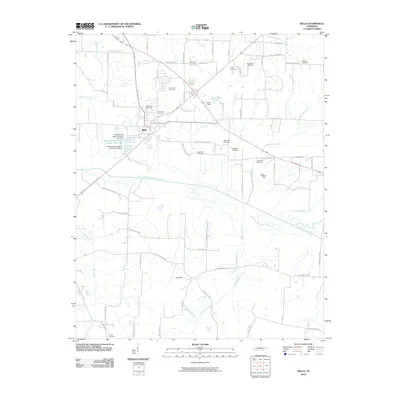 2010 Bells2010 Print · USGSCovers Crockett County, including Bells, Providence, and other nearby areas
 - 2010 Map of Humboldt, 2010 Print
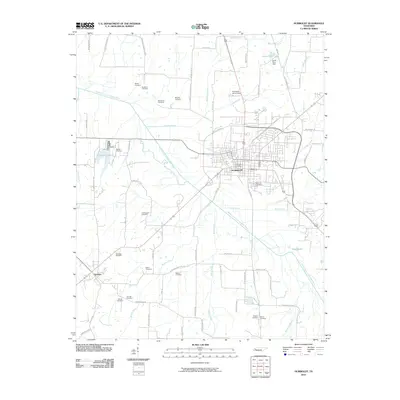 2010 Humboldt2010 Print · USGSCovers Crockett County, including Humboldt, Three Way, and other nearby areas
 - 2010 Map of Maury City, 2010 Print
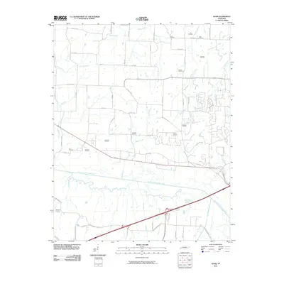
 2010 Maury City2010 Print · USGSCovers Crockett County, including Alamo, Maury City, and other nearby areas
 - 2010 Map of Adair, 2010 Print
 2010 Adair2010 Print · USGSCovers Crockett County, including Jackson, Windy City, and other nearby areas
 - 2010 Map of Jones, 2010 Print
 2010 Jones2010 Print · USGSCovers Crockett County, including Jones, Crossroads, and other nearby areas
Showing maps 1-25 of 75
Top cities of Crockett County
- Alamo historical maps
- Bells historical maps
- Maury City historical maps
- Friendship historical maps
- Gadsden historical maps
Frequently asked questions
- What are the different types of historical maps available for Crockett County?
- What is the oldest map of Crockett County?
- Where can I purchase historical maps of Crockett County for my home or office?
- Where can I download high-res historical maps of Crockett County?
- Are there historical topographic maps available for Crockett County?
- Is there historical aerial imagery available for Crockett County?
- Where are historical maps of Crockett County sourced from?