Old Maps of Davidson County, Tennessee for Hiking & Exploration
Hike through history with 162 historic maps of Davidson County. Explore old trails, ghost towns, and forgotten backroads — perfect for outdoor adventurers and local explorers.
- Rediscover forgotten places: Map out old mining camps, roads, and footpaths that no longer exist on modern maps.
- Layer with modern tools: Combine with LiDAR or satellite views to plan hikes through historical terrain.
- Made for exploration: Popular among hikers, overlanders, and local history lovers.
Use these maps to find adventure and explore the hidden past of Davidson County.
Davidson County, TN maps
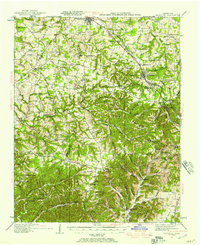
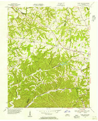
(162)- 1901 Map of Colombia
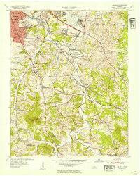
 1901 Colombia1901 Print · USGSMiddle Tennessee at the close of the century reveals a landscape shaped by river bends and a dense network of turnpikes. Genealogists can trace family roots through settlements like Santa Fe and Warner or locate landmarks such as the U.S. Arsenal and Zion Ch.3 unique versions available
 - 1903 Map of Nashville
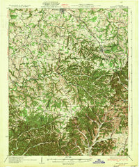
 1903 Nashville1903 Print · USGSTennessee's capital region is captured at the dawn of the 1900s, when iron pikes and river locks dominated local commerce. Trace ancestral routes along Stewarts Ferry Pike, find rural landmarks like Curry Mill, or locate historical sites like The Hermitage.4 unique versions available
 - 1930 Map of White Bluff, 1953 Print
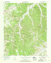
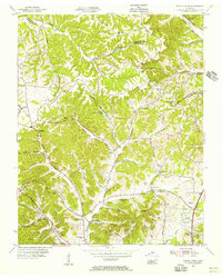
 1930 White Bluff1953 Print · USGSMiddle Tennessee in the 1930s is defined by the serpentine bends of the Harpeth River and the steam-era dominance of the Nashville Chattanooga and St Louis RR. Genealogists and historians can locate vanished country schools like Opossum Sch and trace early road networks including the Dickson Turnpike.
 - 1931 Map of Ridgetop, 1957 Print
 1931 Ridgetop1957 Print · USGSUpper Middle Tennessee in the early thirties reveals a landscape of ridge-top towns and deep hollows. Genealogists can trace family footprints through dozens of rural landmarks like St Michaels Ch, Gordons Store, and the old Ridgetop Sta.2 unique versions available
 - 1932 Map of Hermitage
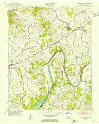
 1932 Hermitage1932 Print · USGSGreater Nashville and its rural eastern reaches come alive in the early 1930s, documenting the river-bend communities and pike roads before modern sprawl. Genealogists can trace family roots through dozens of local landmarks like Woodbine P O, Clover Bottom, and the Andrew Jackson Sch.3 unique versions available
 - 1932 Map of Nashville
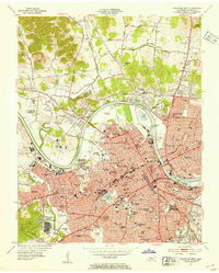
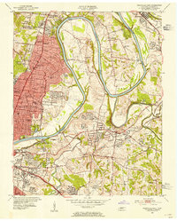
 1932 Nashville1932 Print · USGSNashville and its river bends are captured here in the early thirties, showing a city expanding toward suburbs like Belle Meade and Glendale Park. Genealogists can locate family landmarks like Loves Ch, Brentwood Sta, and numerous rural schools from Gower Sch to Ash Grove Sch.2 unique versions available
 - 1933 Map of White Bluff
 1933 White Bluff1933 Print · USGSThe Tennessee river country in the early thirties is defined here by the winding loops of the Harpeth River and the rail line through White Bluff. Genealogists and researchers can trace rural life through landmarks like Mound Bottom, Frog Pond Ch, and Opossum Sch.
 - 1935 Map of Ridgetop
 1935 Ridgetop1935 Print · USGSNorthern Tennessee's ridge country is captured here between the mid-twenties and early thirties, showing a landscape tied to the Louisville and Nashville railroad. Genealogists can trace family roots through numerous local landmarks like Bethlehem Sch, Gordons Store, and St Michaels Ch.2 unique versions available
 - 1942 Map of Gallatin
 1942 Gallatin1942 Print · USGSThe Tennessee-Kentucky borderlands were a crossroads of river and rail during the early war years. Genealogists and historians can trace family roots through dozens of named settlements like Bethpage, Prices Mill, and Mitchellville, or locate historic river crossings such as Kirkpatricks Ferry.
 - 1942 Map of Lebanon, 1944 Print
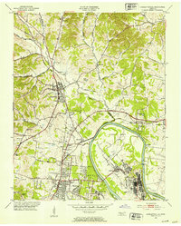
 1942 Lebanon1944 Print · USGSMiddle Tennessee at the start of the war years reveals a landscape of historic homesteads and burgeoning military infrastructure. Genealogists and historians can trace family locations near The Hermitage, follow the Tennessee Central rail lines, or locate the newly established Smyrna Air Base.
 - 1951 Map of Fairview, 1957 Print
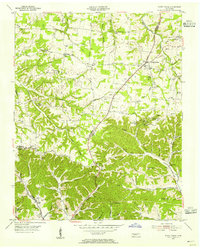
 1951 Fairview1957 Print · USGSThe rural borderlands of Williamson and Davidson counties are captured here in the early 1950s, centered on the South Fork Harpeth River. Genealogists can trace family names through the McPherson Cem Graveyard, Beasley Ch, and Fernvale Sch.4 unique versions available
 - 1952 Map of Goodlettsville, 1953 Print
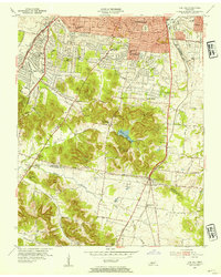
 1952 Goodlettsville1953 Print · USGSNorth of Nashville in the early fifties, the landscape around the Cumberland River reflects a mix of industrial river towns and rural crossroads. Genealogists can trace family footprints through numerous local landmarks like Lumsley Church, Old Center, and the sprawling grounds of Madison College.
 - 1952 Map of Hendersonville, 1953 Print
 1952 Hendersonville1953 Print · USGSSumner County is captured here in the early fifties, before the rapid suburban expansion of the Nashville region. Genealogists can locate family landmarks such as Shackle Island, Stark Knob Ch, and the winding Walton Ferry Road along the river.
 - 1952 Map of Hermitage, 1954 Print
 1952 Hermitage1954 Print · USGSDavidson and Wilson counties are captured in the early fifties, showing the rural landscapes around the Cumberland River before significant suburban growth. Trace family roots at The Hermitage, Bakers Grove Ch, and the Confederate Memorial Cem.
 - 1952 Map of Nashville West, 1954 Print
 1952 Nashville West1954 Print · USGSNashville's western corridor and the winding Cumberland River are captured here in the early fifties during a period of significant institutional growth. Researchers can locate numerous historic campuses and civic sites, including Fisk University, the State Penitentiary, and Cumberland Airfield.2 unique versions available
 - 1952 Map of La Vergne, 1954 Print
 1952 La Vergne1954 Print · USGSThe rural border of Davidson and Rutherford counties is documented here in the early fifties, showing a landscape defined by the winding Stones River. Genealogists and historians can locate numerous small burial sites like Eskridge Cem and the Slave Cem, alongside landmarks such as Sewart Air Force Base.2 unique versions available
 - 1952 Map of Nashville East, 1954 Print
 1952 Nashville East1954 Print · USGSEast Nashville and the Cumberland River are captured in the early fifties as post-war growth reaches Donelson and Inglewood. Trace family history at Mount Olivet Cemetery or locate old landmarks like the State School for the Blind and the Phosphate Mine.
 - 1952 Map of Antioch, 1954 Print
 1952 Antioch1954 Print · USGSIn the early fifties, southeast Davidson County was a landscape of expanding rail hubs and rural crossroads. Researchers can trace the layout of Radnor yards, the original Nashville Municipal Airport (Berry Field), and community landmarks like Antioch and Whitsetts Cem.2 unique versions available
 - 1953 Map of Oak Hill, 1954 Print
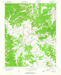
 1953 Oak Hill1954 Print · USGSSouth of Nashville in the early fifties, this area shows a landscape of growing suburbs and institutional landmarks before the interstate era. Genealogists and historians can trace family locations near Woodlawn Cem, Robertson Academy, and Brentwood Sta.2 unique versions available
 - 1954 Map of White House, 1955 Print
 1954 White House1955 Print · USGSThe Tennessee borderlands of Robertson and Sumner counties are captured here in the mid-1950s. Family researchers can trace dozens of homesteads and burial grounds like the Strickland Cem, alongside landmarks such as Indian Cave and White House.4 unique versions available
 - 1955 Map of Whites Creek, 1956 Print
 1955 Whites Creek1956 Print · USGSDavidson County north of Nashville was a landscape of steep ridges and deep hollows in the mid-1950s. Family historians can trace ancestral lands through named features like Bennett Hollow or find rural landmarks like Union Hill Ch and Joelton.4 unique versions available
 - 1955 Map of Forest Grove, 1956 Print
 1955 Forest Grove1956 Print · USGSNorthwest of Nashville in the mid-fifties, this area shows a rural landscape of ridges and hollows defined by the meeting of three counties. Genealogists can trace family landmarks like Gupton Cem, New Hope Ch, and the small settlement of Morny.5 unique versions available
 - 1955 Map of Scottsboro, 1956 Print
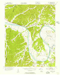 1955 Scottsboro1956 Print · USGSThe Cumberland River bends through western Davidson County in the mid-fifties, revealing a landscape of rural schoolhouses and riverside bends. Local researchers can trace family roots at New Bethel Ch, Wade Sch, and the grounds of the State Penitentiary.
 - 1955 Map of Belleview, 1956 Print
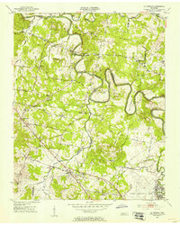
 1955 Belleview1956 Print · USGSDavidson County in the mid-fifties remains a landscape of winding river bends and rural crossroads as the suburbs begin to stir. Genealogists and historians can trace family locations through landmarks like Ash Grove Ch, Gower Sch, and the winding Harpeth River.2 unique versions available
 - 1956 Map of Columbia, 1960 Print
 1956 Columbia1960 Print · USGSMiddle Tennessee in the mid-fifties presents a landscape of established river towns and critical rail hubs before the arrival of the modern interstate system. Researchers can trace the routes of the Louisville and Nashville railroad or locate historic landmarks like Stones River National Military Park and the Tennessee National Wildlife Refuge.6 unique versions available
Showing maps 1-25 of 162
Top cities of Davidson County
- Nashville historical maps
- Forest Hills historical maps
- Oak Hill historical maps
- Belle Meade historical maps
- Berry Hill historical maps
Frequently asked questions
- What are the different types of historical maps available for Davidson County?
- What is the oldest map of Davidson County?
- Where can I purchase historical maps of Davidson County for my home or office?
- Where can I download high-res historical maps of Davidson County?
- Are there historical topographic maps available for Davidson County?
- Is there historical aerial imagery available for Davidson County?
- Where are historical maps of Davidson County sourced from?