Old Maps of Brooklyn Heights, Nashville for Genealogy
Trace your family roots with 13 historic maps of Brooklyn Heights. These high-res maps reveal old neighborhoods, homesites, landmarks, and streets — helping you uncover where your ancestors lived and how the area evolved over time.
- Explore historic neighborhoods: Identify where your relatives may have lived in the 1800s or 1900s.
- Compare maps over time: Trace the changes in streets, buildings, and landmarks for multi-generational research.
- Perfect for genealogy & ancestry research: Used by family historians and researchers to map out lineage and migration.
These maps are an incredible resource for exploring your personal connection to Brooklyn Heights's past.
Brooklyn Heights, Nashville maps
(13)- 1903 Map of Nashville
 1903 Nashville1903 Print · USGSTennessee's capital region is captured at the dawn of the 1900s, when iron pikes and river locks dominated local commerce. Trace ancestral routes along Stewarts Ferry Pike, find rural landmarks like Curry Mill, or locate historical sites like The Hermitage.4 unique versions available
 - 1932 Map of Nashville
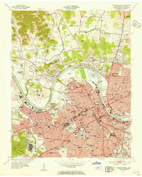
 1932 Nashville1932 Print · USGSNashville and its river bends are captured here in the early thirties, showing a city expanding toward suburbs like Belle Meade and Glendale Park. Genealogists can locate family landmarks like Loves Ch, Brentwood Sta, and numerous rural schools from Gower Sch to Ash Grove Sch.2 unique versions available
 - 1952 Map of Nashville West, 1954 Print
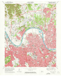
 1952 Nashville West1954 Print · USGSNashville's western corridor and the winding Cumberland River are captured here in the early fifties during a period of significant institutional growth. Researchers can locate numerous historic campuses and civic sites, including Fisk University, the State Penitentiary, and Cumberland Airfield.2 unique versions available
 - 1956 Map of Nashville, 1971 Print
 1956 Nashville1971 Print · USGSThe Tennessee-Kentucky borderlands come into focus in the mid-1960s as major reservoir projects transformed the Cumberland and Tennessee river valleys. Researchers can trace the rail networks of the Louisville and Nashville and visit sites like Fort Campbell and Fort Donelson National Military Park.2 unique versions available
 - 1959 Map of Nashville
 1959 Nashville1959 Print · USGSMiddle Tennessee and Southern Kentucky come into focus during the late fifties, showing the region's transition into a modern transportation and military hub. Researchers can trace the sprawling Fort Campbell Military Reservation or locate historic rail stops along the Tennessee Central Ry and Illinois Central RR.
 - 1968 Map of Nashville West, 1971 Print
 1968 Nashville West1971 Print · USGSNashville was undergoing rapid urban transformation in the late sixties as the interstate system carved through its historic districts. Researchers can trace the mid-century city layout of Fisk University, the State Capitol, and the Tennessee Central RR lines.4 unique versions available
 - 1984 Map of Nashville, 1985 Print
 1984 Nashville1985 Print · USGSMiddle Tennessee in the mid-1980s reveals a region balancing urban expansion with its deep river-valley roots. Genealogists and historians can trace family locations near Old Hickory Lake, explore the grounds of Vanderbilt University, or locate ancestral sites like Greenwood Cem.
 - 1997 Map of Nashville West, 1999 Print
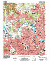 1997 Nashville West1999 Print · USGSNashville and the Cumberland River are shown in the late 1990s, capturing the city's academic core and expanding industrial infrastructure. Researchers can trace historic sites like Fisk University, the City Cem, and the State Penitentiary during a period of significant urban change.
 - 2010 Map of Nashville West, 2010 Print
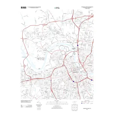
 2010 Nashville West2010 Print · USGSCovers Brooklyn Heights, including Nashville, North Nashville, and other nearby areas
 - 2013 Map of Nashville West, 2013 Print
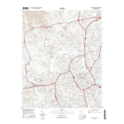
 2013 Nashville West2013 Print · USGSCovers Brooklyn Heights, including Nashville, North Nashville, and other nearby areas
 - 2016 Map of Nashville West, 2016 Print
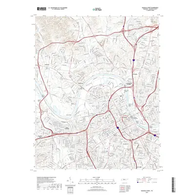
 2016 Nashville West2016 Print · USGSCovers Brooklyn Heights, including Nashville, North Nashville, and other nearby areas
 - 2019 Map of Nashville West, 2019 Print
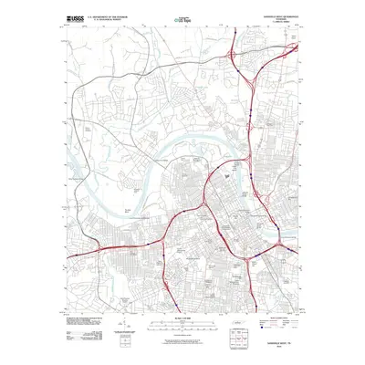
 2019 Nashville West2019 Print · USGSCovers Brooklyn Heights, including Nashville, North Nashville, and other nearby areas
 - 2022 Map of Nashville West, 2022 Print
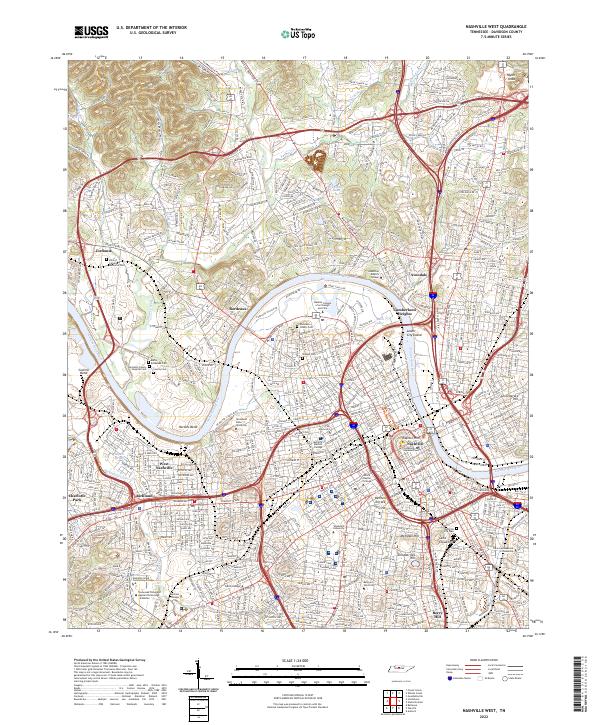 2022 Nashville West2022 Print · USGSThe Tennessee state capital and its surrounding Davidson County suburbs are mapped here during a period of significant urban density. Researchers can trace historic burial sites like the Nashville City Cem and the grounds of institutions such as Vanderbilt University and Capitol Hill.
End of results
Showing maps 1-13 of 13
Top cities near Brooklyn Heights
- Nashville historical maps
- Franklin historical maps
- Hendersonville historical maps
- Smyrna historical maps
- Brentwood historical maps
- La Vergne historical maps
See more
Frequently asked questions
- What are the different types of historical maps available for Brooklyn Heights?
- What is the oldest map of Brooklyn Heights?
- Where can I purchase historical maps of Brooklyn Heights for my home or office?
- Where can I download high-res historical maps of Brooklyn Heights?
- Are there historical topographic maps available for Brooklyn Heights?
- Is there historical aerial imagery available for Brooklyn Heights?
- Where are historical maps of Brooklyn Heights sourced from?