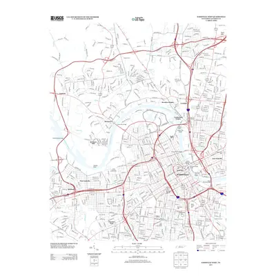
2013 Map of Nashville West
USGS Topo · Published 2013About this map
The Cumberland River carves a winding path through the heart of the Tennessee capital, defining the character of the city's western and northern neighborhoods. High ground is marked by several significant rises, including Saint Cloud Hill, Kirkpatricks Hill, and Confederate Hill, which served as tactical vantage points in the city's past and now anchor various residential districts. The map captures the dense urban landscape of Nashville during a period of sustained growth, showing the complex network of bridges that unify the north and south banks, such as the Victory Memorial Bridge and the Jefferson Street Bridge.
Find a feature on this map
42 named features on this map. Tap any name to fly to it.
Don’t see what you’re looking for? This feature index may not catch every label — zoom into the map to look around manually.
Map Details
Editions of this 2013 Nashville West Map
This is the sole edition of this map. No revisions or reprints were ever made.
Other maps of this area

1903 · Nashville
USGS Topo · 1:125,000

1931 · Ridgetop
USGS Topo · 1:62,500

1932 · Hermitage
USGS Topo · 1:62,500

1932 · Nashville
USGS Topo · 1:62,500

1935 · Ridgetop
USGS Topo · 1:62,500

1942 · Gallatin
USGS Topo · 1:100,000

1942 · Lebanon
USGS Topo · 1:100,000

1952 · Goodlettsville
USGS Topo · 1:24,000

1952 · Nashville West
USGS Topo · 1:24,000

1952 · Nashville East
USGS Topo · 1:24,000