Old Maps of Claylick, Tennessee for Genealogy
Trace your family roots with 11 historic maps of Claylick. These high-res maps reveal old neighborhoods, homesites, landmarks, and streets — helping you uncover where your ancestors lived and how the area evolved over time.
- Explore historic neighborhoods: Identify where your relatives may have lived in the 1800s or 1900s.
- Compare maps over time: Trace the changes in streets, buildings, and landmarks for multi-generational research.
- Perfect for genealogy & ancestry research: Used by family historians and researchers to map out lineage and migration.
These maps are an incredible resource for exploring your personal connection to Claylick's past.
Claylick, TN maps
(11)- 1930 Map of White Bluff, 1953 Print
 1930 White Bluff1953 Print · USGSMiddle Tennessee in the 1930s is defined by the serpentine bends of the Harpeth River and the steam-era dominance of the Nashville Chattanooga and St Louis RR. Genealogists and historians can locate vanished country schools like Opossum Sch and trace early road networks including the Dickson Turnpike.
 - 1933 Map of White Bluff
 1933 White Bluff1933 Print · USGSThe Tennessee river country in the early thirties is defined here by the winding loops of the Harpeth River and the rail line through White Bluff. Genealogists and researchers can trace rural life through landmarks like Mound Bottom, Frog Pond Ch, and Opossum Sch.
 - 1956 Map of Nashville, 1971 Print
 1956 Nashville1971 Print · USGSThe Tennessee-Kentucky borderlands come into focus in the mid-1960s as major reservoir projects transformed the Cumberland and Tennessee river valleys. Researchers can trace the rail networks of the Louisville and Nashville and visit sites like Fort Campbell and Fort Donelson National Military Park.2 unique versions available
 - 1959 Map of Nashville
 1959 Nashville1959 Print · USGSMiddle Tennessee and Southern Kentucky come into focus during the late fifties, showing the region's transition into a modern transportation and military hub. Researchers can trace the sprawling Fort Campbell Military Reservation or locate historic rail stops along the Tennessee Central Ry and Illinois Central RR.
 - 1966 Map of Harpeth Valley, 1967 Print
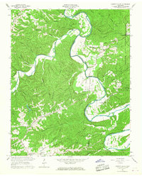 1966 Harpeth Valley1967 Print · USGSThe Harpeth River meanders through the Dickson and Cheatham county line in the mid-1960s, revealing a landscape of high ridges and rural valley settlements. Genealogists and researchers can trace family-named locations such as Petway, Griffintown, and the Taylortown Ch Cem.3 unique versions available
 - 1985 Map of Dickson
 1985 Dickson1985 Print · USGSMid-Tennessee in the mid-1980s was defined by the intersection of the Cumberland and Tennessee rivers and a massive network of wildlife refuges. Researchers can trace the Seaboard System rail lines connecting Waverly, Dickson, and White Bluff, or locate old landmarks near Fort Donelson National Military Park.
 - 2010 Map of Harpeth Valley, 2010 Print
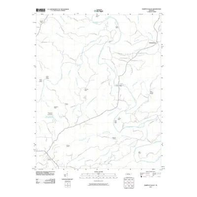 2010 Harpeth Valley2010 Print · USGSCovers Claylick, including White Bluff, Germantown, and other nearby areas
 - 2013 Map of Harpeth Valley, 2013 Print
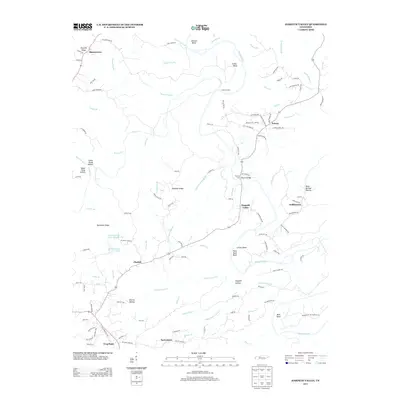 2013 Harpeth Valley2013 Print · USGSCovers Claylick, including White Bluff, Germantown, and other nearby areas
 - 2016 Map of Harpeth Valley, 2016 Print
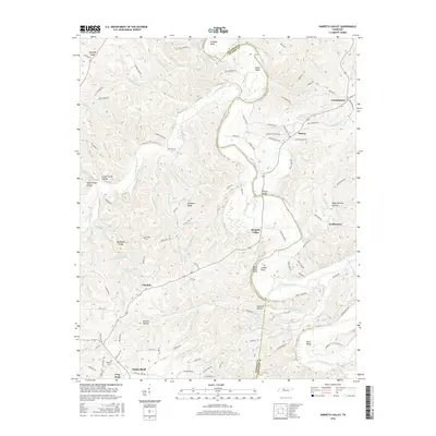 2016 Harpeth Valley2016 Print · USGSCovers Claylick, including White Bluff, Germantown, and other nearby areas
 - 2019 Map of Harpeth Valley, 2019 Print
 2019 Harpeth Valley2019 Print · USGSCovers Claylick, including White Bluff, Germantown, and other nearby areas
 - 2022 Map of Harpeth Valley, 2022 Print
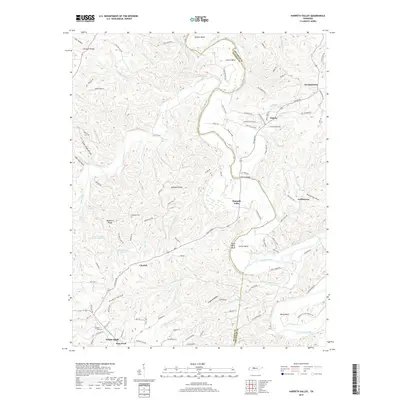
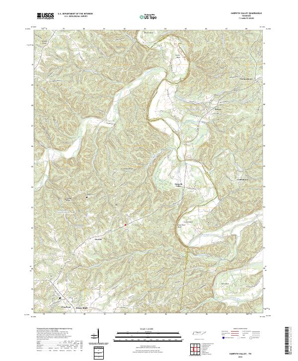 2022 Harpeth Valley2022 Print · USGSThe Harpeth River valley in the early 2020s reveals a landscape of winding watercourses and rural settlements along the Dickson and Cheatham county line. Researchers can locate family landmarks like Nosegay Cem, the community of White Bluff, and the unique Narrows of the Harpeth.
End of results
Showing maps 1-11 of 11
Top cities near Claylick
- Nashville historical maps
- Dickson historical maps
- Fairview historical maps
- Ashland City historical maps
- Pleasant View historical maps
- Coopertown historical maps
See more
Frequently asked questions
- What are the different types of historical maps available for Claylick?
- What is the oldest map of Claylick?
- Where can I purchase historical maps of Claylick for my home or office?
- Where can I download high-res historical maps of Claylick?
- Are there historical topographic maps available for Claylick?
- Is there historical aerial imagery available for Claylick?
- Where are historical maps of Claylick sourced from?