Old Maps of Dickson County, Tennessee for Genealogy
Trace your family roots with 113 historic maps of Dickson County. These high-res maps reveal old neighborhoods, homesites, landmarks, and streets — helping you uncover where your ancestors lived and how the area evolved over time.
- Explore historic neighborhoods: Identify where your relatives may have lived in the 1800s or 1900s.
- Compare maps over time: Trace the changes in streets, buildings, and landmarks for multi-generational research.
- Perfect for genealogy & ancestry research: Used by family historians and researchers to map out lineage and migration.
These maps are an incredible resource for exploring your personal connection to Dickson County's past.
Dickson County, TN maps
(113)- 1901 Map of Colombia
 1901 Colombia1901 Print · USGSMiddle Tennessee at the close of the century reveals a landscape shaped by river bends and a dense network of turnpikes. Genealogists can trace family roots through settlements like Santa Fe and Warner or locate landmarks such as the U.S. Arsenal and Zion Ch.3 unique versions available
 - 1930 Map of White Bluff, 1953 Print
 1930 White Bluff1953 Print · USGSMiddle Tennessee in the 1930s is defined by the serpentine bends of the Harpeth River and the steam-era dominance of the Nashville Chattanooga and St Louis RR. Genealogists and historians can locate vanished country schools like Opossum Sch and trace early road networks including the Dickson Turnpike.
 - 1931 Map of Erin
 1931 Erin1931 Print · USGSThe Cumberland River corridor and the railroad hub of Erin define this landscape in the late 1920s. Genealogists can trace family footprints through dozens of rural schools and churches, from Blooming Grove Ch to the remote Cave Orchard Sch.
 - 1933 Map of White Bluff
 1933 White Bluff1933 Print · USGSThe Tennessee river country in the early thirties is defined here by the winding loops of the Harpeth River and the rail line through White Bluff. Genealogists and researchers can trace rural life through landmarks like Mound Bottom, Frog Pond Ch, and Opossum Sch.
 - 1936 Map of Ruskin
 1936 Ruskin1936 Print · USGSMid-Tennessee's highland rim is captured here in the mid-1930s, showing the intersection of Dickson, Houston, and Humphreys counties. Local researchers can trace family lands near Cave Ruskin, find old rural schoolhouses like Olivet Sch, and locate family burial grounds including Dotson Cem.
 - 1936 Map of Texas Hollow
 1936 Texas Hollow1936 Print · USGSHickman and Dickson counties come into focus during the mid-1930s, showing a rural landscape organized around the Piney River. Genealogists and local historians can trace schoolhouse locations like Mt Gossett Sch, family sites such as Petty Cem, and the early aviation Airway Beacon.
 - 1936 Map of Spot
 1936 Spot1936 Print · USGSHickman County is shown in the mid-1930s as a landscape of isolated hollows and rural school districts before modern development. You can trace family footprints at Wilkens Cem and Turner Cem, or locate landmarks like Spot Sch and the Lookout Tower.
 - 1936 Map of Burns
 1936 Burns1936 Print · USGSDickson County's rural landscape is captured during the mid-1930s as modern infrastructure began to reshape the Tennessee interior. Researchers can trace the path of the N C AND ST L railroad through Tidwell and Pomona or locate the site of the Herbertson Sch.
 - 1936 Map of Craigfield
 1936 Craigfield1936 Print · USGSThe Hickman and Williamson county border comes alive in the mid-1930s, showing a rural Tennessee landscape defined by narrow creek valleys and the Basin Divide. Genealogists can locate family-named sites like McCord Cem, Tidwell Sch, and Shady Grove Ch.
 - 1936 Map of Lyles
 1936 Lyles1936 Print · USGSHickman and Dickson counties come into focus during the mid-1930s, showing a landscape defined by the Tennessee Basin Divide and the Nashville, Chattanooga and St. Louis Railway. Researchers can locate vanished rural landmarks such as Frazier Cem, Porter Sch, and the Steam Pumping Station at Mill Creek.
 - 1936 Map of Tennessee City
 1936 Tennessee City1936 Print · USGSThe Humphreys and Dickson County borderlands were undergoing a period of rapid modernization in the mid-1930s as electricity and highways expanded across the hills. Researchers can trace rural life through landmarks like Fiftyfour, Fewville, and several country schools including Holland Sch.
 - 1936 Map of Dickson
 1936 Dickson1936 Print · USGSIn the mid-thirties, the area around Dickson was a bustling rail junction where the Nashville Chattanooga and St Louis Ry met the local timber and river economy. Genealogists can trace family names at England Cem or find historic rural sites like Eno Sch and Bethel Ch.
 - 1952 Map of Spot, 1957 Print
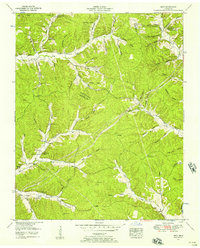 1952 Spot1957 Print · USGSHickman County is a labyrinth of ridges and named hollows at the start of the fifties, revealing the deep-rooted family legacy of this rural region. Genealogists can trace early homesteads near Spot and local landmarks like Pleasant Valley Ch, Pinewood Lookout Tower, and McMackins Cem.3 unique versions available
 - 1952 Map of Texas Hollow, 1957 Print
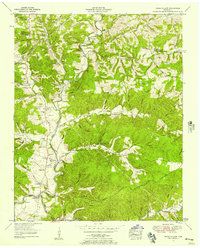 1952 Texas Hollow1957 Print · USGSThe Tennessee river-and-rail landscape of the early 1950s comes alive in this survey of the Hickman and Dickson county line. Researchers can trace family homesteads near Pinewood, locate family-named cemeteries like Shipp Cemetery, or find old industrial sites such as abandoned open pit mines.3 unique versions available
 - 1953 Map of Dickson, 1957 Print
 1953 Dickson1957 Print · USGSMid-century Dickson, Tennessee is captured here as a bustling railroad hub surrounded by deep-rooted family homesteads. Genealogists and historians can locate dozens of ancestral sites like Sullivan Cem and Robinson Chapel, or trace the industrial history of abandoned iron mines.3 unique versions available
 - 1953 Map of Lyles, 1957 Print
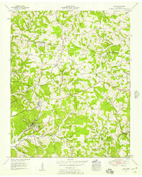 1953 Lyles1957 Print · USGSHickman and Dickson counties show a landscape of ridges and hollows in the early fifties, defined by the Tennessee Valley Divide. Trace the Nashville Chattanooga and St Louis rail line through Lyles and find family histories at Dunnagan Cem or Tatum Sch.3 unique versions available
 - 1953 Map of Tennessee City, 1957 Print
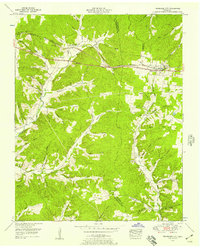 1953 Tennessee City1957 Print · USGSThe border of Humphreys and Dickson counties comes alive in the 1950s, showing a landscape defined by the Nashville Chattanooga and St Louis rail line. Researchers can locate numerous family burial sites like Washburn Cemetery and Few Chapel Cemetery, along with the old Broadway of America highway.3 unique versions available
 - 1953 Map of Craigfield, 1957 Print
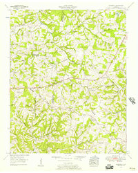 1953 Craigfield1957 Print · USGSMiddle Tennessee rural life is captured here in the early fifties, where the borders of three counties meet along the Tennessee Valley Divide. Genealogists can trace family names through dozens of sites like the Cunningham Cem, Lampley Sch, and Emanuel Fairview Ch.3 unique versions available
 - 1953 Map of Burns, 1958 Print
 1953 Burns1958 Print · USGSMid-century Dickson County centers on the railroad towns of Burns and Colesburg as the local economy shifts from industry to recreation. Genealogists and historians can locate numerous family burial sites such as Dugan Cem or trace the early layout of Montgomery Bell State Park.5 unique versions available
 - 1953 Map of Ruskin, 1958 Print
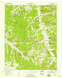 1953 Ruskin1958 Print · USGSThe rural borders of Dickson, Houston, and Humphreys counties are captured here in the early fifties, showing a landscape defined by deep hollows and high ridges. Family researchers can locate dozens of remote burial sites like Dotson Cem and Yates Cem, alongside crossroads communities like Ruskin and Thompsons Crossroads.3 unique versions available
 - 1956 Map of Columbia, 1960 Print
 1956 Columbia1960 Print · USGSMiddle Tennessee in the mid-fifties presents a landscape of established river towns and critical rail hubs before the arrival of the modern interstate system. Researchers can trace the routes of the Louisville and Nashville railroad or locate historic landmarks like Stones River National Military Park and the Tennessee National Wildlife Refuge.6 unique versions available
 - 1956 Map of Nashville, 1971 Print
 1956 Nashville1971 Print · USGSThe Tennessee-Kentucky borderlands come into focus in the mid-1960s as major reservoir projects transformed the Cumberland and Tennessee river valleys. Researchers can trace the rail networks of the Louisville and Nashville and visit sites like Fort Campbell and Fort Donelson National Military Park.2 unique versions available
 - 1957 Map of Cheatham Dam, 1958 Print
 1957 Cheatham Dam1958 Print · USGSMid-century Tennessee river life is preserved here as the Cumberland River transitions into Lake Cheatham. Genealogists and historians can trace family locations through rural landmarks like Bellsburg Sch, Mt Zion Ch, and the Tennessee Central rail line.3 unique versions available
 - 1958 Map of Charlotte, 1959 Print
 1958 Charlotte1959 Print · USGSMid-century Dickson County comes to life in this survey of the area surrounding the county seat just before the 1960s. Genealogists can trace family landmarks like Nesbitt Cem, Fagens Chapel, and the early buildings of Charlotte.2 unique versions available
 - 1958 Map of Cumberland Furnace, 1959 Print
 1958 Cumberland Furnace1959 Print · USGSMid-century Middle Tennessee comes to life here as the rural landscapes of Dickson and Montgomery counties appear before modern development. Genealogists and local historians can trace family roots through numerous small burial sites like Hamble Cem and old community hubs such as McAllisters Crossroads and Stayton.3 unique versions available
Showing maps 1-25 of 113
Top cities of Dickson County
- Dickson historical maps
- White Bluff historical maps
- Burns historical maps
- Charlotte historical maps
- Vanleer historical maps
- Slayden historical maps
Frequently asked questions
- What are the different types of historical maps available for Dickson County?
- What is the oldest map of Dickson County?
- Where can I purchase historical maps of Dickson County for my home or office?
- Where can I download high-res historical maps of Dickson County?
- Are there historical topographic maps available for Dickson County?
- Is there historical aerial imagery available for Dickson County?
- Where are historical maps of Dickson County sourced from?