Old Maps of Fayette County, Tennessee
Explore 176 old maps of Fayette County, spanning from 1943 to today. These high-resolution historic maps reveal how streets, neighborhoods, landmarks, and natural features evolved over time — perfect for genealogy, metal detecting, research, and local history exploration.
What you can do with these maps:
- See how Fayette County changed over time: Compare historical maps to modern-day views to trace roads, homesites, rail lines & more.
- View detailed metadata: Each map includes creators, publishers, year, scale, and archive source.
- Overlay maps with satellite & LiDAR: Visualize the past alongside modern tools to explore terrain & human change.
- Trusted historical sources: Maps sourced from the USGS, Library of Congress, and other archives.
- Access maps your way: View online, download high-res files, or order prints for personal or research use.
Start exploring old maps of Fayette County to uncover forgotten places, hidden landmarks, and the deep history beneath your feet.
Fayette County, TN maps
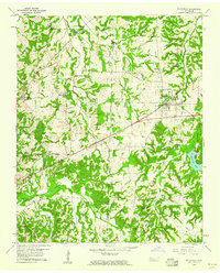
(176)- 1943 Map of Collierville, 1964 Print
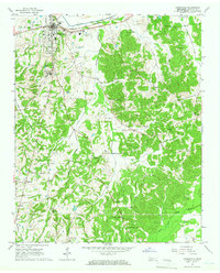
 1943 Collierville1964 Print · USGSThe rural borderlands of Shelby and Fayette counties are captured here in the early 1940s, anchored by the rail hubs of Collierville and Rossville. Genealogists can trace family roots through numerous sites like Augusta Rosenwald Sch, Magnolia Cem, and Morning Sun Ch & Cem.
 - 1948 Map of Byhalia
 1948 Byhalia1948 Print · USGSMarshall County in the late 1940s is captured here as a thriving network of small settlements and rail-side towns. Genealogists and historians can trace family locations through numerous rural landmarks like Shelby Ch & Cem, Red Banks, and the Marshall Inst Ch.3 unique versions available
 - 1949 Map of Moscow, 1964 Print
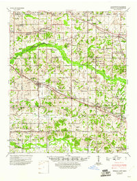
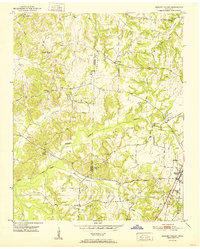
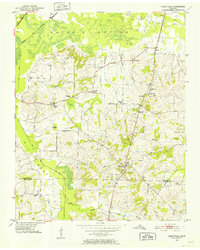
 1949 Moscow1964 Print · USGSFayette County in the late nineteen-forties was a landscape of rail-centered commerce and deeply rooted rural communities. Genealogists and historians can trace numerous family-named landmarks and institutions, from the Fayette Co Training Sch to settlements like Moscow and Hays Crossing.
 - 1950 Map of Ashland, 1952 Print
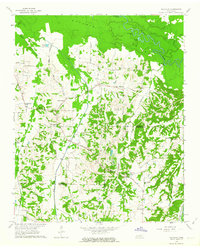
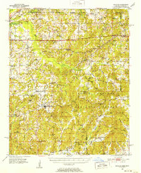 1950 Ashland1952 Print · USGSBenton County at the mid-century is captured here as a landscape of small timber towns and forest clearings before modern development. You can trace early school sites like Holloway Sch and family-centered landmarks such as Whitten Town and Hunters Chapel.3 unique versions available
 - 1950 Map of Grand Junction, 1981 Print
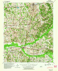
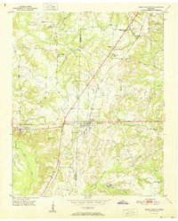
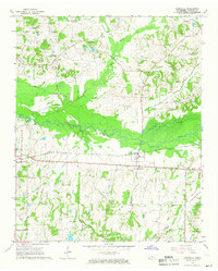
 1950 Grand Junction1981 Print · USGSRailroads converge at Grand Junction in the 1950s, anchoring a landscape of rural schoolhouses and family plantations. Genealogists can trace property and community roots through Ames Plantation, Jones Chapel Sch, and La Grange Cem.
 - 1951 Map of Hickory Valley
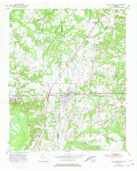
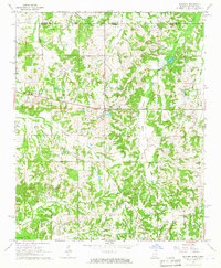
 1951 Hickory Valley1951 Print · USGSHardeman County in the early fifties is captured here as a landscape of small schools and rail-side commerce. Genealogists can trace family roots through the numerous local landmarks, including Woods Cem, Hickory Valley Sch, and Stuart Chapel.3 unique versions available
 - 1951 Map of Grand Junction
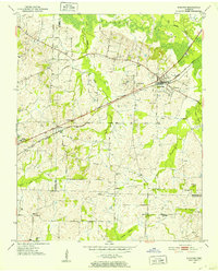
 1951 Grand Junction1951 Print · USGSThe rail-and-river landscape of the Tennessee borderlands comes alive in this mid-century survey of the junction between the Southern and Illinois Central lines. Genealogists and historians can trace community roots at Ames Plantation, Jones Chapel Sch, and Pleasant Grove Cem.2 unique versions available
 - 1952 Map of Stanton
 1952 Stanton1952 Print · USGSWestern Tennessee at the start of the fifties was a landscape of rail-connected towns and crossroads communities. Genealogists can trace family roots through numerous rural landmarks like Wesley Cem, Fredonia Sch, and the community of Keeling.3 unique versions available
 - 1952 Map of Lambert
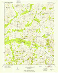 1952 Lambert1952 Print · USGSMid-century Fayette County comes into focus through this 1952 survey of the Loosahatchie River drainage systems. Genealogists and historians can trace numerous family burial grounds and country schools like Mablin Quarter Cem and Travelers Rest Sch.2 unique versions available
 - 1952 Map of Dancyville
 1952 Dancyville1952 Print · USGSDancyville and the surrounding West Tennessee countryside appear in the early fifties as a landscape of small crossroads and creek-bottom farms. Genealogists can trace family landmarks like McKenzie Chapel, Wilkinson Corner, and the St Johns Sch Cem.2 unique versions available
 - 1952 Map of Laconia, 1953 Print
 1952 Laconia1953 Print · USGSMid-century Fayette County comes alive in this survey of rural settlements and bottomlands just before the era of major highway expansion. Genealogists can locate family-named landmarks such as Yum Yum, Taylor Cem, and many vanished local classrooms like Alexander Sch.2 unique versions available
 - 1952 Map of Stanton, 1958 Print
 1952 Stanton1958 Print · USGSMid-century West Tennessee comes to life here as the rail-driven town of Stanton and the crossroads at Dancyville anchor a landscape of bottomlands and family farms. Trace the roots of local communities through landmarks like Yum Yum, Gailor High Sch, and the Antioch Ch.
 - 1953 Map of Holly Springs
 1953 Holly Springs1953 Print · USGSNorth-central Mississippi and the Tennessee borderlands are captured here in the early 1950s, centered on the railroad crossing at Holly Springs. Genealogists can trace family locations through numerous rural sites like Hudsonville Ch & Cem and Slayden Sch.
 - 1953 Map of Collierville
 1953 Collierville1953 Print · USGSThe rural borderlands of Shelby and Fayette counties are captured here in the early fifties, showing a landscape of river bottoms and rail-side hamlets. Genealogists can locate family landmarks like Chambers Chapel & Cem, Hickory Withe Sta, and Morning Sun Ch & Cem.
 - 1954 Map of Mason
 1954 Mason1954 Print · USGSWest Tennessee in the mid-1950s shows a landscape of rail-linked towns and deep-rooted rural institutions. Genealogists and researchers can trace family connections at the Dunlap Orphanage, Home Ferry Sch, and numerous sites like St Matthews Sch & Ch.
 - 1956 Map of Blytheville, 1964 Print
 1956 Blytheville1964 Print · USGSWest Tennessee and the Arkansas Delta come alive in this mid-century survey of the river-and-rail corridor connecting Memphis to Jackson. Genealogists and historians can trace the rail lines of the Louisville and Nashville RR and locate landmarks like Western State Hospital or Fort Pillow State Prison Farm.2 unique versions available
 - 1956 Map of Tupelo, 1967 Print
 1956 Tupelo1967 Print · USGSNortheast Mississippi and parts of Tennessee and Alabama are shown here during the mid-fifties, a time of major reservoir construction and forestry management. Researchers can trace the St Louis-San Francisco RR through Tupelo or locate historic sites like Tishomingo State Park and the University.2 unique versions available
 - 1958 Map of Tupelo
 1958 Tupelo1958 Print · USGSNortheast Mississippi and neighboring Alabama and Tennessee appear here during the late fifties as a region defined by new reservoirs and historic rail lines. Genealogists can trace family locations near Sardis Lake, Woodall Mountain, and the St Louis-San Francisco Ry.
 - 1959 Map of Blytheville
 1959 Blytheville1959 Print · USGSWest Tennessee and Northeast Arkansas meet along the river in the late fifties, during a period of steady industrial and agricultural growth. Genealogists can trace the rail corridors of the Illinois Central through Jackson or explore landmarks like Shiloh National Military Park and Fort Pillow State Prison.
 - 1959 Map of Whiteville, 1960 Print
 1959 Whiteville1960 Print · USGSWest Tennessee’s rural landscape comes into focus during the late fifties as the Louisville and Nashville railroad connects small towns. Local historians can trace family-named sites like Clover Garden Cem, Lewis Sch, and the grounds of Whiteville Lake.3 unique versions available
 - 1959 Map of Hillville, 1964 Print
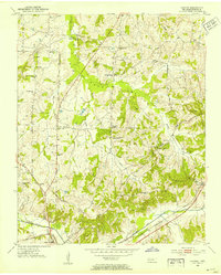
 1959 Hillville1964 Print · USGSThe tri-county border of Haywood, Hardeman, and Fayette counties comes alive in this late 1950s survey of the Hatchie River basin. Researchers can trace rural life through numerous family cemeteries and country churches like Cedar Chapel, Mt Tabor Ch, and the crossroads at Hillville.
 - 1965 Map of Rossville, 1966 Print
 1965 Rossville1966 Print · USGSFayette County in the mid-sixties reveals a landscape defined by the WOLF RIVER and the SOUTHERN rail line. Genealogists and researchers can trace numerous family-named landmarks, from Hunter Cem and Walker Cem to Philadelphia Ch and St Luke Sch.3 unique versions available
 - 1965 Map of Slayden, 1966 Print
 1965 Slayden1966 Print · USGSSpanning the Tennessee and Mississippi border in the 1960s, this area reveals a landscape of rural school districts and family cemeteries. Trace the locations of historic landmarks like Early Grove, Sand Flats Jr High Sch, and the Pittman Cem.2 unique versions available
 - 1965 Map of Somerville, 1966 Print
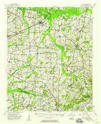
 1965 Somerville1966 Print · USGSFayette County’s rural character is on full display in the mid-sixties, centered on the historic seat of Somerville. Genealogists can trace family names through numerous landmarks like Hutchins Cem, Brooks Sch, and the Rehobeth Ch.2 unique versions available
 - 1965 Map of Oakland, 1966 Print
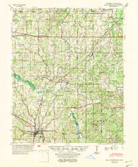
 1965 Oakland1966 Print · USGSFayette County in the mid-sixties shows a landscape defined by the Louisville and Nashville railroad and tight-knit rural communities. Genealogists can trace family names across dozens of sites like Dudney Cem, Bailey Cem, and the Sanctified Ch.3 unique versions available
Showing maps 1-25 of 176
Top cities of Fayette County
- Oakland historical maps
- Somerville historical maps
- Piperton historical maps
- Gallaway historical maps
- Moscow historical maps
- Rossville historical maps
See more
Frequently asked questions
- What are the different types of historical maps available for Fayette County?
- What is the oldest map of Fayette County?
- Where can I purchase historical maps of Fayette County for my home or office?
- Where can I download high-res historical maps of Fayette County?
- Are there historical topographic maps available for Fayette County?
- Is there historical aerial imagery available for Fayette County?
- Where are historical maps of Fayette County sourced from?