Old Maps of Estill Springs, Tennessee
Explore 18 old maps of Estill Springs, spanning from 1928 to today. These high-resolution historic maps reveal how streets, neighborhoods, landmarks, and natural features evolved over time — perfect for genealogy, metal detecting, research, and local history exploration.
What you can do with these maps:
- See how Estill Springs changed over time: Compare historical maps to modern-day views to trace roads, homesites, rail lines & more.
- View detailed metadata: Each map includes creators, publishers, year, scale, and archive source.
- Overlay maps with satellite & LiDAR: Visualize the past alongside modern tools to explore terrain & human change.
- Trusted historical sources: Maps sourced from the USGS, Library of Congress, and other archives.
- Access maps your way: View online, download high-res files, or order prints for personal or research use.
Start exploring old maps of Estill Springs to uncover forgotten places, hidden landmarks, and the deep history beneath your feet.
Estill Springs, TN maps
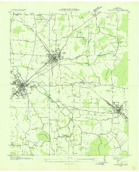
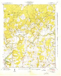
(18)- 1928 Map of Decherd
 1928 Decherd1928 Print · USGSCovers Estill Springs, including Winchester, Decherd, and other nearby areas3 unique versions available
 - 1936 Map of Winchester
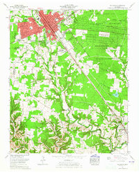
 1936 Winchester1936 Print · USGSCovers Estill Springs, including Winchester, Decherd, and other nearby areas
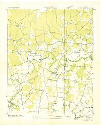
 - 1936 Map of Belvidere
 1936 Belvidere1936 Print · USGSCovers Estill Springs, including Winchester, Myers, and other nearby areas
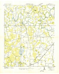
 - 1936 Map of Camp Peay
 1936 Camp Peay1936 Print · USGSCovers Estill Springs, including Tullahoma, Lynchburg, and other nearby areas
 - 1936 Map of Capitol Hill
 1936 Capitol Hill1936 Print · USGSCovers Estill Springs, including Decherd, Duncantown, and other nearby areas
 - 1941 Map of Camp Forrest, 1943 Print
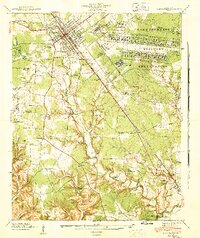 1941 Camp Forrest1943 Print · USGSCovers Estill Springs, including Tullahoma, Lynchburg, and other nearby areas2 unique versions available
 - 1941 Map of Capitol Hill, 1944 Print
 1941 Capitol Hill1944 Print · USGSCovers Estill Springs, including Decherd, Duncantown, and other nearby areas2 unique versions available
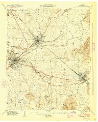
 - 1943 Map of Mc Minnville, 1944 Print
 1943 Mc Minnville1944 Print · USGSCovers Estill Springs, including Tullahoma, McMinnville, and other nearby areas
 - 1947 Map of Winchester, 1948 Print
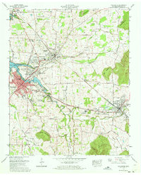
 1947 Winchester1948 Print · USGSCovers Estill Springs, including Winchester, Decherd, and other nearby areas3 unique versions available
 - 1947 Map of Belvidere, 1948 Print
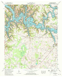
 1947 Belvidere1948 Print · USGSCovers Estill Springs, including Winchester, Myers, and other nearby areas3 unique versions available
 - 1956 Map of Columbia, 1960 Print
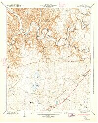
 1956 Columbia1960 Print · USGSCovers Estill Springs, including Nashville, Murfreesboro, and other nearby areas6 unique versions available
 - 1962 Map of Capitol Hill, 1964 Print
 1962 Capitol Hill1964 Print · USGSCovers Estill Springs, including Decherd, Duncantown, and other nearby areas
 - 1962 Map of Tullahoma, 1965 Print
 1962 Tullahoma1965 Print · USGSCovers Estill Springs, including Tullahoma, Lynchburg, and other nearby areas
 - 1971 Map of Winchester, 1973 Print
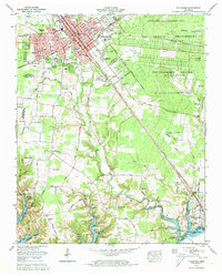
 1971 Winchester1973 Print · USGSCovers Estill Springs, including Winchester, Decherd, and other nearby areas
 - 1972 Map of Tullahoma, 1973 Print
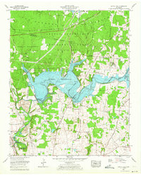
 1972 Tullahoma1973 Print · USGSCovers Estill Springs, including Tullahoma, Lynchburg, and other nearby areas5 unique versions available
 - 1972 Map of Belvidere, 1973 Print
 1972 Belvidere1973 Print · USGSCovers Estill Springs, including Winchester, Myers, and other nearby areas2 unique versions available
 - 1972 Map of Capitol Hill, 1973 Print
 1972 Capitol Hill1973 Print · USGSCovers Estill Springs, including Decherd, Duncantown, and other nearby areas4 unique versions available
 - 1981 Map of Tullahoma, 1982 Print
 1981 Tullahoma1982 Print · USGSCovers Estill Springs, including Shelbyville, Tullahoma, and other nearby areas
End of results
Showing maps 1-18 of 18
Top cities near Estill Springs
- Tullahoma historical maps
- Manchester historical maps
- Winchester historical maps
- Sewanee historical maps
- Decherd historical maps
- Cowan historical maps
See more
Top neighborhoods of Estill Springs
- Taylor Creek East Subdivision historical maps
- Taylor Creek West Subdivision historical maps
- Elkins historical maps
Frequently asked questions
- What are the different types of historical maps available for Estill Springs?
- What is the oldest map of Estill Springs?
- Where can I purchase historical maps of Estill Springs for my home or office?
- Where can I download high-res historical maps of Estill Springs?
- Are there historical topographic maps available for Estill Springs?
- Is there historical aerial imagery available for Estill Springs?
- Where are historical maps of Estill Springs sourced from?