2020s Maps of Greene County, Tennessee
Explore 20 historic maps of Greene County from the 2020s. These maps offer a rare glimpse into what life looked like during the 2020s — showing old roads, neighborhoods, homes, and landmarks that have changed or disappeared over time.
Whether you're researching your family's past, planning a metal detecting trip, or studying how Greene County's landscape evolved across the 2020s, these high-resolution maps are a powerful tool for exploring the history of this region.
- Focus on a specific era: All maps on this page are from the 2020s, giving you a focused view of this time period.
- See what’s changed: Compare century-old streets, trails, and buildings to today's modern landscape using overlays and satellite layers.
- Research with precision: Use these maps for genealogy, historical research, land use analysis, or educational projects.
- View, download, or print: Maps are fully viewable online in high resolution, and can be downloaded or printed for your own records.
Start exploring Greene County's history through authentic maps from the 2020s. This is your window into the past.
Greene County, TN maps
(20)- 2022 Map of Stony Point, 2022 Print
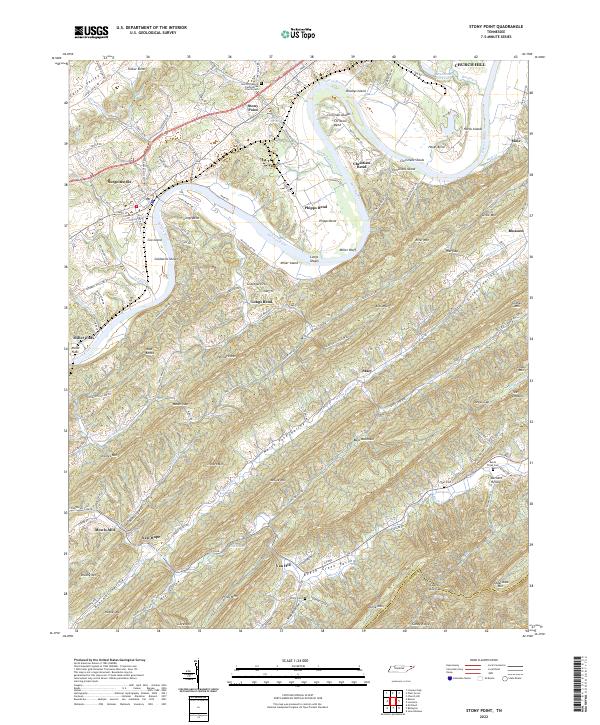 2022 Stony Point2022 Print · USGSHawkins County is documented here in the early twenty-first century, showcasing the deep-rooted settlements and river bends of the Holston River valley. Genealogists and local historians can trace legacy sites like New Providence Presbyterian Church Cem, Mowls Mill, and Ball Cem.
 - 2022 Map of Telford, 2022 Print
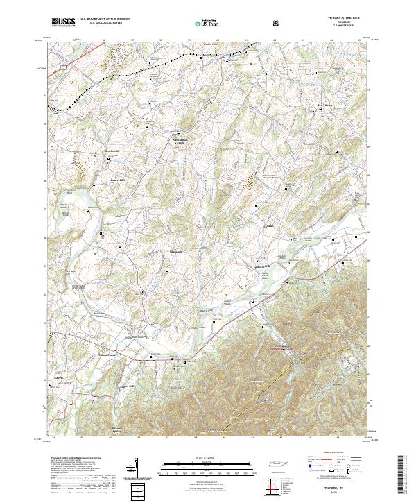 2022 Telford2022 Print · USGSNortheastern Tennessee's river valleys and historic educational grounds are captured here in the early twenty-first century. Researchers can trace family history through dozens of local burial sites like Telford Cem or explore the river-frontage near Gladstone and Broylesville.
 - 2022 Map of Chuckey, 2022 Print
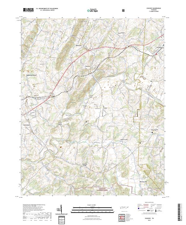 2022 Chuckey2022 Print · USGSThe Nolichucky River valley in East Tennessee remains a patchwork of historic settlements and river shoals in the early twenty-first century. Genealogists and local researchers can trace family landmarks and rural routes, including Philadelphia Cem, Hensley Airpark, and the rolling terrain of Quaker Knobs.
 - 2022 Map of Cedar Creek, 2022 Print
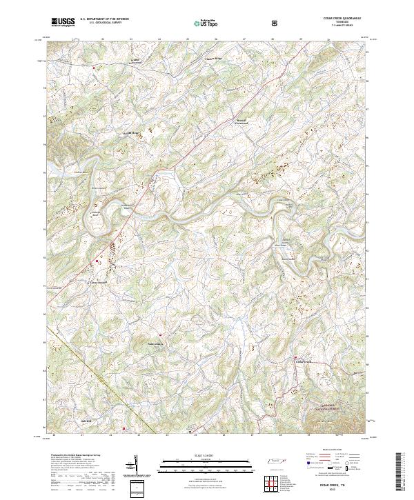 2022 Cedar Creek2022 Print · USGSGreene County at the start of the 2020s shows a landscape of river-bend settlements and mountain ridges. Genealogists can trace family roots through Saint James, Walter Crossroad, and Mount Olive Cem near the forest edge.
 - 2022 Map of Mosheim, 2022 Print
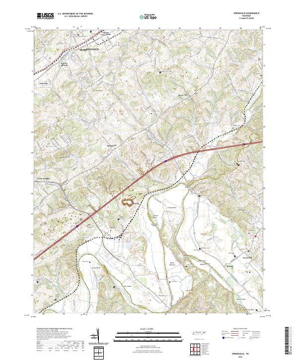
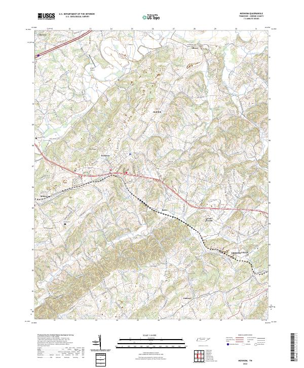 2022 Mosheim2022 Print · USGSGreene County is shown here in the early twenty-first century, spanning the rolling gap between Lick Creek and Little Chucky Creek. Local historians can trace family-named landmarks and rural settlements like Mosheim, Hull Mill, and the historic Weems Chapel.
 - 2022 Map of Jearoldstown, 2022 Print
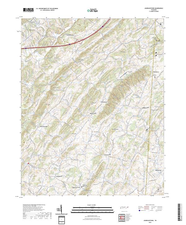 2022 Jearoldstown2022 Print · USGSGreene and Washington counties in East Tennessee are captured here in a period of rural continuity. Genealogists and local historians can trace legacy family sites like Hale Cemetery, visit the Union Temple Church, and explore the geography of Happy Valley.
 - 2022 Map of Baileyton, 2022 Print
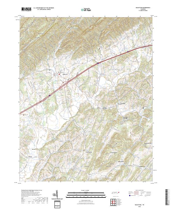 2022 Baileyton2022 Print · USGSGreene County is shown in the 2020s, where the Horton Highway connects rural communities under the shadow of the Hawkins County line ridges. Trace family history through Union Temple Church, Holland Mill, and dozens of family-named peaks like Marshall Knob.
 - 2022 Map of Paint Rock, 2022 Print
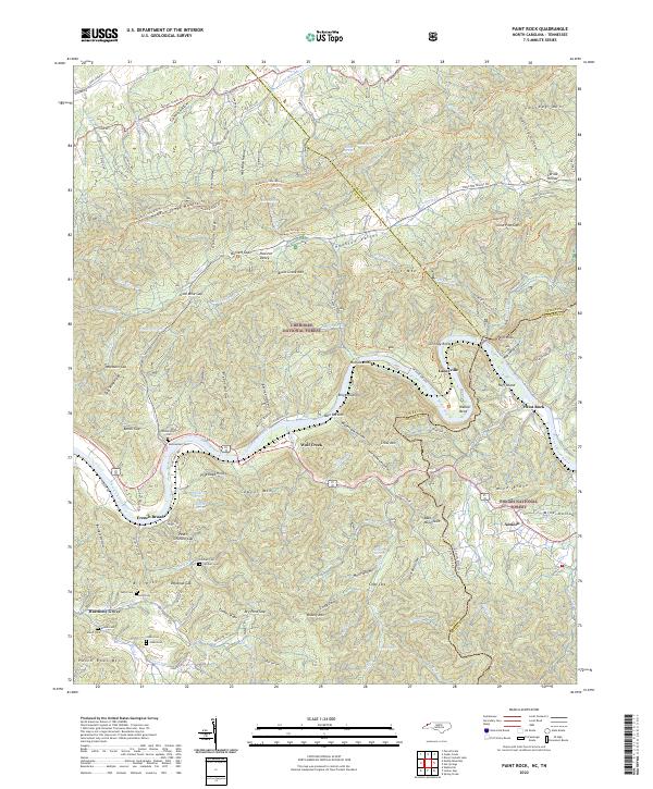 2022 Paint Rock2022 Print · USGSThe French Broad River borderland comes alive in this survey of the North Carolina and Tennessee line. Researchers can trace family history through sites like Mooneyham Cem, Justis Cem, and the old settlement at Lanceville.
 - 2022 Map of Hot Springs, 2022 Print
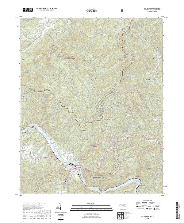 2022 Hot Springs2022 Print · USGSThe North Carolina-Tennessee border comes alive in this 2022 survey centered on the river town of Hot Springs. Genealogists can locate family sites like Odd Fellows Cem and Click Cem or trace the early paths through Hurricane and Houston Valley.
 - 2022 Map of Greystone, 2022 Print
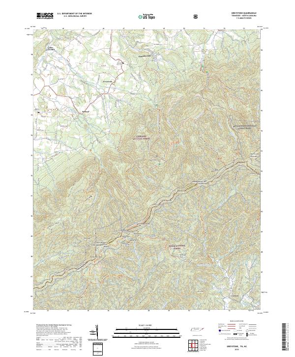 2022 Greystone2022 Print · USGSThe Tennessee and North Carolina border country comes alive on this map, showing the high ridges where the Appalachian National Scenic Trail winds through the Bald Mountains. Genealogists and historians can trace local family landmarks from Water Fork Mill and Hampton Mill to the Mountain View Cem.
 - 2022 Map of Flag Pond, 2022 Print
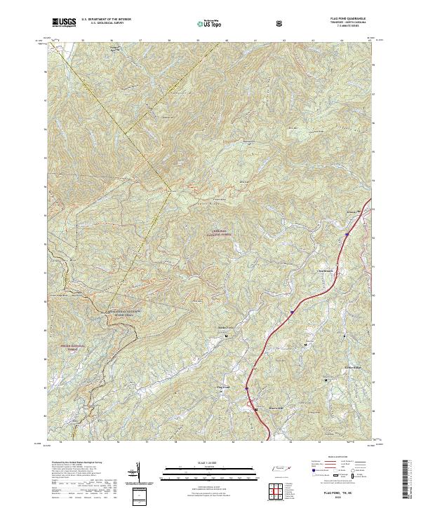 2022 Flag Pond2022 Print · USGSThe Tennessee-North Carolina border country comes alive in this 2022 survey of the Unicoi County highlands. Trace the high-altitude path of the Appalachian National Scenic Trl and locate family landmarks like Ernestville, Flag Pond, and Tilson Cem.
 - 2022 Map of McCloud, 2022 Print
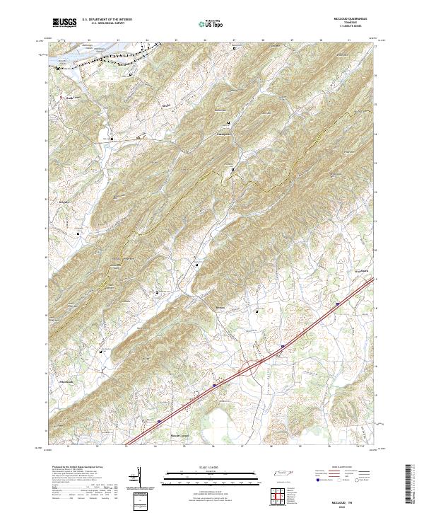 2022 McCloud2022 Print · USGSNortheast Tennessee's ridge-and-valley country is shown here at the Hawkins and Greene County border during the early 2020s. Genealogists can locate family burial sites like Reynolds or Burns cemeteries and trace old routes near McCloud and Romeo.
 - 2022 Map of Lovelace, 2022 Print
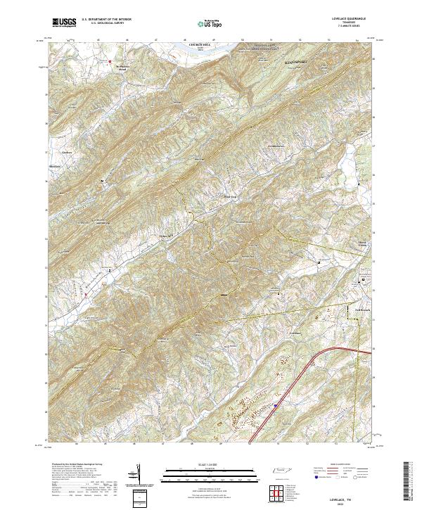 2022 Lovelace2022 Print · USGSNortheast Tennessee's ridge-and-valley landscape is captured here in recent years, where the Holston River meets the foothills of Bays Mountain. Researchers can find old family burial sites like Yankee Cem and landmarks such as Dykes Mill or Wire Knob.
 - 2022 Map of Davy Crockett Lake, 2022 Print
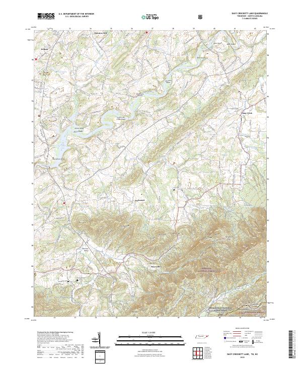 2022 Davy Crockett Lake2022 Print · USGSThe Nolichucky River valley at the Tennessee-North Carolina border shows a landscape shaped by river shoals and mountain gaps. Genealogists and hikers can trace family names and historic paths through Hayesville, Beersheba Cem, and the rugged slopes of Greene Mtn.
 - 2022 Map of Greeneville, 2022 Print
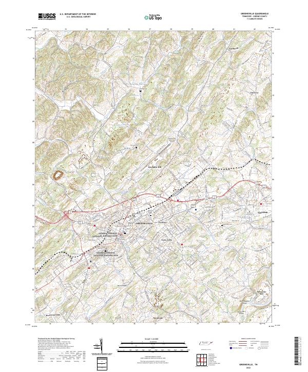 2022 Greeneville2022 Print · USGSGreeneville and its surrounding ridges come into focus in this contemporary Tennessee survey. Genealogists and local historians can trace legacy sites like Harmony Cem, Alexander Mill, and the Andrew Johnson National Historic Site.
 - 2022 Map of Parrottsville, 2022 Print
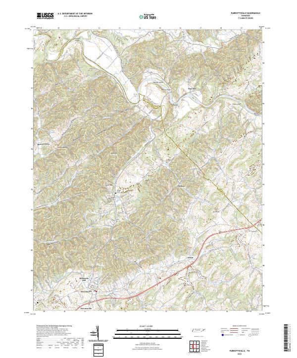 2022 Parrottsville2022 Print · USGSParrottsville and the surrounding hollows of Cocke and Greene Counties are captured here in the early 2020s. Genealogists and local historians can trace family-named sites like Brookside Mill, Hameds Chapel, and Ottinger Cem near the Nolichucky River.
 - 2022 Map of Springvale, 2022 Print
 2022 Springvale2022 Print · USGSHamblen County in 2022 shows a landscape where the Nolichucky River meets the ridges of Bays Mountain. Researchers can trace local heritage through dozens of family burial sites like Bethesda Cem and the settlement at Cheeks Crossroads.
 - 2022 Map of Mohawk, 2022 Print
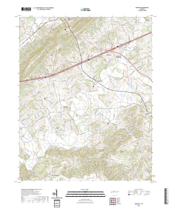 2022 Mohawk2022 Print · USGSThe East Tennessee ridge-and-valley landscape near the Greene-Hamblen border is captured here in recent decades. Researchers can trace family history through numerous landmarks like Wisecarver Cemetery, Bibles Chapel, and the community at Bulls Gap.
 - 2022 Map of Bulls Gap, 2022 Print
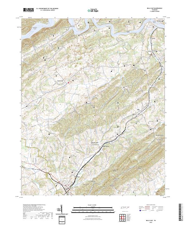 2022 Bulls Gap2022 Print · USGSBulls Gap and the surrounding ridges of Hawkins County are mapped here in the early 2020s. Genealogists can locate family burial grounds like McBride Cem and Bacon Cem, or trace the rail corridor through Ward Gap and Guthrie Gap.
 - 2022 Map of Rankin, 2022 Print
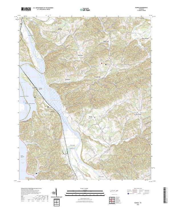 2022 Rankin2022 Print · USGSThe confluence of the French Broad and Pigeon Rivers at Douglas Lake defines this portion of Cocke County in the early 2020s. Researchers can trace old ferry routes and family histories through Old Solomon Ferry Rd, Rogers Cem, and Rankin Bottoms.
End of results
Showing maps 1-20 of 20
Top cities of Greene County
Frequently asked questions
- What are the different types of historical maps available for Greene County?
- What is the oldest map of Greene County?
- Where can I purchase historical maps of Greene County for my home or office?
- Where can I download high-res historical maps of Greene County?
- Are there historical topographic maps available for Greene County?
- Is there historical aerial imagery available for Greene County?
- Where are historical maps of Greene County sourced from?