1930s Maps of Greene County, Tennessee
Explore 41 historic maps of Greene County from the 1930s. These maps offer a rare glimpse into what life looked like during the 1930s — showing old roads, neighborhoods, homes, and landmarks that have changed or disappeared over time.
Whether you're researching your family's past, planning a metal detecting trip, or studying how Greene County's landscape evolved across the 1930s, these high-resolution maps are a powerful tool for exploring the history of this region.
- Focus on a specific era: All maps on this page are from the 1930s, giving you a focused view of this time period.
- See what’s changed: Compare century-old streets, trails, and buildings to today's modern landscape using overlays and satellite layers.
- Research with precision: Use these maps for genealogy, historical research, land use analysis, or educational projects.
- View, download, or print: Maps are fully viewable online in high resolution, and can be downloaded or printed for your own records.
Start exploring Greene County's history through authentic maps from the 1930s. This is your window into the past.
Greene County, TN maps
(41)- 1935 Map of Surgoinsville
 1935 Surgoinsville1935 Print · USGSHawkins and Greene counties are shown in the mid-1930s as the Tennessee Valley Authority began documenting the Holston River corridor. Genealogists can trace early homesteads and landmarks like Hennard Mill, Alumwell Academy, and Beech Creek Cem among the numerous mountain hollows.
 - 1935 Map of Baileyton
 1935 Baileyton1935 Print · USGSNortheastern Tennessee in the mid-1930s shows a landscape of small farming hamlets and mountain gaps. Genealogists can trace family names at Babbs Mill, Dotys Chapel, and scattered schoolhouses like Cross Anchor Sch and Piney Grove Sch.
 - 1935 Map of Lovelace
 1935 Lovelace1935 Print · USGSHawkins and Sullivan counties are captured here in the mid-thirties, showing a landscape of ridge-top beacons and creek-side mills. Researchers can trace rural family life through landmarks like Dykes Mill, Mountain View Sch, and the Airway Beacon atop the peaks.
 - 1935 Map of Rogersville
 1935 Rogersville1935 Print · USGSHawkins and Greene Counties come alive in the mid-1930s, showing a landscape of ridge-top schools and river-bottom farms. Genealogists can trace family footprints near Pressmans Home, Bulls Gap, and local centers like Macedonia Ch.
 - 1935 Map of Parrottsville
 1935 Parrottsville1935 Print · USGSThe Nolichucky River valley in the mid-1930s reveals a dense rural fabric of Greene and Cocke counties before modern development. Genealogists can trace family landmarks like Baysinger Hollow alongside community centers such as Parrottsville, Reaves Mill, and Salem Ch.
 - 1935 Map of Paint Rock
 1935 Paint Rock1935 Print · USGSThe French Broad River corridor at the Tennessee-North Carolina border comes to life in this mid-1930s survey. Genealogists and local historians can trace family locations near Paint Rock and Harmony Grove or find old community centers like Wolf Creek Sch and Mt Olive Ch.
 - 1935 Map of McCloud
 1935 McCloud1935 Print · USGSThe rural borderlands of Hawkins and Greene counties are captured here in the mid-1930s, showing a landscape defined by ridges and creek-side settlements. Genealogists can locate family-named sites like Butcher Valley, Kite Cem, and several local schools including Grigsby Sch.
 - 1935 Map of Mosheim
 1935 Mosheim1935 Print · USGSMid-1930s Greene County revolves around the rail-and-road corridor of Mosheim. Genealogists can trace rural homesteads near Clarissa Ramsey Memorial Chapel or locate the historic Gilbreath Sch and New Bethel Sch.
 - 1935 Map of Springvale
 1935 Springvale1935 Print · USGSIn the mid-thirties, the Nolichucky River valley supported a vibrant network of rural communities at the junction of three Tennessee counties. Genealogists and historians can trace family locations through numerous landmarks like Bethesda Ch, Silver City, and river crossings such as Inman Ford.
 - 1935 Map of Cedar Creek
 1935 Cedar Creek1935 Print · USGSMid-1930s Greene County life centers on the river and rural crossroads in this Tennessee Valley Authority study. Genealogists can locate family landmarks like Walter Crossroads, Whittenburg Ch, and the numerous islands of the Nolichucky River.
 - 1935 Map of Stonypoint
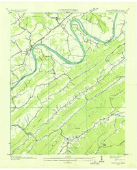 1935 Stonypoint1935 Print · USGSHawkins and Greene counties in the mid-1930s are captured here as the Tennessee Valley Authority began its regional transformation. Researchers can trace ancestral lands near Surgoinsville, locate old schools like Maxwell Academy, or find the County Ferry crossing the Holston River.
 - 1935 Map of Hot Springs
 1935 Hot Springs1935 Print · USGSThe French Broad River valley and the Tennessee borderlands come alive in the mid-1930s as the Appalachian Trail took shape across these ridges. Genealogists can locate Hot Springs at its rail-and-river peak, along with Fairview Ch and the Odd Fellows Cem.
 - 1935 Map of Mohawk
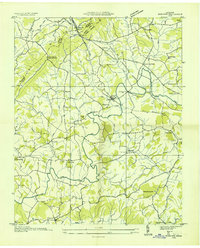 1935 Mohawk1935 Print · USGSGreene County was a landscape of small milling towns and rail-side junctions during the mid-1930s. Researchers can locate vanished landmarks like the Mohawk Roller Mill, the rural Sinking Springs Sch, and family sites near Warrensburg.
 - 1935 Map of Fall Branch
 1935 Fall Branch1935 Print · USGSNortheast Tennessee in the mid-thirties shows a rural landscape of ridges and crossroads at the junction of four counties. Trace family history through dozens of local landmarks like Kincheloe Mill, Evening Star Sch, and Cedar Chapel.
 - 1935 Map of Rankin
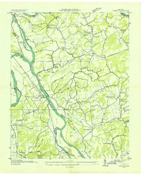 1935 Rankin1935 Print · USGSIn the mid-1930s, the river valleys of East Tennessee were still defined by small farming communities and country schools. Genealogists can trace family footprints at Atchleys Mill, Rorex Chapel, and the community of Rankin along the Southern railroad.
 - 1935 Map of Bulls Gap
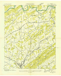 1935 Bulls Gap1935 Print · USGSBulls Gap and the surrounding East Tennessee valley appear here in the mid-1930s as a landscape of rural junctions and river crossings. Researchers can trace family history at Morrissetts Chapel, locate the old MELENDY FERRY on the HOLSTON RIVER, or explore rail-side hamlets like Persia and St Clair.2 unique versions available
 - 1935 Map of Small
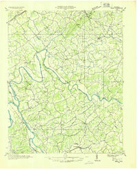 1935 Small1935 Print · USGSEast Tennessee river life in the mid-1930s centered on the fertile valley between the Bays Mountains and the French Broad River. Researchers can trace ancestral locations at Mohawk, Parrottsville, and dozens of rural sites like Alshieys Mill or Bethesda Ch.
 - 1935 Map of Jearoldstown
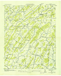 1935 Jearoldstown1935 Print · USGSGreene County settlement and Tennessee Valley utility expansion are captured here in the mid-1930s. Genealogists can trace family names at Dixon Chapel, Union Temple Ch, and the rural community of Milburton.
 - 1936 Map of Greystone
 1936 Greystone1936 Print · USGSThe Tennessee and North Carolina borderlands in the mid-1930s reveal a landscape of mountain mills and remote forest settlements. Researchers can trace early family sites like Jennings, visit rural centers like Gethsemane Ch, or locate old industrial sites like Water Fork Mill.
 - 1936 Map of Lake Davy Crockett
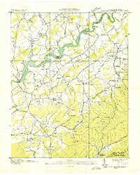 1936 Lake Davy Crockett1936 Print · USGSGreene County is documented here during the mid-1930s as new reservoirs began to alter the river valleys. Local historians can trace the foundations of many vanished community sites, from the Cove Creek Mill to the Tobacco Experimental Station and the original Birds Bridge.
 - 1936 Map of Chuckey
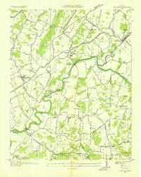 1936 Chuckey1936 Print · USGSGreene County is shown here in the mid-thirties, when the Nolichucky River shaped local life from Rheatown to Limestone. Genealogists can trace family footprints at Quaker Knobs Ch, Stone Dam Ch, and the Chestnut Ridge Sch.
 - 1936 Map of Flag Pond
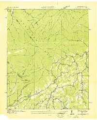 1936 Flag Pond1936 Print · USGSThe Tennessee and North Carolina borderlands come alive in the mid-1930s, showing a landscape of high ridges and secluded valley settlements. Researchers can trace the original path of the Appalachian Trail past family landmarks like Harris Mill and the Clearbranch Post Office.
 - 1936 Map of Telford
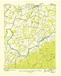 1936 Telford1936 Print · USGSIn the mid-1930s, the Nolichucky River valley supported a landscape of water-powered industry and mountain mining. Genealogists can trace family names through landmarks like Washington College, Broylesville Mill, and the Peach Orchard Mine.
 - 1936 Map of Greeneville
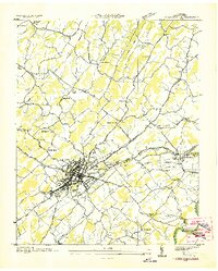 1936 Greeneville1936 Print · USGSGreeneville and the surrounding Greene County countryside are captured here in the mid-1930s. Researchers can locate family roots at Hardin Chapel, study the early campus of Tusculum College, or find the Depression-era CCC Camp No 4492.
 - 1939 Map of Mosheim
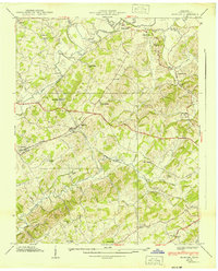 1939 Mosheim1939 Print · USGSGreene County community life thrived in the late thirties along the SOUTHERN railroad and the Andrew Johnson Highway. Researchers can trace rural roots at Hawkins Cem or locate several local landmarks like Hull Mill and Ramsey Chapel.3 unique versions available
Showing maps 1-25 of 41
Top cities of Greene County
Frequently asked questions
- What are the different types of historical maps available for Greene County?
- What is the oldest map of Greene County?
- Where can I purchase historical maps of Greene County for my home or office?
- Where can I download high-res historical maps of Greene County?
- Are there historical topographic maps available for Greene County?
- Is there historical aerial imagery available for Greene County?
- Where are historical maps of Greene County sourced from?