1930s Maps of Rustic Acres, Tennessee
Explore 2 historic maps of Rustic Acres from the 1930s. These maps offer a rare glimpse into what life looked like during the 1930s — showing old roads, neighborhoods, homes, and landmarks that have changed or disappeared over time.
Whether you're researching your family's past, planning a metal detecting trip, or studying how Rustic Acres's landscape evolved across the 1930s, these high-resolution maps are a powerful tool for exploring the history of this region.
- Focus on a specific era: All maps on this page are from the 1930s, giving you a focused view of this time period.
- See what’s changed: Compare century-old streets, trails, and buildings to today's modern landscape using overlays and satellite layers.
- Research with precision: Use these maps for genealogy, historical research, land use analysis, or educational projects.
- View, download, or print: Maps are fully viewable online in high resolution, and can be downloaded or printed for your own records.
Start exploring Rustic Acres's history through authentic maps from the 1930s. This is your window into the past.
Rustic Acres, TN maps
(2)- 1936 Map of Greeneville
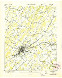 1936 Greeneville1936 Print · USGSGreeneville and the surrounding Greene County countryside are captured here in the mid-1930s. Researchers can locate family roots at Hardin Chapel, study the early campus of Tusculum College, or find the Depression-era CCC Camp No 4492.
 - 1939 Map of Greeneville, 1958 Print
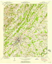 1939 Greeneville1958 Print · USGSGreene County entered the pre-war era as a thriving crossroads of rail and river commerce along the SOUTHERN line. Researchers can trace ancestral sites from Tusculum College to family landmarks like Doughty Chapel, Alexander Mill, and the Andrew Johnson National Cem.
End of results
Showing maps 1-2 of 2
Top cities near Rustic Acres
Frequently asked questions
- What are the different types of historical maps available for Rustic Acres?
- What is the oldest map of Rustic Acres?
- Where can I purchase historical maps of Rustic Acres for my home or office?
- Where can I download high-res historical maps of Rustic Acres?
- Are there historical topographic maps available for Rustic Acres?
- Is there historical aerial imagery available for Rustic Acres?
- Where are historical maps of Rustic Acres sourced from?