1930s Maps of Duck Creek, Tennessee
Explore 3 historic maps of Duck Creek from the 1930s. These maps offer a rare glimpse into what life looked like during the 1930s — showing old roads, neighborhoods, homes, and landmarks that have changed or disappeared over time.
Whether you're researching your family's past, planning a metal detecting trip, or studying how Duck Creek's landscape evolved across the 1930s, these high-resolution maps are a powerful tool for exploring the history of this region.
- Focus on a specific era: All maps on this page are from the 1930s, giving you a focused view of this time period.
- See what’s changed: Compare century-old streets, trails, and buildings to today's modern landscape using overlays and satellite layers.
- Research with precision: Use these maps for genealogy, historical research, land use analysis, or educational projects.
- View, download, or print: Maps are fully viewable online in high resolution, and can be downloaded or printed for your own records.
Start exploring Duck Creek's history through authentic maps from the 1930s. This is your window into the past.
Duck Creek, TN maps
(3)- 1935 Map of Rogersville
 1935 Rogersville1935 Print · USGSHawkins and Greene Counties come alive in the mid-1930s, showing a landscape of ridge-top schools and river-bottom farms. Genealogists can trace family footprints near Pressmans Home, Bulls Gap, and local centers like Macedonia Ch.
 - 1935 Map of Lee Valley
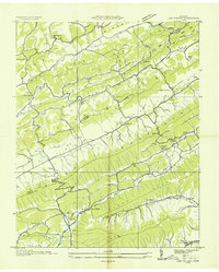 1935 Lee Valley1935 Print · USGSThe Clinch Mountain ridges of Hancock and Hawkins counties come into focus during the mid-thirties, showing a landscape defined by mountain gaps and valley farming. Genealogists can locate family landmarks like Murrell Town, Trents, and Gills Chapel tucked among the steep slopes.
 - 1939 Map of Lee Valley, 1956 Print
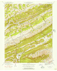 1939 Lee Valley1956 Print · USGSHawkins and Hancock Counties are shown here just before the mid-century, where ridges and valleys shaped a landscape of small farmsteads and rural schoolhouses. Researchers can trace family sites like Murrell Cem or find local centers like Lee Valley, Treadway, and Spruce Pine Sch.3 unique versions available
End of results
Showing maps 1-3 of 3
Top cities near Duck Creek
- Morristown historical maps
- Rogersville historical maps
- Bean Station historical maps
- Sneedville historical maps
- Jonesville historical maps
- Mooresburg historical maps
See more
Frequently asked questions
- What are the different types of historical maps available for Duck Creek?
- What is the oldest map of Duck Creek?
- Where can I purchase historical maps of Duck Creek for my home or office?
- Where can I download high-res historical maps of Duck Creek?
- Are there historical topographic maps available for Duck Creek?
- Is there historical aerial imagery available for Duck Creek?
- Where are historical maps of Duck Creek sourced from?