Old Maps of Savannah, Tennessee for Academic Research
Study the evolution of Savannah with 19 high-resolution historic maps. Whether you're teaching, researching, or modeling changes in land use, these maps provide essential visual documentation of urban, environmental, and geographic change.
- Analyze long-term change: Track patterns in development, transportation, and natural features.
- Ideal for environmental or urban studies: Support academic projects with primary historical map data.
- Use in the classroom or lab: Educators and researchers rely on these maps to bring historical context to life.
These maps are a powerful tool for teaching, research, and visualizing how Savannah has changed over the decades.
Savannah, TN maps
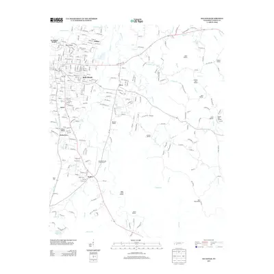
(19)- 1936 Map of Savannah
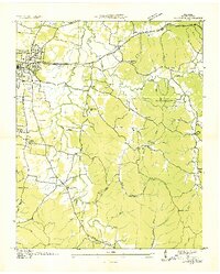 1936 Savannah1936 Print · USGSHardin County was undergoing a major modernization in the mid-1930s as the Tennessee Valley Authority expanded its reach. Researchers can trace early family settlements and rural landmarks from Walkers Academy and Burnt Church to the crossroads at Maddox.
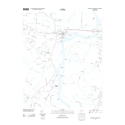
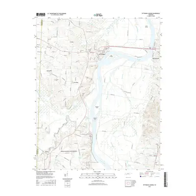
 - 1936 Map of Pittsburg Landing
 1936 Pittsburg Landing1936 Print · USGSHardin County during the mid-1930s shows a landscape defined by the Tennessee River and the grounds of Shiloh National Military Park. Researchers can trace early river crossings like Pittsburg Ferry and find vanished landmarks like CCC Camp No 2425.
 - 1949 Map of Pittsburg Landing, 1952 Print
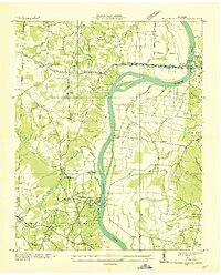
 1949 Pittsburg Landing1952 Print · USGSHardin County history is centered on the hallowed grounds of Shiloh National Military Park and the vital banks of the Tennessee River in the late 1940s. Genealogists and historians can trace the riverside at Pittsburg Landing, locate the National Cem, or find rural family sites like Ledbetter Cem and Mt Zion Ch.
 - 1949 Map of Savannah, 1952 Print
 1949 Savannah1952 Print · USGSHardin County during the late 1940s shows a landscape of riverfront growth near the Tennessee River and scattered rural hamlets. You can trace early family sites and community centers like Burnt Church, Walkertown, and the Sevier Chapel School.
 - 1956 Map of Blytheville, 1964 Print
 1956 Blytheville1964 Print · USGSWest Tennessee and the Arkansas Delta come alive in this mid-century survey of the river-and-rail corridor connecting Memphis to Jackson. Genealogists and historians can trace the rail lines of the Louisville and Nashville RR and locate landmarks like Western State Hospital or Fort Pillow State Prison Farm.2 unique versions available
 - 1959 Map of Blytheville
 1959 Blytheville1959 Print · USGSWest Tennessee and Northeast Arkansas meet along the river in the late fifties, during a period of steady industrial and agricultural growth. Genealogists can trace the rail corridors of the Illinois Central through Jackson or explore landmarks like Shiloh National Military Park and Fort Pillow State Prison.
 - 1972 Map of Savannah, 1974 Print
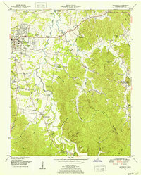
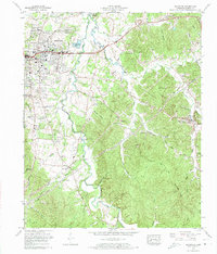 1972 Savannah1974 Print · USGSHardin County and the city of Savannah are captured here during a period of local growth in the early seventies. Genealogists and historians can trace family roots through numerous small burial grounds and rural landmarks like Sand Hill Cem, Plummer Church, and Old Town.2 unique versions available
 - 1972 Map of Pittsburg Landing, 1974 Print
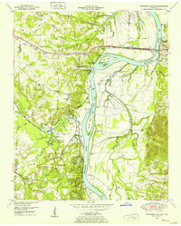
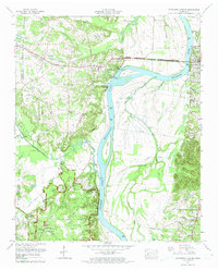 1972 Pittsburg Landing1974 Print · USGSHardin County during the early seventies reveals a landscape defined by the Tennessee River and the sacred grounds of Shiloh National Military Park. Historians can trace rural community life through sites like Pittsburg Landing, Bethlehem Cem, and Crump Landing.2 unique versions available
 - 1986 Map of Selmer
 1986 Selmer1986 Print · USGSThe Tennessee River valley and the West Tennessee highlands come into focus in the mid-eighties, showing the region's unique intersection of Civil War history and modern infrastructure. Genealogists and researchers can trace family landmarks like Gillisses Mills, the campus of Freed-Hardeman College, and the hallowed grounds of Shiloh National Military Park.3 unique versions available
 - 2010 Map of Savannah, 2010 Print
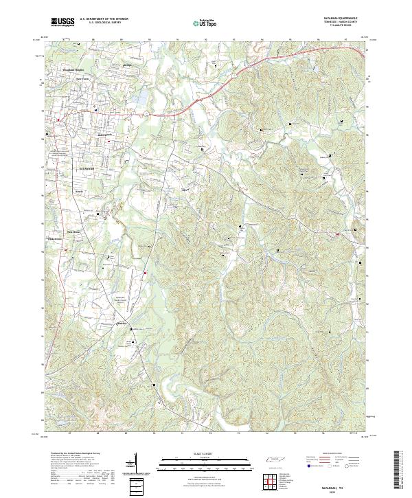
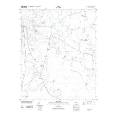 2010 Savannah2010 Print · USGSCovers Savannah, including Maddox, Woodland Heights, and other nearby areas
 - 2010 Map of Pittsburg Landing, 2010 Print
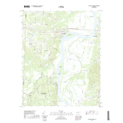
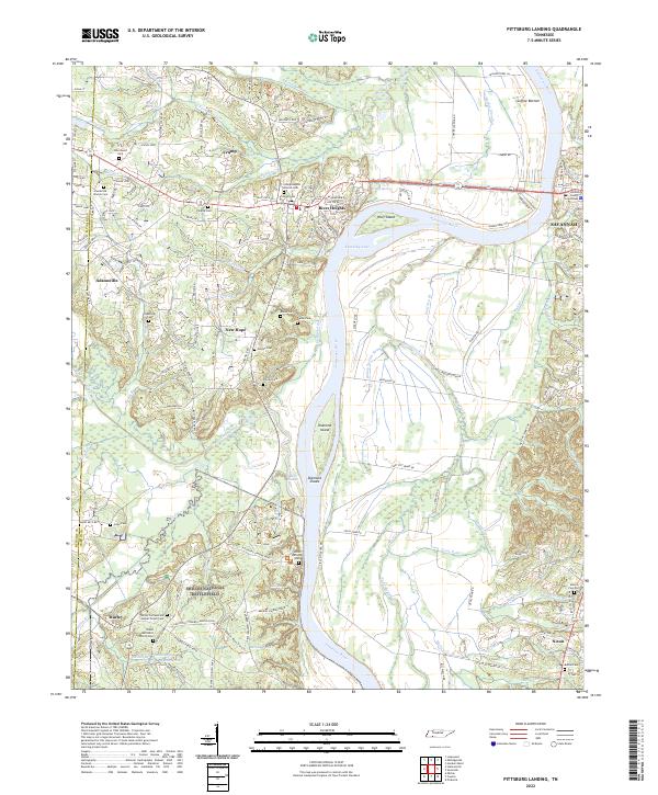
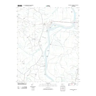 2010 Pittsburg Landing2010 Print · USGSCovers Savannah, including Adamsville, Crump, and other nearby areas
 - 2013 Map of Pittsburg Landing, 2013 Print
 2013 Pittsburg Landing2013 Print · USGSCovers Savannah, including Adamsville, Crump, and other nearby areas
 - 2013 Map of Savannah, 2013 Print
 2013 Savannah2013 Print · USGSCovers Savannah, including Maddox, Woodland Heights, and other nearby areas
 - 2016 Map of Savannah, 2016 Print
 2016 Savannah2016 Print · USGSCovers Savannah, including Maddox, Woodland Heights, and other nearby areas
 - 2016 Map of Pittsburg Landing, 2016 Print
 2016 Pittsburg Landing2016 Print · USGSCovers Savannah, including Adamsville, Crump, and other nearby areas
 - 2019 Map of Savannah, 2019 Print
 2019 Savannah2019 Print · USGSCovers Savannah, including Maddox, Woodland Heights, and other nearby areas
 - 2019 Map of Pittsburg Landing, 2019 Print
 2019 Pittsburg Landing2019 Print · USGSCovers Savannah, including Adamsville, Crump, and other nearby areas
 - 2022 Map of Pittsburg Landing, 2022 Print
 2022 Pittsburg Landing2022 Print · USGSHardin County's riverfront and the hallowed grounds of the Civil War are detailed here in this 2022 survey. Genealogists and historians can trace family names and military positions near Shiloh National Battlefield, Bloody Pond, and the Hardin County Courthouse.
 - 2023 Map of Savannah, 2023 Print
 2023 Savannah2023 Print · USGSSavannah and its surrounding neighborhoods are captured in detail during this modern era of Tennessee growth. Researchers can trace family history through a dense network of local sites including Campground Church Cem, Belle Meade, and the Savannah-Hardin County Airport.
End of results
Showing maps 1-19 of 19
Top cities near Savannah
- Corinth historical maps
- Clifton historical maps
- Adamsville historical maps
- Crump historical maps
- Michie historical maps
- Sardis historical maps
See more
Top neighborhoods of Savannah
- Phillips historical maps
- Belle Meade historical maps
- Woodland Heights historical maps
- New Town historical maps
- Austin historical maps
Frequently asked questions
- What are the different types of historical maps available for Savannah?
- What is the oldest map of Savannah?
- Where can I purchase historical maps of Savannah for my home or office?
- Where can I download high-res historical maps of Savannah?
- Are there historical topographic maps available for Savannah?
- Is there historical aerial imagery available for Savannah?
- Where are historical maps of Savannah sourced from?