2020s Maps of Henderson County, Tennessee
Explore 15 historic maps of Henderson County from the 2020s. These maps offer a rare glimpse into what life looked like during the 2020s — showing old roads, neighborhoods, homes, and landmarks that have changed or disappeared over time.
Whether you're researching your family's past, planning a metal detecting trip, or studying how Henderson County's landscape evolved across the 2020s, these high-resolution maps are a powerful tool for exploring the history of this region.
- Focus on a specific era: All maps on this page are from the 2020s, giving you a focused view of this time period.
- See what’s changed: Compare century-old streets, trails, and buildings to today's modern landscape using overlays and satellite layers.
- Research with precision: Use these maps for genealogy, historical research, land use analysis, or educational projects.
- View, download, or print: Maps are fully viewable online in high resolution, and can be downloaded or printed for your own records.
Start exploring Henderson County's history through authentic maps from the 2020s. This is your window into the past.
Henderson County, TN maps
(15)- 2022 Map of Luray, 2022 Print
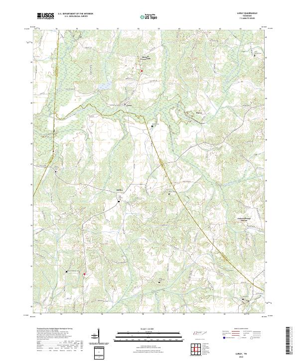 2022 Luray2022 Print · USGSWestern Tennessee rural life is documented here in the early twenty-first century, spanning the junction of three counties. Genealogists can trace family footprints across numerous sites like Mount Pleasant Cem, New Friendship Cem, and the settlement of Mifflin.
 - 2022 Map of Scotts Hill, 2022 Print
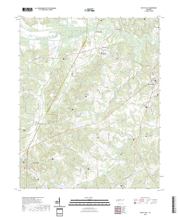 2022 Scotts Hill2022 Print · USGSWest Tennessee hill country is meticulously detailed in this recent survey of the Henderson and Decatur county line. Genealogists can trace family names through dozens of burial sites, including Rushing Grove Cem, Houston Young Cem, and Peace Chapel Cem.
 - 2022 Map of Chesterfield, 2022 Print
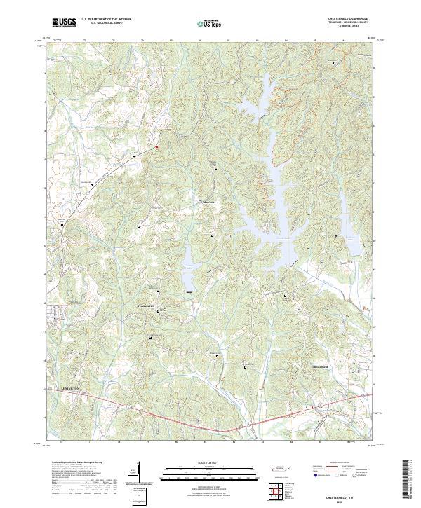 2022 Chesterfield2022 Print · USGSHenderson County, Tennessee, appears in high detail in the early 2020s, showing a landscape defined by the Beech River and local water bodies. Genealogists can locate over a dozen family and community burial sites, including Mazies Chapel Cem and Wallace Cem.
 - 2022 Map of Holladay, 2022 Print
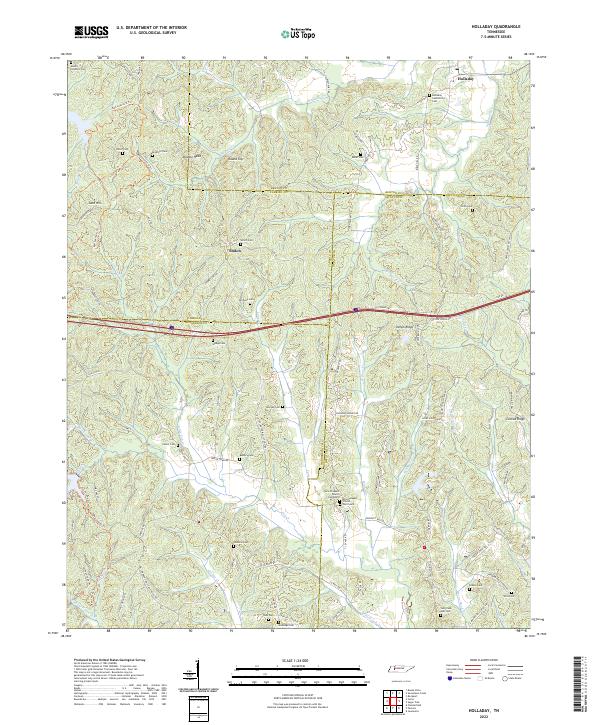 2022 Holladay2022 Print · USGSBenton and Decatur counties in the early twenty-first century reveal a landscape of interconnected family ridges and stream valleys. Genealogists can trace numerous burial sites including Lester Cem, Hedge Cem, and Smith Cem near the historic Holladay settlement.
 - 2022 Map of Cedar Grove, 2022 Print
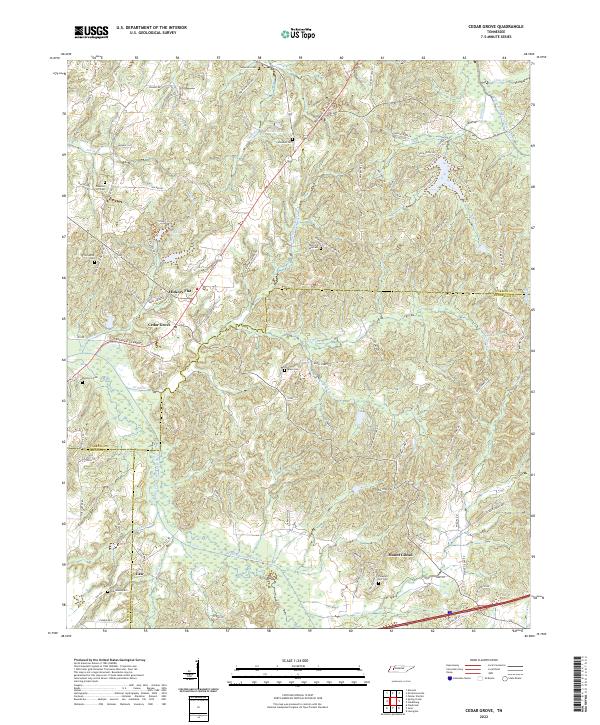 2022 Cedar Grove2022 Print · USGSThe West Tennessee tri-county borderlands of Carroll, Madison, and Henderson appear here in the early 2020s. Genealogists can trace family burial sites across the landscape, from Morning Sun Cem to Oak Grove Cem and Wood Hill Cem.
 - 2022 Map of Sardis, 2022 Print
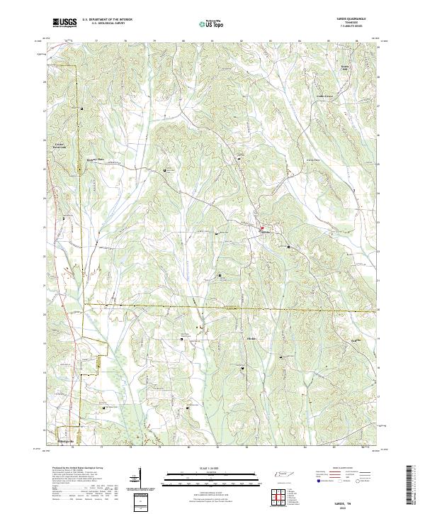 2022 Sardis2022 Print · USGSIn the early twenty-first century, this West Tennessee borderland remains a landscape of quiet crossroads and family burial grounds. Genealogists can locate historic sites like Old Salem Cem, Hinkle, and the Hurricane Church-Cem.
 - 2022 Map of Lexington, 2022 Print
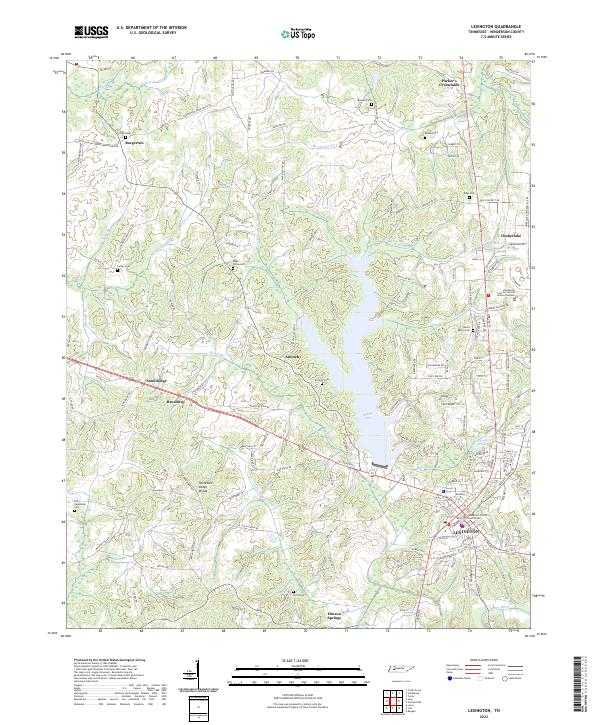 2022 Lexington2022 Print · USGSHenderson County comes to life in the early 2020s, centered on the growing county seat and its surrounding reservoir. Genealogists can trace family lines through Beech River Cem, Kizer Cem, and the historic Antioch Cem.
 - 2022 Map of Reagan, 2022 Print
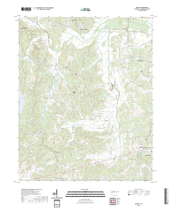 2022 Reagan2022 Print · USGSHenderson County, Tennessee, is captured here in the early twenty-first century, showcasing a landscape shaped by the Beech River. Local historians can trace family roots through several rural burial sites like Buckley Cem and Powers Cem or locate the crossroads of Reagan and Middleburg.
 - 2022 Map of Yuma, 2022 Print
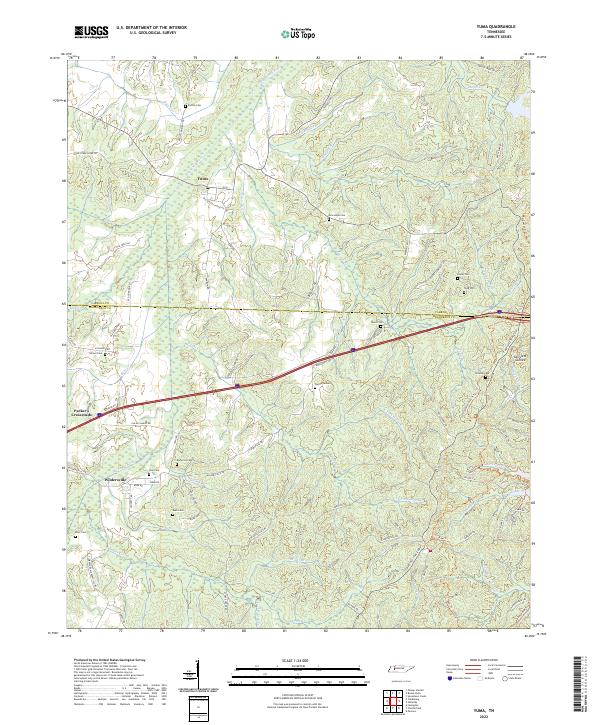 2022 Yuma2022 Print · USGSCarroll and Henderson counties are captured here in the early twenty-first century as the traditional farming landscape meets modern transit. Genealogists can trace family landmarks and burial sites including Enochs Cem, Cain Cem, and the settlement at Yuma.
 - 2022 Map of Clarksburg, 2022 Print
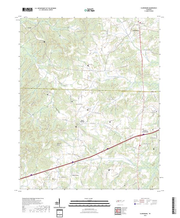 2022 Clarksburg2022 Print · USGSThe Tennessee and Mississippi drainage basins meet here along the Tennessee Valley Divide in Carroll and Henderson counties. Genealogists can trace family heritage through numerous burial sites like Palestine Cem, Rock Springs Cem, and the quiet crossroads at Jumbo.
 - 2022 Map of Thurman, 2022 Print
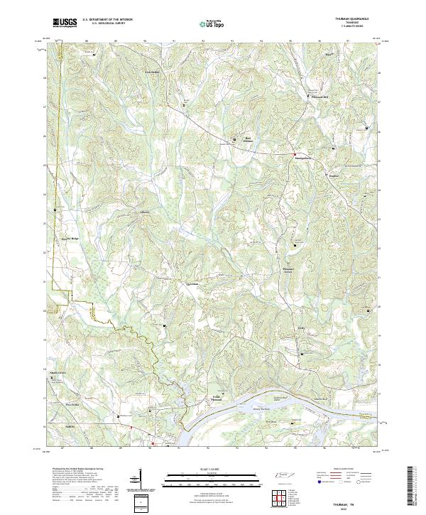 2022 Thurman2022 Print · USGSDecatur County and the Tennessee River corridor are captured here in their modern rural character. Genealogists and local historians can trace family locations through numerous sites like Saltillo, the Red Walnut Church Cem, and the uniquely named Lick Skillet.
 - 2022 Map of Life, 2022 Print
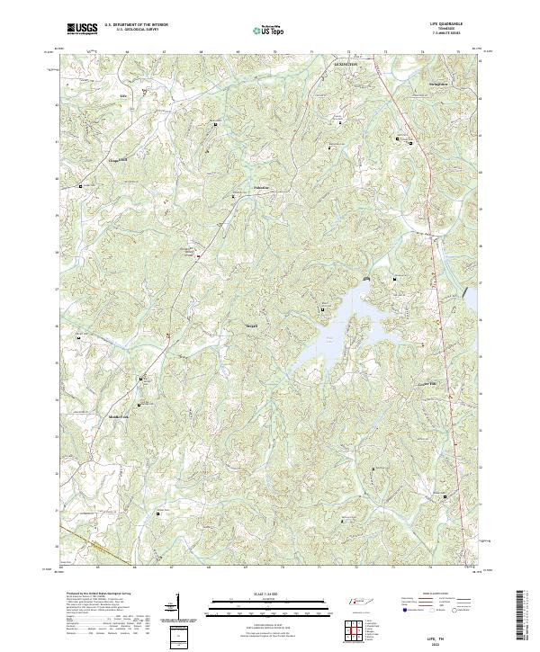 2022 Life2022 Print · USGSHenderson and Chester counties appear in the early 21st century as a landscape of crossroads hamlets and family-named landmarks. Researchers can trace numerous local burial grounds and historic sites like Old Big Springs Cem, Middle Fork, and the Tennessee Valley Divide.
 - 2022 Map of Parsons, 2022 Print
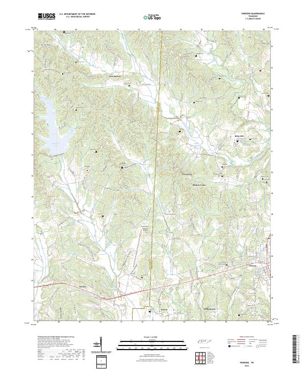 2022 Parsons2022 Print · USGSCrossing the county line between Henderson and Decatur during the early 2020s, this area shows a landscape of creek-fed hollows and tight-knit rural settlements. Genealogists can locate numerous family burial sites and country congregations like Mount Ararat Cem and Bible Hill Church.
 - 2022 Map of Juno, 2022 Print
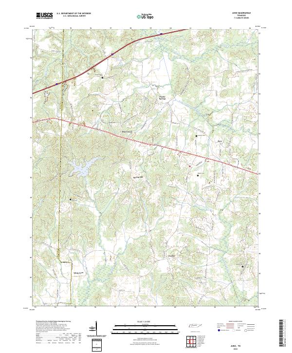 2022 Juno2022 Print · USGSHenderson County, Tennessee, is mapped here in its modern rural character along the historic forks of the Deer River. Researchers can trace family history through several sites like Union Grove Cem and Hamlet Cem or locate the crossroads of Blue Goose and Crucifer.
 - 2022 Map of Enville, 2022 Print
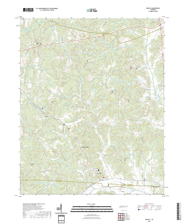 2022 Enville2022 Print · USGSThe rural borderlands where Henderson, Chester, and McNairy counties meet are shown here in modern detail. Genealogists can trace family heritage at Woodlawn Cem, Grove Springs Cem, and the small settlement of Cabo.
End of results
Showing maps 1-15 of 15
Top cities of Henderson County
Frequently asked questions
- What are the different types of historical maps available for Henderson County?
- What is the oldest map of Henderson County?
- Where can I purchase historical maps of Henderson County for my home or office?
- Where can I download high-res historical maps of Henderson County?
- Are there historical topographic maps available for Henderson County?
- Is there historical aerial imagery available for Henderson County?
- Where are historical maps of Henderson County sourced from?