Old Maps of Henderson County, Tennessee for Metal Detecting
Plan your next treasure hunt with 107 historic maps of Henderson County. Find old homesites, ghost towns, trails, and gathering spots that may be lost to time — perfect for identifying promising metal detecting locations.
- Locate forgotten sites: Uncover places like long-lost settlements, abandoned rail lines, or gathering spots.
- Plan better hunts: Use map overlays combined with LiDAR or satellite views to narrow in on historically rich areas.
- Made for detectorists: Thousands of hobbyists use these maps to discover relics, coins, and hidden history.
Use these historic maps to boost your research and find new opportunities beneath the surface of Henderson County.
Henderson County, TN maps
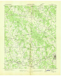
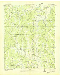
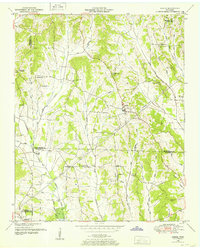
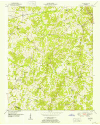
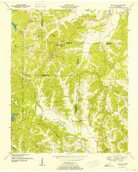
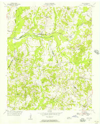
(107)- 1936 Map of Clarksburg
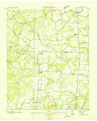 1936 Clarksburg1936 Print · USGSWest Tennessee’s rural landscape comes alive in the mid-1930s, showing the early road networks and community hubs of Carroll and Henderson Counties. Genealogists can locate family-named landmarks like Hart Cem and schools including Pritchard Sch and Clarksburg Sch.
 - 1936 Map of Lexington
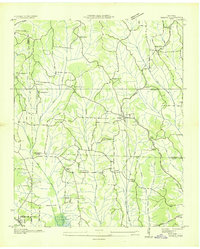
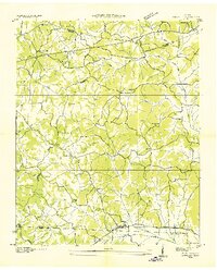
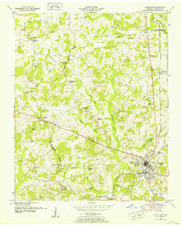
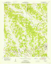
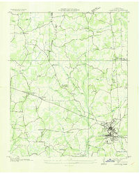 1936 Lexington1936 Print · USGSHenderson County in the mid-thirties reveals a landscape of rural schoolhouses and busy rail junctions centered on the town of Lexington. Genealogists can trace family landmarks like Caffey Cem or visit the site of the CCC Camp No 496.
 - 1936 Map of Yuma
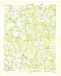
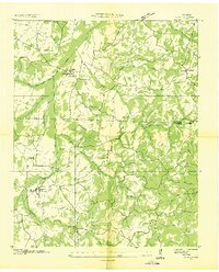 1936 Yuma1936 Print · USGSCarroll and Henderson Counties in the mid-1930s were defined by small rail-stop communities and a dense network of country schools. Genealogists can locate family burial sites at Farmsville Cem and trace the paths between New Hope Ch and Belgrade Sch.
 - 1936 Map of Scotts Hill
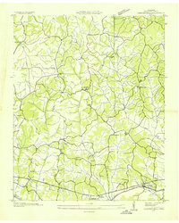
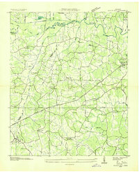 1936 Scotts Hill1936 Print · USGSHenderson and Decatur counties appear here in the mid-1930s, showing a rural landscape before modern development altered the river valleys. Researchers can locate many vanished community hubs like Dixie Mills, the County Farm, and New Hope Ch.
 - 1936 Map of Parsons
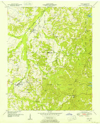
 1936 Parsons1936 Print · USGSDecatur and Henderson counties are captured here in the mid-1930s, showing a landscape defined by the Nashville Chattanooga and St Louis Railway. Trace family history across rural settlements and landmarks like Old Safford, Wilkinstown, and the Cedar Hill Ch & Cem.
 - 1936 Map of Thurman
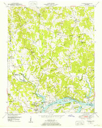
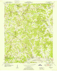
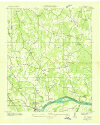 1936 Thurman1936 Print · USGSThe Tennessee River valley at Pitts Bend is captured here in the mid-thirties, showing a landscape of riverfront landings and upland farms. Genealogists can trace family names at Altillo Cem and Bethel Cem or find old school sites like Doe Creek Sch.
 - 1936 Map of Sardis
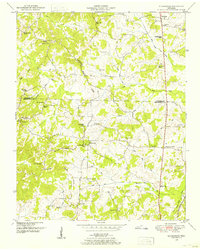
 1936 Sardis1936 Print · USGSWest Tennessee rural life is documented here during the mid-1930s as the regional electrical grid began to expand across the landscape. Genealogists and local historians can locate early landmarks such as Taylors Store, New Hurricane Ch, and the Tri County Sch near the county lines.
 - 1936 Map of Reagan
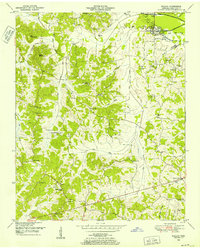
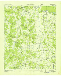 1936 Reagan1936 Print · USGSHenderson County was a landscape of small farming communities and river bottomlands during the mid-1930s. Researchers can trace ancestral locations through numerous rural schools and churches, including Reagan Sch, Mt Moriah Ch, and the remote Ridley Chapel.
 - 1936 Map of Cavvia
 1936 Cavvia1936 Print · USGSWest Tennessee rural life is captured in the mid-1930s where four counties converge among the forks of Birdsong and Cub Creeks. Researchers can trace ancestral locations at Shiloh Cem, identify vanished schoolhouse sites like Unity Sch, or locate old commercial hubs such as Tolleys Store.
 - 1936 Map of Enville
 1936 Enville1936 Print · USGSThe crossroads of West Tennessee are captured here in the mid-1930s as rural life centered on local schools and churches. Researchers can pinpoint long-standing community hubs like Enville, Pleasant Hill Ch, and the Cherry Cem.
 - 1936 Map of Life
 1936 Life1936 Print · USGSHenderson and Chester counties appear here in the mid-thirties, showcasing a rural landscape defined by the Tennessee Basin Divide. Genealogists can trace family names through numerous sites like Patterson Cem, Sainte Chapel, and the community Poorhouse.
 - 1936 Map of Chesterfield
 1936 Chesterfield1936 Print · USGSHenderson County was a landscape of small farming communities and country schools in the mid-1930s. Genealogists can locate family landmarks like Mays Chapel Cem and Bible Grove Ch or trace the N C & St L rail corridor.
 - 1949 Map of Sardis, 1952 Print
 1949 Sardis1952 Print · USGSSardis and the borderlands of Henderson, Chester, and Hardin Counties are captured here at the end of the 1940s. Genealogists and historians can locate family landmarks such as Brazelton Cem, Maria Bluff Ch, and the rural Tri-County School among the area's many drainage canals.2 unique versions available
 - 1949 Map of Thurman, 1952 Print
 1949 Thurman1952 Print · USGSThe Tennessee River shoreline at the turn of the 1950s is captured here in detail, showing the river-based economy of Decatur County. Researchers can trace old family names and settlements like Lick Skillet, find the Union Hall School, or locate river landings at Swallow Bluff.2 unique versions available
 - 1950 Map of Reagan, 1952 Print
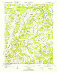
 1950 Reagan1952 Print · USGSHenderson County's rural communities and river bottomlands are captured here at mid-century during a time of changing transportation and land use. Genealogists can trace family roots through numerous sites like Mt Gilead Ch, Judson School, and the Dismantled RR near Warrens Bluff.2 unique versions available
 - 1950 Map of Scotts Hill, 1952 Print
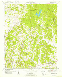
 1950 Scotts Hill1952 Print · USGSHenderson and Decatur Counties are captured here in the early fifties, showing a rural landscape anchored by Scotts Hill and the western shore of Kentucky Lake. Genealogists can trace deep local roots at Rushing Grove Church, Dixie Mills, and numerous family cemeteries.3 unique versions available
 - 1950 Map of Life, 1952 Print
 1950 Life1952 Print · USGSHenderson and Chester County rural life in the early fifties was centered around small crossroads settlements and family-named landmarks. Genealogists can trace local heritage through sites like the Poorhouse, the County Farm Cem, and schools like Sheppard Sch.
 - 1950 Map of Enville, 1952 Print
 1950 Enville1952 Print · USGSMid-century West Tennessee comes to life here along the Tennessee Valley Divide at the meeting of three counties. Genealogists and local historians can trace family locations through numerous rural landmarks like Grove Springs Cem, Bailey Chapel, and Roby Sch.3 unique versions available
 - 1950 Map of Yuma, 1953 Print
 1950 Yuma1953 Print · USGSCarroll and Henderson Counties are seen here in the early fifties, a landscape where the Natchez Trace State Park and Forest meets the rail corridor. Researchers can locate family landmarks like Enochs Cem or trace the old paths near Wildersville and New Hope Church.3 unique versions available
 - 1950 Map of Lexington, 1953 Print
 1950 Lexington1953 Print · USGSHenderson County is captured here in the mid-century as a landscape of crossroads, railroads, and ridge-line communities. Genealogists can trace family names and local landmarks through the Old Hephzibah Cem, Timberlake School, and the busy rail junction at Lexington.3 unique versions available
 - 1950 Map of Holladay, 1953 Print
 1950 Holladay1953 Print · USGSBenton and Carroll counties meet in this mid-century survey of West Tennessee just as the modern state park system was maturing. Genealogists can locate family names and rural centers like Shiloh, Poplar Springs Sch, and the Williams Cem.3 unique versions available
 - 1950 Map of Chesterfield, 1953 Print
 1950 Chesterfield1953 Print · USGSMid-century Henderson County is captured here at a time when the Natchez Trace and the surrounding state forest defined the local landscape. Genealogists and historians can trace numerous family-named sites, such as Holbrook Cem, Howard Sch, and the community of Chesterfield.5 unique versions available
 - 1950 Map of Parsons, 1953 Print
 1950 Parsons1953 Print · USGSThe rural communities and creek-side settlements of West Tennessee are well-documented here just after the war. Family historians can trace the locations of Mt Ararat Church, Central School, and Hayes Cemetery across the Henderson and Decatur County line.2 unique versions available
 - 1950 Map of Clarksburg, 1953 Print
 1950 Clarksburg1953 Print · USGSWest Tennessee rural life is documented here at mid-century, where the Tennessee Valley Divide separates the river systems of Carroll and Henderson Counties. Researchers can trace family history through numerous landmarks like Parker Crossroads, Hickory Plains Church, and Parkers Chapel School.2 unique versions available
 - 1955 Map of Luray, 1956 Print
 1955 Luray1956 Print · USGSHenderson and Chester counties are captured here in the mid-fifties, showing a landscape defined by the Nashville Chattanooga and St Louis rail line. Genealogists can trace family names through numerous landmarks like Buckley Cem, Jackson Range Sta, and the New Friendship Sch.2 unique versions available
Showing maps 1-25 of 107
Top cities of Henderson County
Frequently asked questions
- What are the different types of historical maps available for Henderson County?
- What is the oldest map of Henderson County?
- Where can I purchase historical maps of Henderson County for my home or office?
- Where can I download high-res historical maps of Henderson County?
- Are there historical topographic maps available for Henderson County?
- Is there historical aerial imagery available for Henderson County?
- Where are historical maps of Henderson County sourced from?