Old Maps of Whiteoak Creek Subdivision, Tennessee for Academic Research
Study the evolution of Whiteoak Creek Subdivision with 10 high-resolution historic maps. Whether you're teaching, researching, or modeling changes in land use, these maps provide essential visual documentation of urban, environmental, and geographic change.
- Analyze long-term change: Track patterns in development, transportation, and natural features.
- Ideal for environmental or urban studies: Support academic projects with primary historical map data.
- Use in the classroom or lab: Educators and researchers rely on these maps to bring historical context to life.
These maps are a powerful tool for teaching, research, and visualizing how Whiteoak Creek Subdivision has changed over the decades.
Whiteoak Creek Subdivision, TN maps
(10)- 1936 Map of Harmon Creek
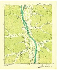 1936 Harmon Creek1936 Print · USGSBenton and Humphreys counties are captured here in the mid-1930s, documenting the riverfront landings and valley farms along the Tennessee River. Genealogists can locate family-named landmarks like the Phifer Place, Carter Cem, and the Harmon Creek Sch.
 - 1949 Map of Harmon Creek, 1953 Print
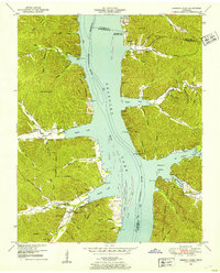 1949 Harmon Creek1953 Print · USGSThe Tennessee River valley at the junction of Benton and Humphreys counties is shown here shortly after the reservoir's formation. Researchers can locate numerous family burial sites and rural centers like Harmon Creek Church, St John School, and Melton Cem.3 unique versions available
 - 1956 Map of Nashville, 1971 Print
 1956 Nashville1971 Print · USGSThe Tennessee-Kentucky borderlands come into focus in the mid-1960s as major reservoir projects transformed the Cumberland and Tennessee river valleys. Researchers can trace the rail networks of the Louisville and Nashville and visit sites like Fort Campbell and Fort Donelson National Military Park.2 unique versions available
 - 1959 Map of Nashville
 1959 Nashville1959 Print · USGSMiddle Tennessee and Southern Kentucky come into focus during the late fifties, showing the region's transition into a modern transportation and military hub. Researchers can trace the sprawling Fort Campbell Military Reservation or locate historic rail stops along the Tennessee Central Ry and Illinois Central RR.
 - 1985 Map of Dickson
 1985 Dickson1985 Print · USGSMid-Tennessee in the mid-1980s was defined by the intersection of the Cumberland and Tennessee rivers and a massive network of wildlife refuges. Researchers can trace the Seaboard System rail lines connecting Waverly, Dickson, and White Bluff, or locate old landmarks near Fort Donelson National Military Park.
 - 2010 Map of Harmon Creek, 2010 Print
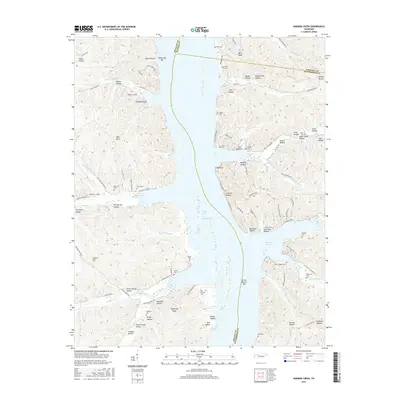
 2010 Harmon Creek2010 Print · USGSCovers Whiteoak Creek Subdivision, including Camden, Humphreys County, and other nearby areas
 - 2013 Map of Harmon Creek, 2013 Print
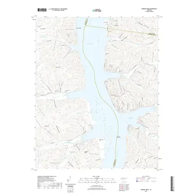
 2013 Harmon Creek2013 Print · USGSCovers Whiteoak Creek Subdivision, including Camden, Humphreys County, and other nearby areas
 - 2016 Map of Harmon Creek, 2016 Print
 2016 Harmon Creek2016 Print · USGSCovers Whiteoak Creek Subdivision, including Camden, Humphreys County, and other nearby areas
 - 2019 Map of Harmon Creek, 2019 Print
 2019 Harmon Creek2019 Print · USGSCovers Whiteoak Creek Subdivision, including Camden, Humphreys County, and other nearby areas
 - 2022 Map of Harmon Creek, 2022 Print
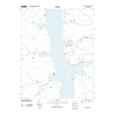
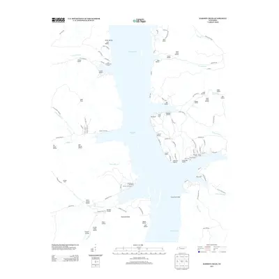
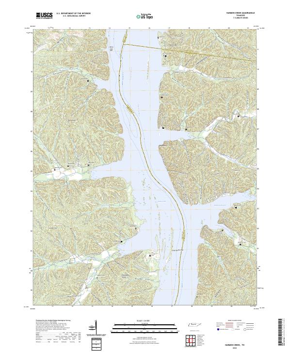 2022 Harmon Creek2022 Print · USGSBenton and Humphreys counties meet along the Tennessee River in this modern survey of Kentucky Lake’s eastern and western shores. Genealogists can trace decades of local history through family burial sites like Si Melton Cem, McMurtrie Cem, and the Union Chapel Cem near Richland Harbor.
End of results
Showing maps 1-10 of 10
Top cities near Whiteoak Creek Subdivision
- Waverly historical maps
- Camden historical maps
- New Johnsonville historical maps
- Dover historical maps
- Erin historical maps
- Big Sandy historical maps
Frequently asked questions
- What are the different types of historical maps available for Whiteoak Creek Subdivision?
- What is the oldest map of Whiteoak Creek Subdivision?
- Where can I purchase historical maps of Whiteoak Creek Subdivision for my home or office?
- Where can I download high-res historical maps of Whiteoak Creek Subdivision?
- Are there historical topographic maps available for Whiteoak Creek Subdivision?
- Is there historical aerial imagery available for Whiteoak Creek Subdivision?
- Where are historical maps of Whiteoak Creek Subdivision sourced from?