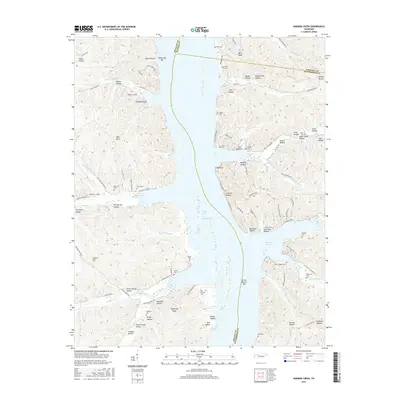
2016 Map of Harmon Creek
USGS Topo · Published 2016About this map
Kentucky Lake dominates this Tennessee landscape where the borders of Benton, Houston, and Humphreys counties meet. The flooded valley created by the damming of the Tennessee River has transformed the local geography into a complex network of inlets and peninsulas, including Richland Harbor and the expansive Green Botton Bar. Inland, the terrain is deeply dissected by numerous hollows and ridges such as Highstand Ridge and Lathen Hill. For genealogists and local historians, the sheet is particularly valuable for its density of small, family-named burial grounds. Significant sites like Union Chapel Cem, Si Melton Cem, and Rushing Cem are preserved among the ridges, while features like Dodds Landing Rd and Harmon Dock Rd trace the persistent connection between these upland communities and the water's edge.
Find a feature on this map
109 named features on this map. Tap any name to fly to it.
Don’t see what you’re looking for? This feature index may not catch every label — zoom into the map to look around manually.
Map Details
Editions of this 2016 Harmon Creek Map
This is the sole edition of this map. No revisions or reprints were ever made.
Other maps of this area

1936 · Poplar Creek
USGS Topo · 1:24,000

1936 · McKinnon
USGS Topo · 1:24,000

1936 · Camden
USGS Topo · 1:24,000

1936 · Big Sandy
USGS Topo · 1:24,000

1936 · Stewart
USGS Topo · 1:24,000

1936 · Halls Creek
USGS Topo · 1:24,000

1936 · Johnsonville
USGS Topo · 1:24,000

1936 · Harmon Creek
USGS Topo · 1:24,000

1936 · Waverly
USGS Topo · 1:24,000

1949 · Harmon Creek
USGS Topo · 1:24,000