Old Maps of Water Valley, Tennessee for Genealogy
Trace your family roots with 9 historic maps of Water Valley. These high-res maps reveal old neighborhoods, homesites, landmarks, and streets — helping you uncover where your ancestors lived and how the area evolved over time.
- Explore historic neighborhoods: Identify where your relatives may have lived in the 1800s or 1900s.
- Compare maps over time: Trace the changes in streets, buildings, and landmarks for multi-generational research.
- Perfect for genealogy & ancestry research: Used by family historians and researchers to map out lineage and migration.
These maps are an incredible resource for exploring your personal connection to Water Valley's past.
Water Valley, TN maps
(9)- 1936 Map of Bucksnort
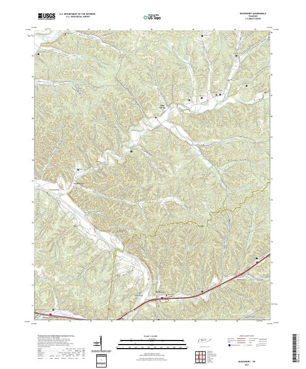
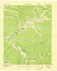 1936 Bucksnort1936 Print · USGSLife along the Humphreys and Hickman county line in the mid-1930s was defined by the winding Duck River and its deep hollows. Researchers can trace family roots at Pruett Cem or locate community hubs like Bold Spring and Old Furnace Sch.2 unique versions available
 - 1952 Map of Bucksnort, 1957 Print
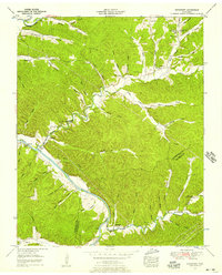 1952 Bucksnort1957 Print · USGSThe Duck River valley in the early 1950s reveals a landscape of isolated hollows and deep-rooted family homesteads along the Humphreys-Hickman line. Researchers can trace rural life through landmarks like Old Furnace Sch, the Water Valley Church, and cemeteries like Sanders Cem.2 unique versions available
 - 1956 Map of Columbia, 1960 Print
 1956 Columbia1960 Print · USGSMiddle Tennessee in the mid-fifties presents a landscape of established river towns and critical rail hubs before the arrival of the modern interstate system. Researchers can trace the routes of the Louisville and Nashville railroad or locate historic landmarks like Stones River National Military Park and the Tennessee National Wildlife Refuge.6 unique versions available
 - 1986 Map of Hohenwald
 1986 Hohenwald1986 Print · USGSThe Western Highland Rim of Tennessee comes into focus during the mid-eighties, showing the deep river valleys and high ridges of Lewis and Perry counties. Researchers can trace the path of the Natchez Trace Parkway or locate interior settlements like Chestnut Grove, Farmers Exchange, and Hustburg.3 unique versions available
 - 2010 Map of Bucksnort, 2010 Print
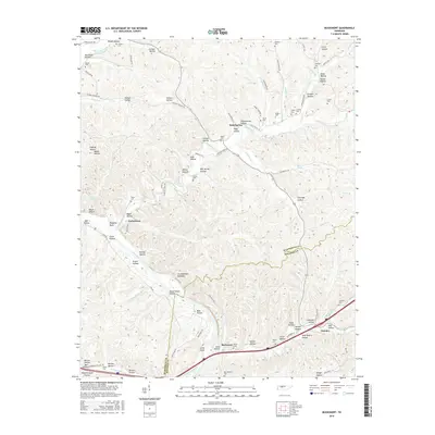
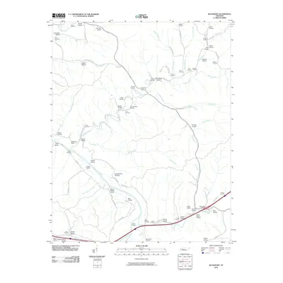 2010 Bucksnort2010 Print · USGSCovers Water Valley, including Bold Spring, Wills Chapel, and other nearby areas
 - 2013 Map of Bucksnort, 2013 Print
 2013 Bucksnort2013 Print · USGSCovers Water Valley, including Bold Spring, Wills Chapel, and other nearby areas
 - 2016 Map of Bucksnort, 2016 Print
 2016 Bucksnort2016 Print · USGSCovers Water Valley, including Bold Spring, Wills Chapel, and other nearby areas
 - 2019 Map of Bucksnort, 2019 Print
 2019 Bucksnort2019 Print · USGSCovers Water Valley, including Bold Spring, Wills Chapel, and other nearby areas
 - 2022 Map of Bucksnort, 2022 Print
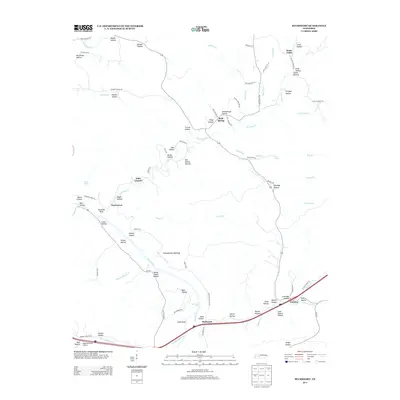
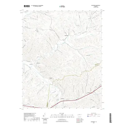
 2022 Bucksnort2022 Print · USGSHumphreys and Hickman counties are shown here in recent years, where the Duck River winds through a dense landscape of named hollows. Researchers can locate numerous family burial sites like Pruett Cem and Sanders Cem, or trace the geography of settlements like Bucksnort and Taylortown.
End of results
Showing maps 1-9 of 9
Top cities near Water Valley
Frequently asked questions
- What are the different types of historical maps available for Water Valley?
- What is the oldest map of Water Valley?
- Where can I purchase historical maps of Water Valley for my home or office?
- Where can I download high-res historical maps of Water Valley?
- Are there historical topographic maps available for Water Valley?
- Is there historical aerial imagery available for Water Valley?
- Where are historical maps of Water Valley sourced from?