Old Maps of North Springs, Tennessee for Academic Research
Study the evolution of North Springs with 10 high-resolution historic maps. Whether you're teaching, researching, or modeling changes in land use, these maps provide essential visual documentation of urban, environmental, and geographic change.
- Analyze long-term change: Track patterns in development, transportation, and natural features.
- Ideal for environmental or urban studies: Support academic projects with primary historical map data.
- Use in the classroom or lab: Educators and researchers rely on these maps to bring historical context to life.
These maps are a powerful tool for teaching, research, and visualizing how North Springs has changed over the decades.
North Springs, TN maps
(10)- 1932 Map of Carthage
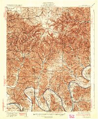 1932 Carthage1932 Print · USGSNorth Central Tennessee comes alive in the early 1930s as the Cumberland River winds past the county seat of Carthage. Genealogists and researchers can trace family roots through numerous country schools and landmarks like Holliman Ferry and Difficult.3 unique versions available
 - 1956 Map of Corbin, 1966 Print
 1956 Corbin1966 Print · USGSThe Kentucky and Tennessee borderlands are captured here in the mid-fifties, showing the region's shift toward modern interstate travel and reservoir development. Genealogists and historians can trace old community lines near Albany and Monticello or locate early rail junctions along the Southern and Tennessee Central lines.3 unique versions available
 - 1958 Map of Corbin
 1958 Corbin1958 Print · USGSThe Upper Cumberland borderlands appear in the late 1950s as massive reservoirs and early atomic-era growth reshape the region. Trace family roots and vanished landmarks near Lake Cumberland, Oak Ridge, and the Cumberland National Forest.
 - 1968 Map of Willette, 1970 Print
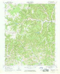 1968 Willette1970 Print · USGSThe hills of Jackson and Macon counties are shown here in the late sixties just before the landscape was changed by the Cordell Hull Reservoir. Genealogists can trace family sites like Thomas Cem, Hayden, and the Wartrace Sch among the winding hollows.
 - 1982 Map of Cookeville, 1983 Print
 1982 Cookeville1983 Print · USGSThe Upper Cumberland region comes into focus during the early eighties as Cookeville and its surrounding counties adapt to new reservoirs and highways. Researchers can trace the Louisville and Nashville rail line and locate landmarks like Tennessee Technological University and Standing Stone State Forest.
 - 2010 Map of Willette, 2010 Print
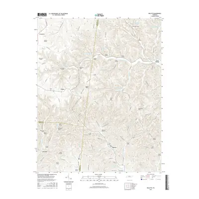
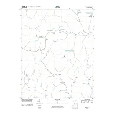 2010 Willette2010 Print · USGSCovers North Springs, including Prosperity, Goose Horn, and other nearby areas
 - 2013 Map of Willette, 2013 Print
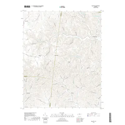
 2013 Willette2013 Print · USGSCovers North Springs, including Prosperity, Goose Horn, and other nearby areas
 - 2016 Map of Willette, 2016 Print
 2016 Willette2016 Print · USGSCovers North Springs, including Prosperity, Goose Horn, and other nearby areas
 - 2019 Map of Willette, 2019 Print
 2019 Willette2019 Print · USGSCovers North Springs, including Prosperity, Goose Horn, and other nearby areas
 - 2022 Map of Willette, 2022 Print
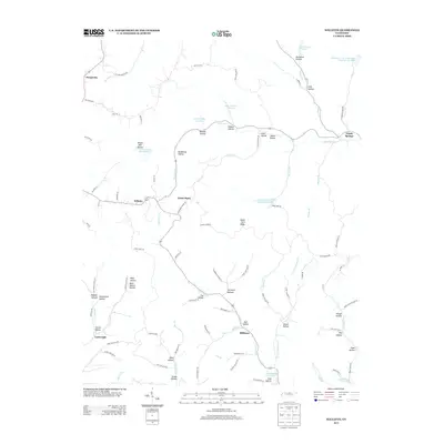
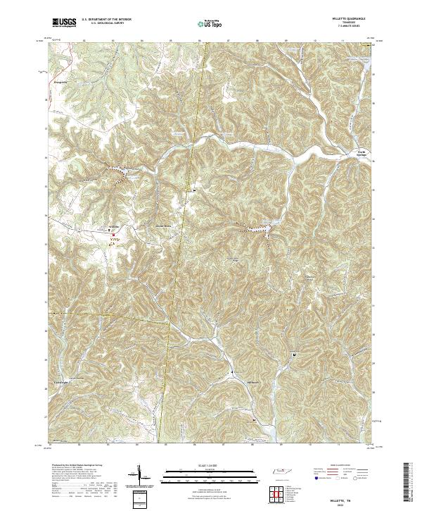 2022 Willette2022 Print · USGSUpper Middle Tennessee hill country is captured here in the early twenty-first century where Macon, Jackson, and Smith counties meet. Researchers can trace family history through numerous rural burials like Thomas Cemetery and Clark Cemetery, or explore the deep hollows of Willette and North Springs.
End of results
Showing maps 1-10 of 10
Top cities near North Springs
- Tompkinsville historical maps
- Carthage historical maps
- South Carthage historical maps
- Red Boiling Springs historical maps
- Gainesboro historical maps
- Gamaliel historical maps
Frequently asked questions
- What are the different types of historical maps available for North Springs?
- What is the oldest map of North Springs?
- Where can I purchase historical maps of North Springs for my home or office?
- Where can I download high-res historical maps of North Springs?
- Are there historical topographic maps available for North Springs?
- Is there historical aerial imagery available for North Springs?
- Where are historical maps of North Springs sourced from?