1900s (20th Century) Maps of Knox County, Tennessee
Explore 104 historic maps of Knox County from the 1900s (20th Century). These maps offer a rare glimpse into what life looked like during the 1900s — showing old roads, neighborhoods, homes, and landmarks that have changed or disappeared over time.
Whether you're researching your family's past, planning a metal detecting trip, or studying how Knox County's landscape evolved across the 1900s, these high-resolution maps are a powerful tool for exploring the history of this region.
- Focus on a specific era: All maps on this page are from the 1900s, giving you a focused view of this time period.
- See what’s changed: Compare century-old streets, trails, and buildings to today's modern landscape using overlays and satellite layers.
- Research with precision: Use these maps for genealogy, historical research, land use analysis, or educational projects.
- View, download, or print: Maps are fully viewable online in high resolution, and can be downloaded or printed for your own records.
Start exploring Knox County's history through authentic maps from the 1900s. This is your window into the past.
Knox County, TN maps
(104)- 1900 Map of Maynardville
 1900 Maynardville1900 Print · USGSEast Tennessee was a world of river fords and mountain gaps at the turn of the century, dominated by the winding Clinch and Powell rivers. Genealogists can trace family roots through specific landmarks like Massongills Mill, Church Grove, and Sharps Chapel.4 unique versions available
 - 1901 Map of Knoxville
 1901 Knoxville1901 Print · USGSThe East Tennessee borderlands meet the high Smokies at the turn of the century. Genealogists can trace early homesteads and crossroads near Sevierville and Maryville, or find landmarks like Cade Cove and Gatlinburg before they became tourist hubs.5 unique versions available
 - 1935 Map of Luttrell
 1935 Luttrell1935 Print · USGSRichland Valley and the surrounding ridges are captured in the mid-1930s as the river-and-rail economy thrived. Genealogists can trace family names through landmarks like Nances Ferry, Rush Strong Sch, and McKinney Cem.
 - 1935 Map of Mascot
 1935 Mascot1935 Print · USGSEast Tennessee during the mid-thirties reveals a landscape of river-bend farms and developing transit corridors along the Holston River. Genealogists and historians can trace family locations near Smith Mill, Howell Cem, and rural schoolhouses like Cynthiana Sch.
 - 1935 Map of Knoxville
 1935 Knoxville1935 Print · USGSKnoxville and its southern Blount County neighbors appear here in the mid-1930s as the TVA era begins. Researchers can trace family roots through Mt Olive Cem, locate the old Eastern State Hospital, or study the early layout of Sequoyah Hills.
 - 1935 Map of Straw Plains
 1935 Straw Plains1935 Print · USGSEast Tennessee life in the mid-1930s is centered on the winding Holston River and the bustling Southern railroad corridor. Researchers can trace family roots at Hickle Cem, find the site of Massengale Mill, or locate Indian Cave.
 - 1935 Map of Graveston
 1935 Graveston1935 Print · USGSEastern Tennessee in the mid-1930s was a landscape of small schools and valley settlements centered around Maynardville and Corryton. Genealogists and historians can trace family roots through landmarks like Millers Chapel, the Graveston Mill Pond, and Plain View Sch.
 - 1935 Map of Bethel Valley
 1935 Bethel Valley1935 Print · USGSEastern Tennessee in the mid-1930s was a landscape of ridge-and-valley farms along the Clinch River. Genealogists and historians can trace the foundations of local life through the George Jones Memorial Ch, Wheat, and the White Wing Ferry.
 - 1935 Map of Maryville
 1935 Maryville1935 Print · USGSBlount County in the mid-1930s reveals a unique mix of industrial expansion and traditional rural life. Researchers can trace the early footprint of Alcoa and Maryville College, or locate family landmarks like Beech Grove Ch and Bungalow Town.
 - 1935 Map of Wildwood
 1935 Wildwood1935 Print · USGSBlount County at the foot of the Smokies appears as a network of creek-side farms and mountain gaps in the mid-1930s. Genealogists and local historians can locate long-standing landmarks such as Eusebia Ch, Oak View Sch, and the community of Wildwood.
 - 1935 Map of Bearden
 1935 Bearden1935 Print · USGSKnox County is captured in the mid-1930s just as the Tennessee Valley Authority began reshaping the regional landscape. Trace the old rail lines of the Southern railroad and find local landmarks like the County Prison Farm and Karns Sch.
 - 1935 Map of Lovell
 1935 Lovell1935 Print · USGSKnox County was a landscape of river crossings and ridge-top communities in the mid-1930s. Genealogists and local historians can trace family locations through rural landmarks like Gallaher Ferry, Grigsby Chapel, and Grand Caverns.
 - 1935 Map of Fountain City
 1935 Fountain City1935 Print · USGSKnox County north of Knoxville in the mid-1930s reveals a transition from traditional ridge-and-valley farming to suburban clusters. Genealogists can trace family names at Mynatt Cem, visit Halls Crossroads, or locate the Beverly Hills Sanitarium.
 - 1935 Map of Sevierville
 1935 Sevierville1935 Print · USGSSevier County during the mid-1930s is captured here in transition, showing the river-dependent communities along the French Broad River before modern development. Genealogists and historians can trace early school sites like Seven Islands Sch and old river crossings such as Trundle Ferry.
 - 1935 Map of Boyds Creek
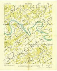 1935 Boyds Creek1935 Print · USGSEast Tennessee river life comes into focus in the mid-1930s along the winding French Broad River. Genealogists and local historians can trace family roots through numerous rural landmarks like Trundle Crossroads, Boyds Creek Cem, and the Huffaker Ferry.2 unique versions available
 - 1936 Map of Gorryton
 1936 Gorryton1936 Print · USGSNortheast of Knoxville in the mid-1930s, the landscape was being reshaped by the newly flooded Norris Reservoir. Genealogists and historians can trace numerous rural landmarks, including Welch Mill, Big Ridge Park Cemetery, and the Southern Railway corridor.
 - 1936 Map of Louisville
 1936 Louisville1936 Print · USGSBlount County and the winding Tennessee River are captured here in the mid-thirties, showing a landscape defined by river bends and railroad stops. Genealogists can trace family roots through landmarks like Holston College, Lowe Ferry, and the settlement at Miser.
 - 1936 Map of Shooks Gap
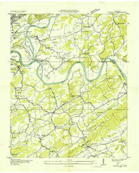 1936 Shooks Gap1936 Print · USGSEast of Knoxville in the mid-1930s, the confluence of the French Broad and Holston rivers shaped a landscape of ferry crossings and ridge-top farming. Genealogists can trace family footprints at Old Salem Cem, Whites Village, and the many rural schools like Anderson Sch.
 - 1936 Map of Knoxville
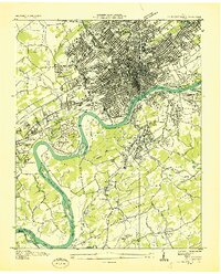 1936 Knoxville1936 Print · USGSKnoxville and its riverfront suburbs come alive in this mid-1930s survey, showing the city just as the TVA began its regional work. Genealogists and historians can locate family homes near Knoxville College, the State School for Deaf, or old cemeteries like New Gray Cem.
 - 1936 Map of John Sevier
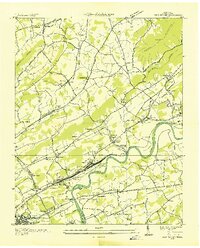 1936 John Sevier1936 Print · USGSKnox County is captured here in the mid-thirties, showing the vital rail and river corridor east of Knoxville during the early TVA era. Researchers can trace family sites from Maloneyville to Mascot, locating landmarks like the Legg England Cem, John Sevier Sta, and Rising Sun Ch.
 - 1936 Map of Norris Dam
 1936 Norris Dam1936 Print · USGSIn the mid-thirties, the Clinch River valley underwent a total transformation as the new Norris Reservoir reshaped the land. Genealogists can trace family homesteads near Clinton, old burial sites like Leach Cem, and coal towns including Briceville.
 - 1936 Map of Friendship
 1936 Friendship1936 Print · USGSEast Tennessee in the mid-1930s is documented here at a turning point for the river and rail landscape of Knox and Blount counties. Genealogists can trace family names at Mt Zion Ch, Martel Sch, and the riverside settlement of Louisville before the valley landscape was transformed.
 - 1936 Map of Norris
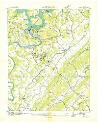 1936 Norris1936 Print · USGSAnderson County and the Clinch River valley are seen here in the mid-1930s during the transformative early years of the Tennessee Valley Authority. Researchers can locate vanished landmarks and Depression-era worksites like C C C Camp No 494, Loys Mill, and Glen Alpine Sch.
 - 1936 Map of Concord
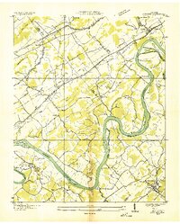 1936 Concord1936 Print · USGSThe Tennessee and Little Tennessee rivers wind through the borders of Knox, Loudon, and Blount counties in the mid-1930s. Researchers can locate early family landmarks like Long Tom Cem, Burnett Sch, and the riverside hamlet of Unitia.
 - 1936 Map of Powell Station
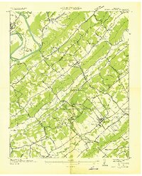 1936 Powell Station1936 Print · USGSThe Tennessee Valley during the mid-1930s shows a landscape of ridge-and-valley settlements and early federal infrastructure projects. Researchers can find many family landmarks and community hubs, including CCC Camp No 495, Bakers Mill, and Union Zion Ch.
Showing maps 1-25 of 104
Top cities of Knox County
- Knoxville historical maps
- Farragut historical maps
- Powell historical maps
- Halls Crossroads historical maps
- Mascot historical maps
Frequently asked questions
- What are the different types of historical maps available for Knox County?
- What is the oldest map of Knox County?
- Where can I purchase historical maps of Knox County for my home or office?
- Where can I download high-res historical maps of Knox County?
- Are there historical topographic maps available for Knox County?
- Is there historical aerial imagery available for Knox County?
- Where are historical maps of Knox County sourced from?