Old Maps of Burlington, Knoxville
Explore 40 old maps of Burlington, spanning from 1886 to today. These high-resolution historic maps reveal how streets, neighborhoods, landmarks, and natural features evolved over time — perfect for genealogy, metal detecting, research, and local history exploration.
What you can do with these maps:
- See how Burlington changed over time: Compare historical maps to modern-day views to trace roads, homesites, rail lines & more.
- View detailed metadata: Each map includes creators, publishers, year, scale, and archive source.
- Overlay maps with satellite & LiDAR: Visualize the past alongside modern tools to explore terrain & human change.
- Trusted historical sources: Maps sourced from the USGS, Library of Congress, and other archives.
- Access maps your way: View online, download high-res files, or order prints for personal or research use.
Start exploring old maps of Burlington to uncover forgotten places, hidden landmarks, and the deep history beneath your feet.
Burlington, Knoxville maps
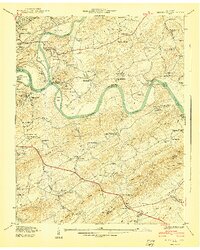
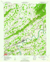
(40)- 1886 Map of Knoxville
 1886 Knoxville1886 Print · USGSCovers Burlington, including Knoxville, Maryville, and other nearby areas
 - 1892 Map of Knoxville
 1892 Knoxville1892 Print · USGSCovers Burlington, including Knoxville, Maryville, and other nearby areas
 - 1894 Map of Knoxville
 1894 Knoxville1894 Print · USGSCovers Burlington, including Knoxville, Maryville, and other nearby areas
 - 1895 Map of Knoxville
 1895 Knoxville1895 Print · USGSCovers Burlington, including Knoxville, Maryville, and other nearby areas2 unique versions available
 - 1897 Map of Maynardville
 1897 Maynardville1897 Print · USGSCovers Burlington, including Knoxville, Sevierville, and other nearby areas
 - 1900 Map of Maynardville
 1900 Maynardville1900 Print · USGSCovers Burlington, including Knoxville, Sevierville, and other nearby areas4 unique versions available
 - 1901 Map of Knoxville
 1901 Knoxville1901 Print · USGSCovers Burlington, including Knoxville, Maryville, and other nearby areas5 unique versions available
 - 1935 Map of Knoxville
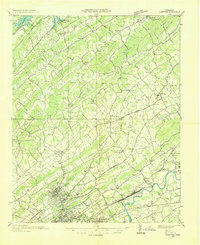
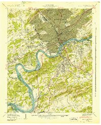
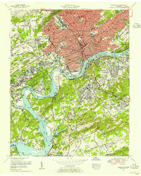
 1935 Knoxville1935 Print · USGSCovers Burlington, including Knoxville, Maryville, and other nearby areas
 - 1935 Map of Fountain City
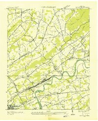
 1935 Fountain City1935 Print · USGSCovers Burlington, including Knoxville, Powell, and other nearby areas
 - 1936 Map of Gorryton
 1936 Gorryton1936 Print · USGSCovers Burlington, including Knoxville, Powell, and other nearby areas
 - 1936 Map of Shooks Gap
 1936 Shooks Gap1936 Print · USGSCovers Burlington, including Knoxville, High Bluff, and other nearby areas
 - 1936 Map of Knoxville
 1936 Knoxville1936 Print · USGSCovers Burlington, including Knoxville, Alcoa, and other nearby areas
 - 1936 Map of John Sevier
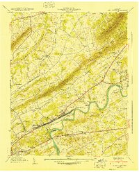
 1936 John Sevier1936 Print · USGSCovers Burlington, including Knoxville, Mascot, and other nearby areas
 - 1940 Map of John Sevier
 1940 John Sevier1940 Print · USGSCovers Burlington, including Knoxville, Mascot, and other nearby areas2 unique versions available
 - 1940 Map of Shooks Gap
 1940 Shooks Gap1940 Print · USGSCovers Burlington, including Knoxville, High Bluff, and other nearby areas3 unique versions available
 - 1941 Map of Fountain City
 1941 Fountain City1941 Print · USGSCovers Burlington, including Knoxville, Powell, and other nearby areas
 - 1942 Map of Knoxville
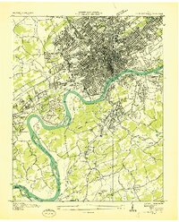
 1942 Knoxville1942 Print · USGSCovers Burlington, including Knoxville, Alcoa, and other nearby areas
 - 1953 Map of Fountain City, 1954 Print
 1953 Fountain City1954 Print · USGSCovers Burlington, including Knoxville, Powell, and other nearby areas2 unique versions available
 - 1953 Map of Shooks Gap, 1954 Print
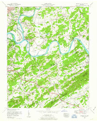 1953 Shooks Gap1954 Print · USGSCovers Burlington, including Knoxville, High Bluff, and other nearby areas3 unique versions available
 - 1953 Map of John Sevier, 1954 Print
 1953 John Sevier1954 Print · USGSCovers Burlington, including Knoxville, Mascot, and other nearby areas2 unique versions available
 - 1953 Map of Knoxville, 1955 Print
 1953 Knoxville1955 Print · USGSCovers Burlington, including Knoxville, Alcoa, and other nearby areas2 unique versions available
 - 1955 Map of Knoxville
 1955 Knoxville1955 Print · USGSCovers Burlington, including Knoxville, Asheville, and other nearby areas
 - 1955 Map of Johnson City
 1955 Johnson City1955 Print · USGSCovers Burlington, including Knoxville, Johnson City, and other nearby areas
 - 1957 Map of Knoxville, 1966 Print
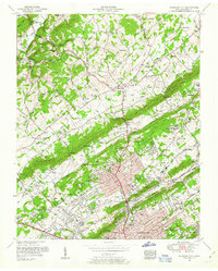
 1957 Knoxville1966 Print · USGSCovers Burlington, including Knoxville, Asheville, and other nearby areas4 unique versions available
 - 1957 Map of Johnson City, 1966 Print
 1957 Johnson City1966 Print · USGSCovers Burlington, including Knoxville, Johnson City, and other nearby areas
Showing maps 1-25 of 40
Frequently asked questions
- What are the different types of historical maps available for Burlington?
- What is the oldest map of Burlington?
- Where can I purchase historical maps of Burlington for my home or office?
- Where can I download high-res historical maps of Burlington?
- Are there historical topographic maps available for Burlington?
- Is there historical aerial imagery available for Burlington?
- Where are historical maps of Burlington sourced from?