Old Maps of Burlington, Knoxville for Metal Detecting
Plan your next treasure hunt with 40 historic maps of Burlington. Find old homesites, ghost towns, trails, and gathering spots that may be lost to time — perfect for identifying promising metal detecting locations.
- Locate forgotten sites: Uncover places like long-lost settlements, abandoned rail lines, or gathering spots.
- Plan better hunts: Use map overlays combined with LiDAR or satellite views to narrow in on historically rich areas.
- Made for detectorists: Thousands of hobbyists use these maps to discover relics, coins, and hidden history.
Use these historic maps to boost your research and find new opportunities beneath the surface of Burlington.
Burlington, Knoxville maps
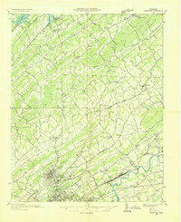
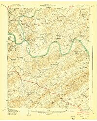
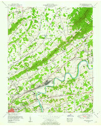
(40)- 1886 Map of Knoxville
 1886 Knoxville1886 Print · USGSCovers Burlington, including Knoxville, Maryville, and other nearby areas
 - 1892 Map of Knoxville
 1892 Knoxville1892 Print · USGSCovers Burlington, including Knoxville, Maryville, and other nearby areas
 - 1894 Map of Knoxville
 1894 Knoxville1894 Print · USGSCovers Burlington, including Knoxville, Maryville, and other nearby areas
 - 1895 Map of Knoxville
 1895 Knoxville1895 Print · USGSCovers Burlington, including Knoxville, Maryville, and other nearby areas2 unique versions available
 - 1897 Map of Maynardville
 1897 Maynardville1897 Print · USGSCovers Burlington, including Knoxville, Sevierville, and other nearby areas
 - 1900 Map of Maynardville
 1900 Maynardville1900 Print · USGSCovers Burlington, including Knoxville, Sevierville, and other nearby areas4 unique versions available
 - 1901 Map of Knoxville
 1901 Knoxville1901 Print · USGSCovers Burlington, including Knoxville, Maryville, and other nearby areas5 unique versions available
 - 1935 Map of Knoxville
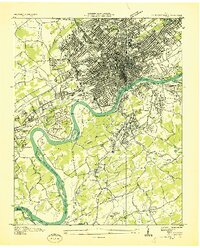
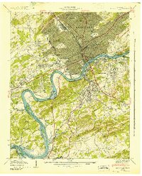
 1935 Knoxville1935 Print · USGSCovers Burlington, including Knoxville, Maryville, and other nearby areas
 - 1935 Map of Fountain City
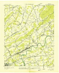
 1935 Fountain City1935 Print · USGSCovers Burlington, including Knoxville, Powell, and other nearby areas
 - 1936 Map of Gorryton
 1936 Gorryton1936 Print · USGSCovers Burlington, including Knoxville, Powell, and other nearby areas
 - 1936 Map of Shooks Gap
 1936 Shooks Gap1936 Print · USGSCovers Burlington, including Knoxville, High Bluff, and other nearby areas
 - 1936 Map of Knoxville
 1936 Knoxville1936 Print · USGSCovers Burlington, including Knoxville, Alcoa, and other nearby areas
 - 1936 Map of John Sevier
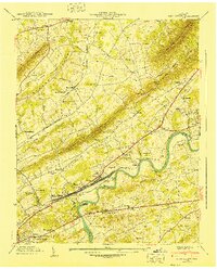
 1936 John Sevier1936 Print · USGSCovers Burlington, including Knoxville, Mascot, and other nearby areas
 - 1940 Map of John Sevier
 1940 John Sevier1940 Print · USGSCovers Burlington, including Knoxville, Mascot, and other nearby areas2 unique versions available
 - 1940 Map of Shooks Gap
 1940 Shooks Gap1940 Print · USGSCovers Burlington, including Knoxville, High Bluff, and other nearby areas3 unique versions available
 - 1941 Map of Fountain City
 1941 Fountain City1941 Print · USGSCovers Burlington, including Knoxville, Powell, and other nearby areas
 - 1942 Map of Knoxville
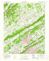
 1942 Knoxville1942 Print · USGSCovers Burlington, including Knoxville, Alcoa, and other nearby areas
 - 1953 Map of Fountain City, 1954 Print
 1953 Fountain City1954 Print · USGSCovers Burlington, including Knoxville, Powell, and other nearby areas2 unique versions available
 - 1953 Map of Shooks Gap, 1954 Print
 1953 Shooks Gap1954 Print · USGSCovers Burlington, including Knoxville, High Bluff, and other nearby areas3 unique versions available
 - 1953 Map of John Sevier, 1954 Print
 1953 John Sevier1954 Print · USGSCovers Burlington, including Knoxville, Mascot, and other nearby areas2 unique versions available
 - 1953 Map of Knoxville, 1955 Print
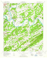
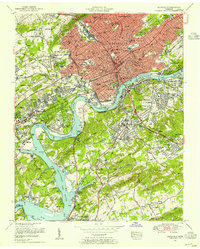 1953 Knoxville1955 Print · USGSCovers Burlington, including Knoxville, Alcoa, and other nearby areas2 unique versions available
 - 1955 Map of Knoxville
 1955 Knoxville1955 Print · USGSCovers Burlington, including Knoxville, Asheville, and other nearby areas
 - 1955 Map of Johnson City
 1955 Johnson City1955 Print · USGSCovers Burlington, including Knoxville, Johnson City, and other nearby areas
 - 1957 Map of Knoxville, 1966 Print
 1957 Knoxville1966 Print · USGSCovers Burlington, including Knoxville, Asheville, and other nearby areas4 unique versions available
 - 1957 Map of Johnson City, 1966 Print
 1957 Johnson City1966 Print · USGSCovers Burlington, including Knoxville, Johnson City, and other nearby areas
Showing maps 1-25 of 40
Frequently asked questions
- What are the different types of historical maps available for Burlington?
- What is the oldest map of Burlington?
- Where can I purchase historical maps of Burlington for my home or office?
- Where can I download high-res historical maps of Burlington?
- Are there historical topographic maps available for Burlington?
- Is there historical aerial imagery available for Burlington?
- Where are historical maps of Burlington sourced from?