Old Maps of Burlington, Knoxville for Hiking & Exploration
Hike through history with 40 historic maps of Burlington. Explore old trails, ghost towns, and forgotten backroads — perfect for outdoor adventurers and local explorers.
- Rediscover forgotten places: Map out old mining camps, roads, and footpaths that no longer exist on modern maps.
- Layer with modern tools: Combine with LiDAR or satellite views to plan hikes through historical terrain.
- Made for exploration: Popular among hikers, overlanders, and local history lovers.
Use these maps to find adventure and explore the hidden past of Burlington.
Burlington, Knoxville maps
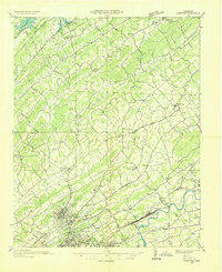
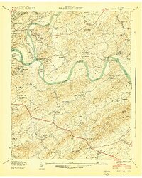
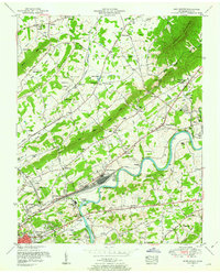
(40)- 1886 Map of Knoxville
 1886 Knoxville1886 Print · USGSCovers Burlington, including Knoxville, Maryville, and other nearby areas
 - 1892 Map of Knoxville
 1892 Knoxville1892 Print · USGSCovers Burlington, including Knoxville, Maryville, and other nearby areas
 - 1894 Map of Knoxville
 1894 Knoxville1894 Print · USGSCovers Burlington, including Knoxville, Maryville, and other nearby areas
 - 1895 Map of Knoxville
 1895 Knoxville1895 Print · USGSCovers Burlington, including Knoxville, Maryville, and other nearby areas2 unique versions available
 - 1897 Map of Maynardville
 1897 Maynardville1897 Print · USGSCovers Burlington, including Knoxville, Sevierville, and other nearby areas
 - 1900 Map of Maynardville
 1900 Maynardville1900 Print · USGSCovers Burlington, including Knoxville, Sevierville, and other nearby areas4 unique versions available
 - 1901 Map of Knoxville
 1901 Knoxville1901 Print · USGSCovers Burlington, including Knoxville, Maryville, and other nearby areas5 unique versions available
 - 1935 Map of Knoxville
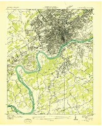
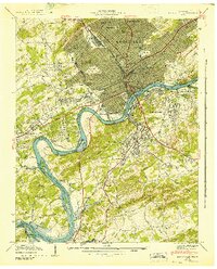
 1935 Knoxville1935 Print · USGSCovers Burlington, including Knoxville, Maryville, and other nearby areas
 - 1935 Map of Fountain City
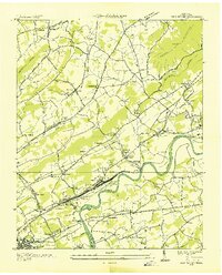
 1935 Fountain City1935 Print · USGSCovers Burlington, including Knoxville, Powell, and other nearby areas
 - 1936 Map of Gorryton
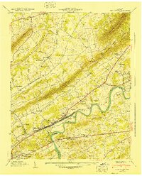
 1936 Gorryton1936 Print · USGSCovers Burlington, including Knoxville, Powell, and other nearby areas
 - 1936 Map of Shooks Gap
 1936 Shooks Gap1936 Print · USGSCovers Burlington, including Knoxville, High Bluff, and other nearby areas
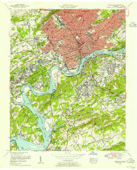
 - 1936 Map of Knoxville
 1936 Knoxville1936 Print · USGSCovers Burlington, including Knoxville, Alcoa, and other nearby areas
 - 1936 Map of John Sevier
 1936 John Sevier1936 Print · USGSCovers Burlington, including Knoxville, Mascot, and other nearby areas
 - 1940 Map of John Sevier
 1940 John Sevier1940 Print · USGSCovers Burlington, including Knoxville, Mascot, and other nearby areas2 unique versions available
 - 1940 Map of Shooks Gap
 1940 Shooks Gap1940 Print · USGSCovers Burlington, including Knoxville, High Bluff, and other nearby areas3 unique versions available
 - 1941 Map of Fountain City
 1941 Fountain City1941 Print · USGSCovers Burlington, including Knoxville, Powell, and other nearby areas
 - 1942 Map of Knoxville
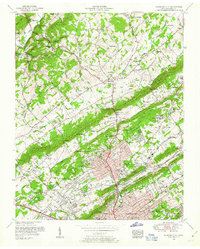
 1942 Knoxville1942 Print · USGSCovers Burlington, including Knoxville, Alcoa, and other nearby areas
 - 1953 Map of Fountain City, 1954 Print
 1953 Fountain City1954 Print · USGSCovers Burlington, including Knoxville, Powell, and other nearby areas2 unique versions available
 - 1953 Map of Shooks Gap, 1954 Print
 1953 Shooks Gap1954 Print · USGSCovers Burlington, including Knoxville, High Bluff, and other nearby areas3 unique versions available
 - 1953 Map of John Sevier, 1954 Print
 1953 John Sevier1954 Print · USGSCovers Burlington, including Knoxville, Mascot, and other nearby areas2 unique versions available
 - 1953 Map of Knoxville, 1955 Print
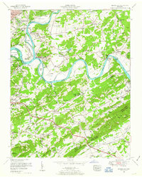
 1953 Knoxville1955 Print · USGSCovers Burlington, including Knoxville, Alcoa, and other nearby areas2 unique versions available
 - 1955 Map of Knoxville
 1955 Knoxville1955 Print · USGSCovers Burlington, including Knoxville, Asheville, and other nearby areas
 - 1955 Map of Johnson City
 1955 Johnson City1955 Print · USGSCovers Burlington, including Knoxville, Johnson City, and other nearby areas
 - 1957 Map of Knoxville, 1966 Print
 1957 Knoxville1966 Print · USGSCovers Burlington, including Knoxville, Asheville, and other nearby areas4 unique versions available
 - 1957 Map of Johnson City, 1966 Print
 1957 Johnson City1966 Print · USGSCovers Burlington, including Knoxville, Johnson City, and other nearby areas
Showing maps 1-25 of 40
Frequently asked questions
- What are the different types of historical maps available for Burlington?
- What is the oldest map of Burlington?
- Where can I purchase historical maps of Burlington for my home or office?
- Where can I download high-res historical maps of Burlington?
- Are there historical topographic maps available for Burlington?
- Is there historical aerial imagery available for Burlington?
- Where are historical maps of Burlington sourced from?