2020s Maps of Lawrence County, Tennessee
Explore 20 historic maps of Lawrence County from the 2020s. These maps offer a rare glimpse into what life looked like during the 2020s — showing old roads, neighborhoods, homes, and landmarks that have changed or disappeared over time.
Whether you're researching your family's past, planning a metal detecting trip, or studying how Lawrence County's landscape evolved across the 2020s, these high-resolution maps are a powerful tool for exploring the history of this region.
- Focus on a specific era: All maps on this page are from the 2020s, giving you a focused view of this time period.
- See what’s changed: Compare century-old streets, trails, and buildings to today's modern landscape using overlays and satellite layers.
- Research with precision: Use these maps for genealogy, historical research, land use analysis, or educational projects.
- View, download, or print: Maps are fully viewable online in high resolution, and can be downloaded or printed for your own records.
Start exploring Lawrence County's history through authentic maps from the 2020s. This is your window into the past.
Lawrence County, TN maps
(20)- 2020 Map of Union Hill, 2020 Print
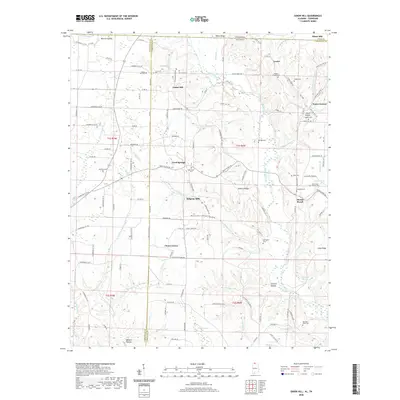 2020 Union Hill2020 Print · USGSCovers Lawrence County, including Minor Hill, Lester, and other nearby areas
 - 2020 Map of Lexington, 2020 Print
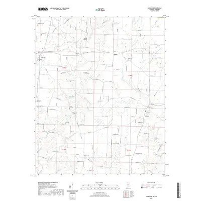 2020 Lexington2020 Print · USGSCovers Lawrence County, including Lexington, Anderson, and other nearby areas
 - 2022 Map of Bodenham, 2022 Print
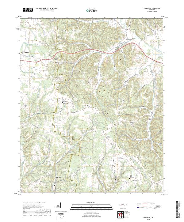 2022 Bodenham2022 Print · USGSThe rural border of Lawrence and Giles Counties comes into focus in this contemporary survey of its hollows and homesteads. Local historians can locate ancestral sites like Hughes Cem, Shores Baptist Church, and the settlement of Fall River.
 - 2022 Map of Ethridge, 2022 Print
 2022 Ethridge2022 Print · USGSLawrence County settlement patterns in the early 2020s are defined by a network of rural hamlets like Ethridge and Three Oaks. Genealogists can trace deep local roots through numerous sites including Mars Hill Methodist Cem and the Norwegian Cem.
 - 2022 Map of Campbellsville, 2022 Print
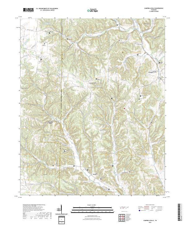 2022 Campbellsville2022 Print · USGSGiles and Lawrence County communities are detailed here during a period of modern rural continuity. Genealogists can locate numerous small family cemeteries like Hannah-Yokley Cem and Lucy Cem or trace the routes through Pleasant Valley and Weakley.
 - 2022 Map of Loretto, 2022 Print
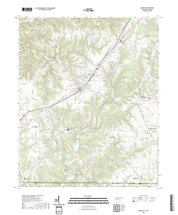 2022 Loretto2022 Print · USGSSouthern Lawrence County is captured here at the Tennessee-Alabama border, where the high ridges give way to the headwaters of Bluewater Cr. Family historians can trace local roots through numerous sites like Sacred Heart Cem, McDougal Cem, and the settlement at Rascal Town.
 - 2022 Map of Bonnertown, 2022 Print
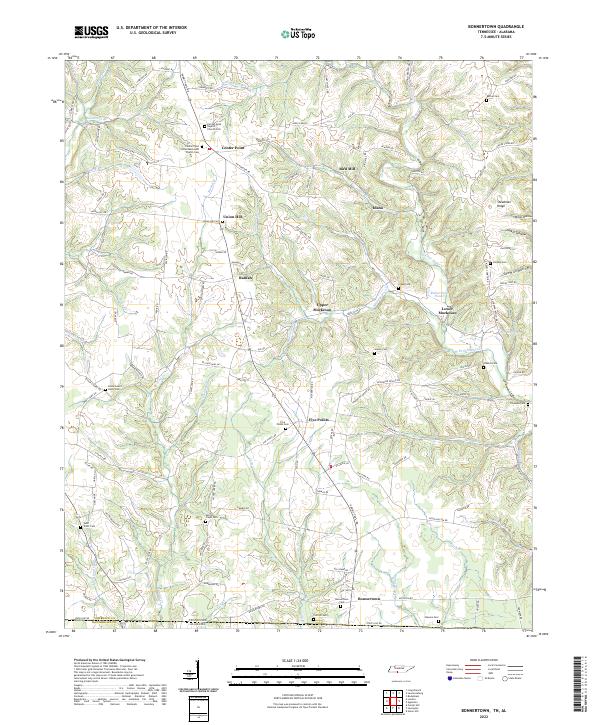 2022 Bonnertown2022 Print · USGSSoutheastern Lawrence County comes into focus in this contemporary survey of the Tennessee-Alabama state line. Genealogists can locate numerous family burial grounds, including Union Hill Cem, Saint Truitt Cem, and the Bonnertown Cem.
 - 2022 Map of Riverside, 2022 Print
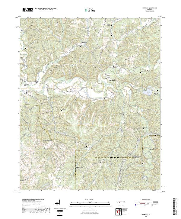 2022 Riverside2022 Print · USGSThe Tennessee backcountry near the Buffalo River is captured here in the early 2020s, showing a landscape of deep hollows and high ridges. Genealogists can trace family names at Mannie Cemetery and Banks Cemetery or locate the old Swiss Colony site.
 - 2022 Map of Lawrenceburg, 2022 Print
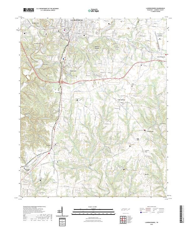 2022 Lawrenceburg2022 Print · USGSLawrenceburg and its outlying rural communities are captured here in the early twenty-first century as the county seat continues to expand. Researchers can trace family ties at the Lawrence County Courthouse or locate ancestral sites at Leoma Cem and Gum Springs Cem.
 - 2022 Map of Long Branch, 2022 Print
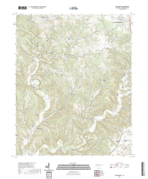 2022 Long Branch2022 Print · USGSLawrence County, Tennessee, is captured here in a period of rural continuity, showing the intricate network of creek-side settlements and family cemeteries. Genealogists and local historians can trace family roots through numerous sites like Pea Ridge Cem, Knob Creek Cem, and the crossroads at Springers Station.
 - 2022 Map of Appleton, 2022 Print
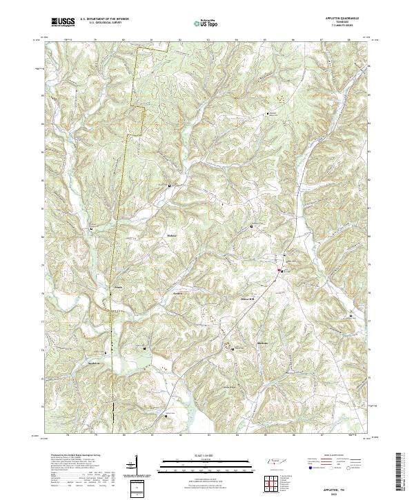 2022 Appleton2022 Print · USGSCovers Lawrence County, including Minor Hill, Sexton, and other nearby areas
 - 2022 Map of Sandy Hook, 2022 Print
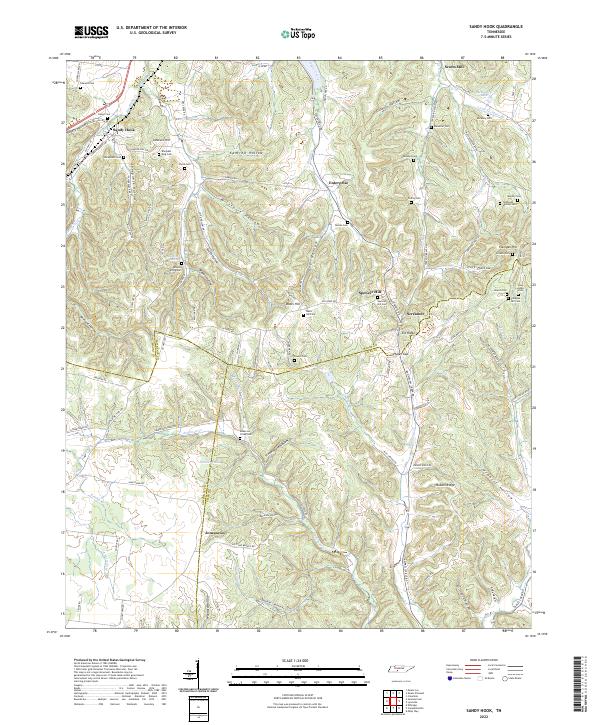 2022 Sandy Hook2022 Print · USGSMiddle Tennessee rural life at the borders of Maury, Lawrence, and Giles Counties is meticulously preserved in this recent survey. Genealogists and historians can locate family-named burial sites like Sheepneck Cem, trace the historic N Old Military Rd, and find old landmarks like Scotts Mill.
 - 2022 Map of Ovilla, 2022 Print
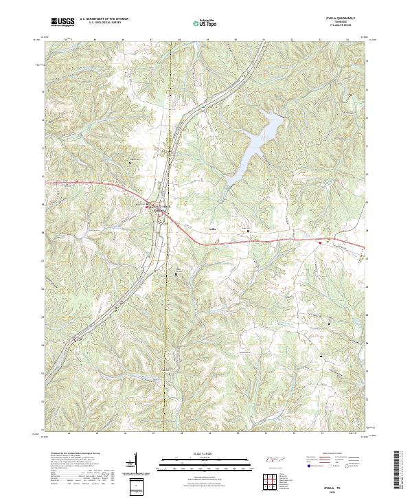 2022 Ovilla2022 Print · USGSThe Lawrence County uplands are documented here in the early twenty-first century, centered on the community of Ovilla. Genealogists can trace numerous family burial sites across the ridges, including Highland Cemetery, Fish Trapp Cemetery, and Owl Hollow Cemetery.
 - 2022 Map of Saint Joseph, 2022 Print
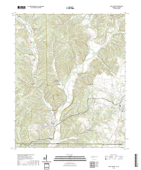 2022 Saint Joseph2022 Print · USGSThe Tennessee and Alabama state line meets in this 2022 survey of the Shoal Creek valley as it appeared in the early twenty-first century. Researchers can trace family history through numerous rural burial sites like Shiloh Cem and the landmarks of Iron City and Wayland Springs.
 - 2022 Map of Westpoint, 2022 Print
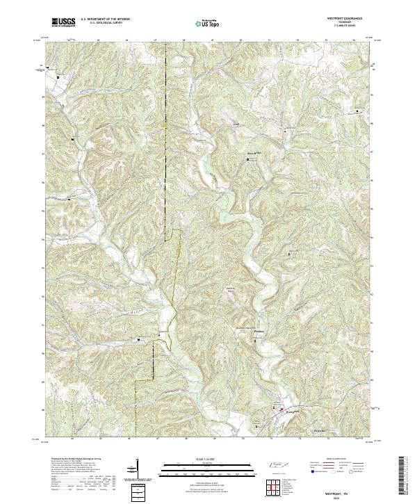 2022 Westpoint2022 Print · USGSWestpoint and the surrounding Tennessee borderlands are mapped here in the early twenty-first century, showing a landscape defined by deep hollows and ridge-top settlements. Genealogists can trace family locations through numerous rural burial sites like Bethlehem Cem, Old West Point Cem, and Wisdom Cem.
 - 2022 Map of Deerfield, 2022 Print
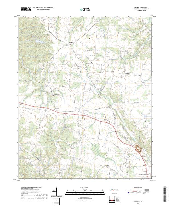 2022 Deerfield2022 Print · USGSLawrence County settlements and the western approach to Lawrenceburg appear in this recent survey. Local historians can trace family-named landmarks and rural burial sites including Deerfield Cem, Macedonia Cem, and O K Baptist Church Cem.
 - 2022 Map of Summertown, 2022 Print
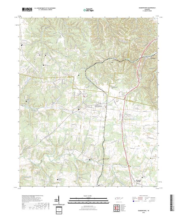 2022 Summertown2022 Print · USGSSummertown and the Highland Rim headwaters come to life in this recent study of the Tennessee backcountry. Genealogists can trace family connections through a high density of burial sites like Colbert Cem and Shrader Cem, while hikers can locate Rattlesnake Falls.
 - 2023 Map of Henryville, 2023 Print
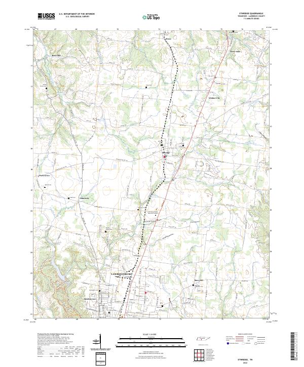
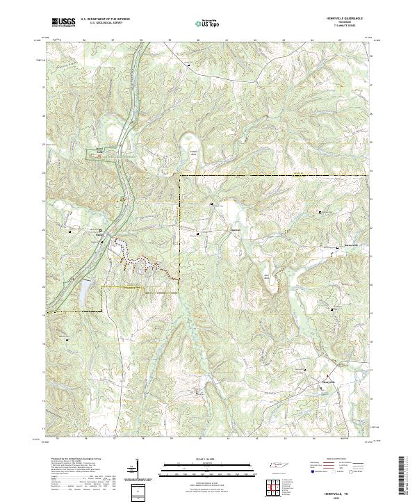 2023 Henryville2023 Print · USGSLawrence and Lewis Counties come into focus in this modern survey of the wooded Tennessee ridges and hollows. Trace local family history and rural settlements through Henryville, Old Salem Cemetery, and the river crossing at Metal Ford.
 - 2024 Map of Lexington, 2024 Print
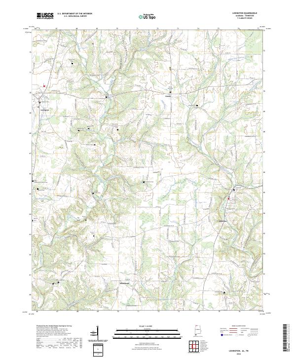 2024 Lexington2024 Print · USGSNorth Alabama's rural landscape is captured here in the early twenty-first century, centered on Lexington and Anderson. Genealogists can trace family names through dozens of local sites, including Shelton Cem, New Hope Cem, and Grassy Memorial Cem.
 - 2024 Map of Union Hill, 2024 Print
 2024 Union Hill2024 Print · USGSLimestone County, Alabama, and the Tennessee borderlands are captured in this modern survey of rural settlements and family burial grounds. Local historians can trace the early road network and locate sites like Ridgway Mill, Union Hill Cem, and the settlement of Scarce Grease.
End of results
Showing maps 1-20 of 20
Top cities of Lawrence County
Frequently asked questions
- What are the different types of historical maps available for Lawrence County?
- What is the oldest map of Lawrence County?
- Where can I purchase historical maps of Lawrence County for my home or office?
- Where can I download high-res historical maps of Lawrence County?
- Are there historical topographic maps available for Lawrence County?
- Is there historical aerial imagery available for Lawrence County?
- Where are historical maps of Lawrence County sourced from?