Old Maps of Spring Creek, Tennessee for Genealogy
Trace your family roots with 9 historic maps of Spring Creek. These high-res maps reveal old neighborhoods, homesites, landmarks, and streets — helping you uncover where your ancestors lived and how the area evolved over time.
- Explore historic neighborhoods: Identify where your relatives may have lived in the 1800s or 1900s.
- Compare maps over time: Trace the changes in streets, buildings, and landmarks for multi-generational research.
- Perfect for genealogy & ancestry research: Used by family historians and researchers to map out lineage and migration.
These maps are an incredible resource for exploring your personal connection to Spring Creek's past.
Spring Creek, TN maps
(9)- 1936 Map of Long Branch
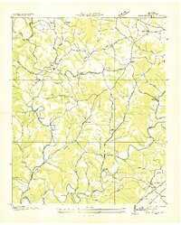 1936 Long Branch1936 Print · USGSLawrence County's rural landscape is captured here in the mid-1930s, showing a transition between traditional creek-side settlements and new transportation corridors. Researchers can locate the Stribling Orphan Home, small schools like Eagle Sch, and the rail stop at Springers Station.
 - 1951 Map of Long Branch, 1956 Print
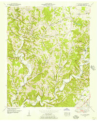 1951 Long Branch1956 Print · USGSLawrence County was a landscape of quiet hollows and family-owned lands in the early 1950s. Genealogists can locate specific burial sites like Ander Smith Cem, while historians can trace the Louisville and Nashville rail line through Springers Station.2 unique versions available
 - 1956 Map of Columbia, 1960 Print
 1956 Columbia1960 Print · USGSMiddle Tennessee in the mid-fifties presents a landscape of established river towns and critical rail hubs before the arrival of the modern interstate system. Researchers can trace the routes of the Louisville and Nashville railroad or locate historic landmarks like Stones River National Military Park and the Tennessee National Wildlife Refuge.6 unique versions available
 - 1985 Map of Lawrenceburg
 1985 Lawrenceburg1985 Print · USGSMiddle Tennessee and Northern Alabama are captured in the mid-1980s, showcasing a landscape of high ridges and winding river valleys. Genealogists and historians can trace rail lines like the Seaboard System Railroad or locate community landmarks such as Saint Marys Church and Three Churches.2 unique versions available
 - 2010 Map of Long Branch, 2010 Print
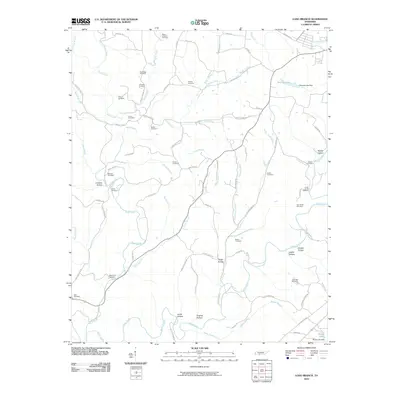 2010 Long Branch2010 Print · USGSCovers Spring Creek, including Lawrenceburg, Gandy, and other nearby areas
 - 2013 Map of Long Branch, 2013 Print
 2013 Long Branch2013 Print · USGSCovers Spring Creek, including Lawrenceburg, Gandy, and other nearby areas
 - 2016 Map of Long Branch, 2016 Print
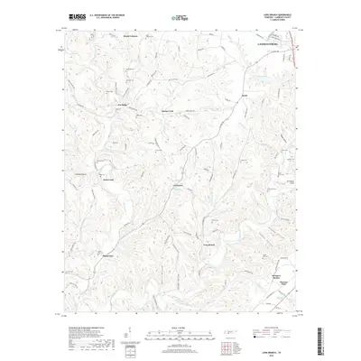
 2016 Long Branch2016 Print · USGSCovers Spring Creek, including Lawrenceburg, Gandy, and other nearby areas
 - 2019 Map of Long Branch, 2019 Print
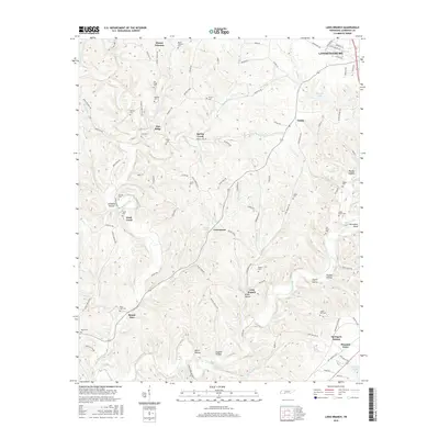
 2019 Long Branch2019 Print · USGSCovers Spring Creek, including Lawrenceburg, Gandy, and other nearby areas
 - 2022 Map of Long Branch, 2022 Print
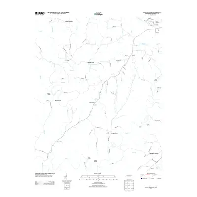
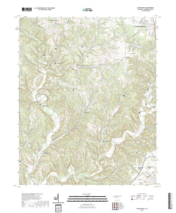 2022 Long Branch2022 Print · USGSLawrence County, Tennessee, is captured here in a period of rural continuity, showing the intricate network of creek-side settlements and family cemeteries. Genealogists and local historians can trace family roots through numerous sites like Pea Ridge Cem, Knob Creek Cem, and the crossroads at Springers Station.
End of results
Showing maps 1-9 of 9
Top cities near Spring Creek
Frequently asked questions
- What are the different types of historical maps available for Spring Creek?
- What is the oldest map of Spring Creek?
- Where can I purchase historical maps of Spring Creek for my home or office?
- Where can I download high-res historical maps of Spring Creek?
- Are there historical topographic maps available for Spring Creek?
- Is there historical aerial imagery available for Spring Creek?
- Where are historical maps of Spring Creek sourced from?