2020s Maps of Lewis County, Tennessee
Explore 11 historic maps of Lewis County from the 2020s. These maps offer a rare glimpse into what life looked like during the 2020s — showing old roads, neighborhoods, homes, and landmarks that have changed or disappeared over time.
Whether you're researching your family's past, planning a metal detecting trip, or studying how Lewis County's landscape evolved across the 2020s, these high-resolution maps are a powerful tool for exploring the history of this region.
- Focus on a specific era: All maps on this page are from the 2020s, giving you a focused view of this time period.
- See what’s changed: Compare century-old streets, trails, and buildings to today's modern landscape using overlays and satellite layers.
- Research with precision: Use these maps for genealogy, historical research, land use analysis, or educational projects.
- View, download, or print: Maps are fully viewable online in high resolution, and can be downloaded or printed for your own records.
Start exploring Lewis County's history through authentic maps from the 2020s. This is your window into the past.
Lewis County, TN maps
(11)- 2022 Map of Beaverdam Springs, 2022 Print
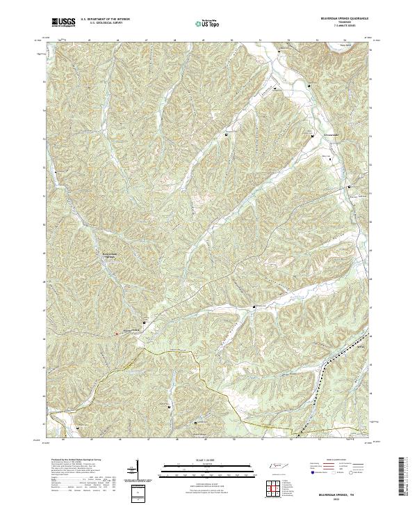 2022 Beaverdam Springs2022 Print · USGSThe Tennessee hill country near Beaverdam Springs is revealed in this modern survey, showing a landscape shaped by narrow hollows and high ridges. Genealogists can locate family burial sites like Wade-Peeler Cem and Horner Cem near the community of Hornertown.
 - 2022 Map of Riverside, 2022 Print
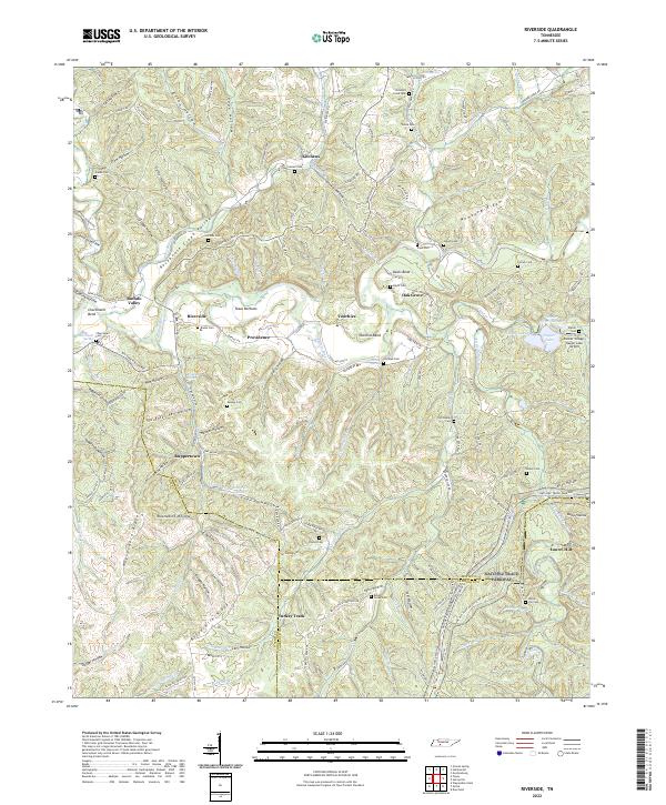 2022 Riverside2022 Print · USGSThe Tennessee backcountry near the Buffalo River is captured here in the early 2020s, showing a landscape of deep hollows and high ridges. Genealogists can trace family names at Mannie Cemetery and Banks Cemetery or locate the old Swiss Colony site.
 - 2022 Map of Gordonsburg, 2022 Print
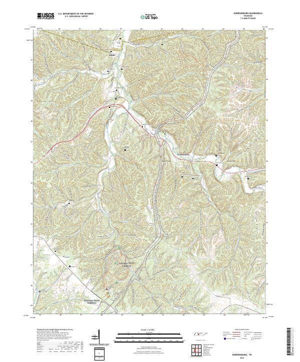 2022 Gordonsburg2022 Print · USGSSettlement and transit history converge in the Western Highland Rim during the 2020s, where the Natchez Trace Parkway winds through the hills. Researchers can trace numerous family burial sites such as Palestine Cem, Stoney Lonesome Cem, and Gordonsburg Cem.
 - 2022 Map of Topsy, 2022 Print
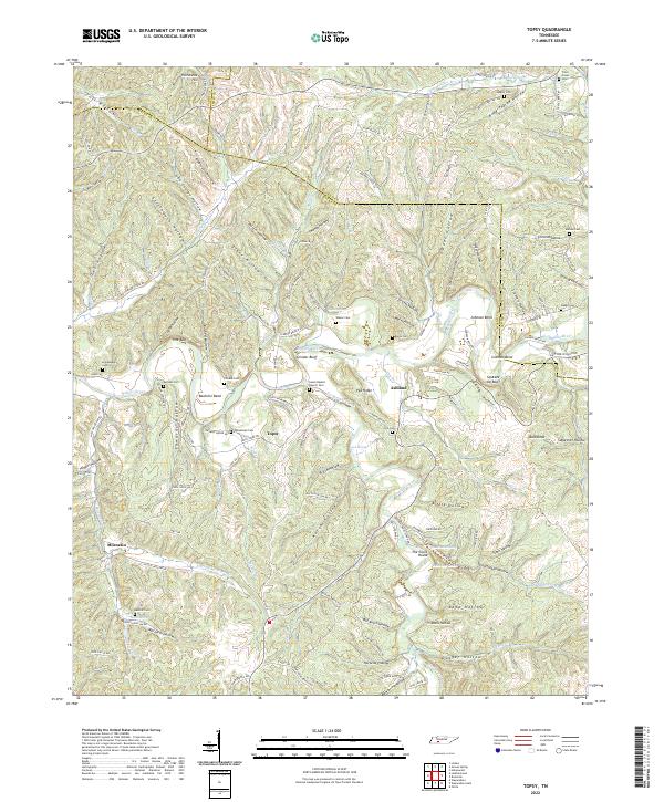 2022 Topsy2022 Print · USGSWayne County's winding river valleys and ridge-top roads are documented here in the early twenty-first century. Genealogists and local historians can trace family locations near Salem Baptist Church Cem, Bachelor Bend, and the settlement of Topsy.
 - 2022 Map of Sunrise, 2022 Print
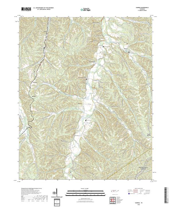 2022 Sunrise2022 Print · USGSThe rural hills of Middle Tennessee are captured here in the early twenty-first century, showing a landscape defined by deep hollows and creek-side settlements. Researchers can trace family history through numerous burial sites like Whiteside Cem and Campground Cem along the banks of Big Swan Creek.
 - 2022 Map of Hohenwald, 2022 Print
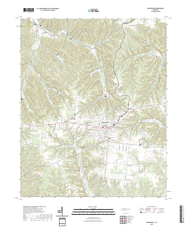 2022 Hohenwald2022 Print · USGSHohenwald and the surrounding Lewis County hollows are captured in 2022, showcasing a landscape defined by deep valleys and high ridges. Family historians can pinpoint numerous burial sites like Talley Cem and Lomax Cem or trace the rural crossroads at Blondy and Theodore.
 - 2022 Map of Summertown, 2022 Print
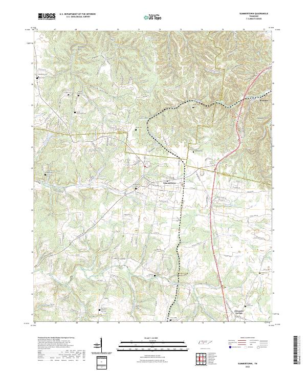 2022 Summertown2022 Print · USGSSummertown and the Highland Rim headwaters come to life in this recent study of the Tennessee backcountry. Genealogists can trace family connections through a high density of burial sites like Colbert Cem and Shrader Cem, while hikers can locate Rattlesnake Falls.
 - 2022 Map of Mount Joy, 2022 Print
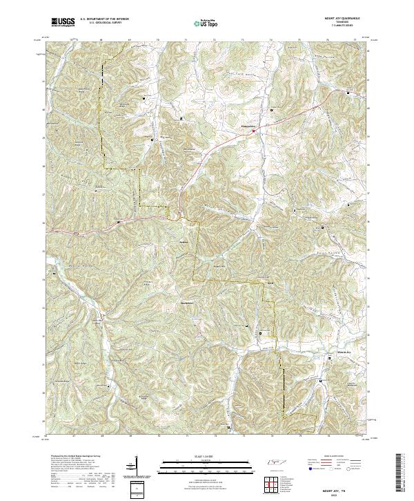 2022 Mount Joy2022 Print · USGSThe border of Lewis and Maury counties comes into focus in this modern survey of Tennessee's rural ridges and hollows. Genealogists can trace family connections through numerous sites like Isom Cem, Mayfield Cem, and the communities of Aethra and Bachelder.
 - 2022 Map of Greenfield Bend, 2022 Print
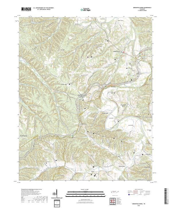 2022 Greenfield Bend2022 Print · USGSThe Duck River valley on the Hickman and Maury County line is captured here in the early twenty-first century, showcasing a landscape of tight ridges and river bends. Researchers can trace historic family names and settlements at Kettle Mills, Shady Grove, and the Old Cathey Cem.
 - 2022 Map of Graves Spring, 2022 Print
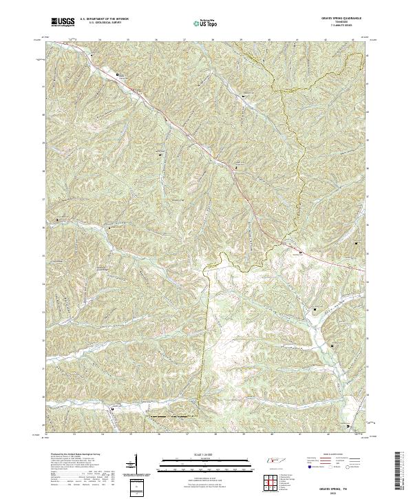 2022 Graves Spring2022 Print · USGSThe Perry and Lewis county borderlands remain a landscape of secluded hollows and family homesteads as seen in the early twenty-first century. Genealogists can trace numerous ancestral burial sites including Hensley Cem, Odam Cem, and the Barber and Qualls Family Cem along the winding creek branches.
 - 2023 Map of Henryville, 2023 Print
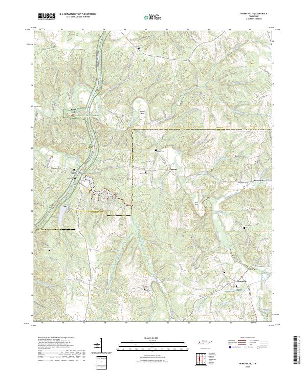 2023 Henryville2023 Print · USGSLawrence and Lewis Counties come into focus in this modern survey of the wooded Tennessee ridges and hollows. Trace local family history and rural settlements through Henryville, Old Salem Cemetery, and the river crossing at Metal Ford.
End of results
Showing maps 1-11 of 11
Top cities of Lewis County
Frequently asked questions
- What are the different types of historical maps available for Lewis County?
- What is the oldest map of Lewis County?
- Where can I purchase historical maps of Lewis County for my home or office?
- Where can I download high-res historical maps of Lewis County?
- Are there historical topographic maps available for Lewis County?
- Is there historical aerial imagery available for Lewis County?
- Where are historical maps of Lewis County sourced from?