Old Maps of Lebanon Heights, Tennessee for Metal Detecting
Plan your next treasure hunt with 11 historic maps of Lebanon Heights. Find old homesites, ghost towns, trails, and gathering spots that may be lost to time — perfect for identifying promising metal detecting locations.
- Locate forgotten sites: Uncover places like long-lost settlements, abandoned rail lines, or gathering spots.
- Plan better hunts: Use map overlays combined with LiDAR or satellite views to narrow in on historically rich areas.
- Made for detectorists: Thousands of hobbyists use these maps to discover relics, coins, and hidden history.
Use these historic maps to boost your research and find new opportunities beneath the surface of Lebanon Heights.
Lebanon Heights, TN maps
(11)- 1901 Map of Colombia
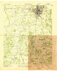
 1901 Colombia1901 Print · USGSMiddle Tennessee at the close of the century reveals a landscape shaped by river bends and a dense network of turnpikes. Genealogists can trace family roots through settlements like Santa Fe and Warner or locate landmarks such as the U.S. Arsenal and Zion Ch.3 unique versions available
 - 1936 Map of Columbia
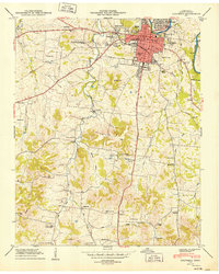
 1936 Columbia1936 Print · USGSMaury County's seat and the surrounding Tennessee countryside are captured here in the mid-1930s during a period of significant infrastructural expansion. Researchers can trace historic family locations and civic sites like Bigbyville, Ephesus Ch, and the Columbia Mil Academy.2 unique versions available
 - 1949 Map of Columbia
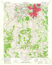
 1949 Columbia1949 Print · USGSColumbia is captured here during a period of steady post-war growth along the Duck River and the Bee Line Highway. Researchers can locate vanished landmarks and family sites, from the Columbia Military Academy to rural gems like Rocky Glade Sch and the Ephesus Ch.2 unique versions available
 - 1956 Map of Columbia, 1960 Print
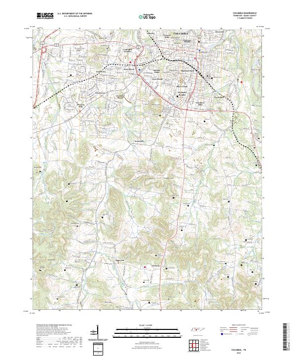
 1956 Columbia1960 Print · USGSMiddle Tennessee in the mid-fifties presents a landscape of established river towns and critical rail hubs before the arrival of the modern interstate system. Researchers can trace the routes of the Louisville and Nashville railroad or locate historic landmarks like Stones River National Military Park and the Tennessee National Wildlife Refuge.6 unique versions available
 - 1965 Map of Columbia, 1967 Print
 1965 Columbia1967 Print · USGSColumbia and the surrounding Maury County landscape are captured in the mid-1960s as suburban growth began to push south and west. Genealogists and local historians can locate dozens of family burial sites like Zollicoffer Cemetery or trace the old paths of the Louisville and Nashville Railroad and Bighyville Road.4 unique versions available
 - 1986 Map of Hohenwald
 1986 Hohenwald1986 Print · USGSThe Western Highland Rim of Tennessee comes into focus during the mid-eighties, showing the deep river valleys and high ridges of Lewis and Perry counties. Researchers can trace the path of the Natchez Trace Parkway or locate interior settlements like Chestnut Grove, Farmers Exchange, and Hustburg.3 unique versions available
 - 2010 Map of Columbia, 2010 Print
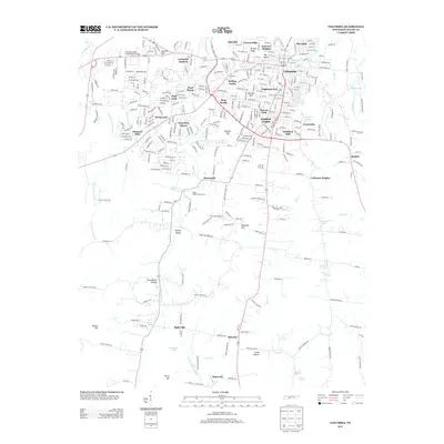
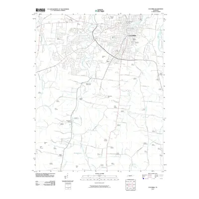 2010 Columbia2010 Print · USGSCovers Lebanon Heights, including Columbia, Idlewild, and other nearby areas
 - 2013 Map of Columbia, 2013 Print
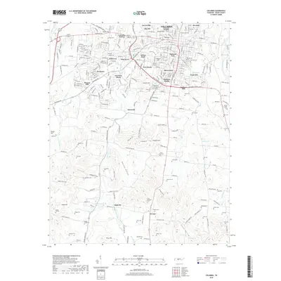
 2013 Columbia2013 Print · USGSCovers Lebanon Heights, including Columbia, Idlewild, and other nearby areas
 - 2016 Map of Columbia, 2016 Print
 2016 Columbia2016 Print · USGSCovers Lebanon Heights, including Columbia, Idlewild, and other nearby areas
 - 2019 Map of Columbia, 2019 Print
 2019 Columbia2019 Print · USGSCovers Lebanon Heights, including Columbia, Idlewild, and other nearby areas
 - 2022 Map of Columbia, 2022 Print
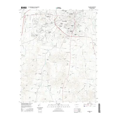
 2022 Columbia2022 Print · USGSMaury County is shown here in its modern era, centered on the city of Columbia and its surrounding valleys. Genealogists can trace family burial sites at Zollicoffer Cem and Mount Evergreen Cem or explore the rural landscapes of Bigbyville.
End of results
Showing maps 1-11 of 11
Top cities near Lebanon Heights
- Columbia historical maps
- Spring Hill historical maps
- Lewisburg historical maps
- Mount Pleasant historical maps
- Thompson's Station historical maps
- Cornersville historical maps
See more
Frequently asked questions
- What are the different types of historical maps available for Lebanon Heights?
- What is the oldest map of Lebanon Heights?
- Where can I purchase historical maps of Lebanon Heights for my home or office?
- Where can I download high-res historical maps of Lebanon Heights?
- Are there historical topographic maps available for Lebanon Heights?
- Is there historical aerial imagery available for Lebanon Heights?
- Where are historical maps of Lebanon Heights sourced from?