1900s (20th Century) Maps of Natco, Tennessee
Explore 7 historic maps of Natco from the 1900s (20th Century). These maps offer a rare glimpse into what life looked like during the 1900s — showing old roads, neighborhoods, homes, and landmarks that have changed or disappeared over time.
Whether you're researching your family's past, planning a metal detecting trip, or studying how Natco's landscape evolved across the 1900s, these high-resolution maps are a powerful tool for exploring the history of this region.
- Focus on a specific era: All maps on this page are from the 1900s, giving you a focused view of this time period.
- See what’s changed: Compare century-old streets, trails, and buildings to today's modern landscape using overlays and satellite layers.
- Research with precision: Use these maps for genealogy, historical research, land use analysis, or educational projects.
- View, download, or print: Maps are fully viewable online in high resolution, and can be downloaded or printed for your own records.
Start exploring Natco's history through authentic maps from the 1900s. This is your window into the past.
Natco, TN maps
(7)- 1901 Map of Colombia
 1901 Colombia1901 Print · USGSMiddle Tennessee at the close of the century reveals a landscape shaped by river bends and a dense network of turnpikes. Genealogists can trace family roots through settlements like Santa Fe and Warner or locate landmarks such as the U.S. Arsenal and Zion Ch.3 unique versions available
 - 1936 Map of Godwin
 1936 Godwin1936 Print · USGSMaury County life in the mid-1930s is captured here, showing a landscape defined by the winding Duck River and local rail lines. Genealogists can locate family landmarks like Timmons Cem, the settlement at Darks Mill, and rural schools including Santa Fe Sch.
 - 1940 Map of Godwin, 1954 Print
 1940 Godwin1954 Print · USGSMaury County's river-carved landscape is captured here in the mid-twentieth century, featuring the winding Duck River and its many valleys. Researchers can trace family history through sites like Old Knob Creek Cem, Darks Mill, and the Louisville and Nashville rail line.
 - 1941 Map of Godwin
 1941 Godwin1941 Print · USGSMaury County at the start of the 1940s is a landscape of winding river bends and tight-knit rural communities. Researchers can trace family history through numerous landmarks like Old Knob Creek Cem, Darks Mill, and the many country churches.
 - 1956 Map of Columbia, 1960 Print
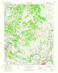
 1956 Columbia1960 Print · USGSMiddle Tennessee in the mid-fifties presents a landscape of established river towns and critical rail hubs before the arrival of the modern interstate system. Researchers can trace the routes of the Louisville and Nashville railroad or locate historic landmarks like Stones River National Military Park and the Tennessee National Wildlife Refuge.6 unique versions available
 - 1965 Map of Godwin, 1967 Print
 1965 Godwin1967 Print · USGSMaury County at the mid-point of the sixties reveals a transition from traditional rural life to modern residential growth. Genealogists can trace family roots through numerous local landmarks like Harlan Sch, Old Knob Creek Cem, and the community at Santa Fe.3 unique versions available
 - 1986 Map of Hohenwald
 1986 Hohenwald1986 Print · USGSThe Western Highland Rim of Tennessee comes into focus during the mid-eighties, showing the deep river valleys and high ridges of Lewis and Perry counties. Researchers can trace the path of the Natchez Trace Parkway or locate interior settlements like Chestnut Grove, Farmers Exchange, and Hustburg.3 unique versions available
End of results
Showing maps 1-7 of 7
Top cities near Natco
- Franklin historical maps
- Columbia historical maps
- Spring Hill historical maps
- Lewisburg historical maps
- Mount Pleasant historical maps
- Thompson's Station historical maps
Frequently asked questions
- What are the different types of historical maps available for Natco?
- What is the oldest map of Natco?
- Where can I purchase historical maps of Natco for my home or office?
- Where can I download high-res historical maps of Natco?
- Are there historical topographic maps available for Natco?
- Is there historical aerial imagery available for Natco?
- Where are historical maps of Natco sourced from?