2020s Maps of Lobelville, Tennessee
Explore 2 historic maps of Lobelville from the 2020s. These maps offer a rare glimpse into what life looked like during the 2020s — showing old roads, neighborhoods, homes, and landmarks that have changed or disappeared over time.
Whether you're researching your family's past, planning a metal detecting trip, or studying how Lobelville's landscape evolved across the 2020s, these high-resolution maps are a powerful tool for exploring the history of this region.
- Focus on a specific era: All maps on this page are from the 2020s, giving you a focused view of this time period.
- See what’s changed: Compare century-old streets, trails, and buildings to today's modern landscape using overlays and satellite layers.
- Research with precision: Use these maps for genealogy, historical research, land use analysis, or educational projects.
- View, download, or print: Maps are fully viewable online in high resolution, and can be downloaded or printed for your own records.
Start exploring Lobelville's history through authentic maps from the 2020s. This is your window into the past.
Lobelville, TN maps
(2)- 2022 Map of Chestnut Grove, 2022 Print
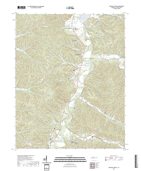 2022 Chestnut Grove2022 Print · USGSPerry County's river-carved hills are shown here in the 2020s, highlighting the enduring settlement patterns along the Buffalo River. Researchers can locate numerous family burial grounds including Murray Cem and Cude Cem or trace the rural routes through Toad Hollow and Beardstown.
 - 2022 Map of Lobelville, 2022 Print
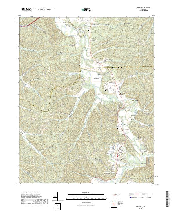 2022 Lobelville2022 Print · USGSThe Buffalo River valley in the early 2020s remains a landscape of traditional river bottoms and family landmarks. Genealogists can trace decades of history at Bone Spring Cem, Leeper Cem, and Gray Cem near Lobelville.
End of results
Showing maps 1-2 of 2
Top cities near Lobelville
Top neighborhoods of Lobelville
Frequently asked questions
- What are the different types of historical maps available for Lobelville?
- What is the oldest map of Lobelville?
- Where can I purchase historical maps of Lobelville for my home or office?
- Where can I download high-res historical maps of Lobelville?
- Are there historical topographic maps available for Lobelville?
- Is there historical aerial imagery available for Lobelville?
- Where are historical maps of Lobelville sourced from?