Old Maps of Caney Creek, Tennessee
Explore 20 old maps of Caney Creek, spanning from 1886 to today. These high-resolution historic maps reveal how streets, neighborhoods, landmarks, and natural features evolved over time — perfect for genealogy, metal detecting, research, and local history exploration.
What you can do with these maps:
- See how Caney Creek changed over time: Compare historical maps to modern-day views to trace roads, homesites, rail lines & more.
- View detailed metadata: Each map includes creators, publishers, year, scale, and archive source.
- Overlay maps with satellite & LiDAR: Visualize the past alongside modern tools to explore terrain & human change.
- Trusted historical sources: Maps sourced from the USGS, Library of Congress, and other archives.
- Access maps your way: View online, download high-res files, or order prints for personal or research use.
Start exploring old maps of Caney Creek to uncover forgotten places, hidden landmarks, and the deep history beneath your feet.
Caney Creek, TN maps
(20)- 1886 Map of Cleveland
 1886 Cleveland1886 Print · USGSSoutheast Tennessee in the mid-1880s was a landscape defined by the iron rails and winding rivers that fueled the region's growth. You can trace early river crossings like Savannah Ford and Kincannons Ferry or locate old community centers like Chestua Mills.
 - 1892 Map of Cleveland
 1892 Cleveland1892 Print · USGSSoutheast Tennessee is captured in the late nineteenth century as a landscape of river ferries and emerging rail junctions. Genealogists and historians can locate early settlements like Charleston and Riceville or trace the original river crossings at Kincannons Ferry and Helderbrand Ford.
 - 1895 Map of Cleveland
 1895 Cleveland1895 Print · USGSSoutheast Tennessee thrived along the Hiwassee River and its rail corridors during the 1890s. Genealogists and historians can trace defunct river crossings like Bunker Hill Ferry and milling sites including Chestuee Mills and Longs Mills.
 - 1901 Map of Cleveland
 1901 Cleveland1901 Print · USGSSoutheast Tennessee was a thriving hub of river and rail commerce at the dawn of the twentieth century. Genealogists can trace family homesteads near vanished landmarks like Marble Switch, Bunker Hill Ferry, or the early settlements of Riceville and Benton.4 unique versions available
 - 1935 Map of Caney Creek
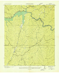 1935 Caney Creek1935 Print · USGSPolk County was undergoing significant industrial and conservation shifts in the mid-1930s as the Tennessee Valley Authority and CCC transformed the landscape. Researchers can trace the Flume Line and Tramway or locate early forest schools like Blue Ridge Sch.
 - 1938 Map of Caney Creek
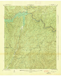 1938 Caney Creek1938 Print · USGSPolk County was undergoing significant infrastructure changes in the late thirties as the TVA harnessed the mountain rivers. Genealogists and hikers can trace old mountain communities like Sylco and locate early forestry sites such as CCC Camp No 1452 and the Forest Guard Cabin.3 unique versions available
 - 1953 Map of Chattanooga
 1953 Chattanooga1953 Print · USGSSoutheast Tennessee in the early fifties shows a landscape reshaped by river management and rail power. Trace the rail lines of the Southern Ry through riverside towns or locate the preserved grounds of the Chickamauga and Chattanooga National Military Park.
 - 1957 Map of Chattanooga, 1966 Print
 1957 Chattanooga1966 Print · USGSEast Tennessee in the mid-1960s shows a landscape of massive hydroelectric reservoirs and emerging industrial sites like the Atomic Energy Commission (Oak Ridge Area). Trace the rail networks of the Southern Ry through Chattanooga or locate family-named ridges across the Cumberland Plateau.3 unique versions available
 - 1959 Map of Chattanooga
 1959 Chattanooga1959 Print · USGSSoutheast Tennessee is shown here during a decade of industrial growth and hydroelectric development. Trace the regional rail networks of the Southern Ry and find landmark sites like Lookout Mountain, Fall Creek Falls State Park, and Chattanooga.
 - 1960 Map of Chattanooga
 1960 Chattanooga1960 Print · USGSSoutheast Tennessee and the southern Appalachians are shown here at the height of the river-management era. You can trace the valley rail lines and locate Lookout Mountain and the expansive waters of Chickamauga Reservoir.
 - 1964 Map of Chattanooga
 1964 Chattanooga1964 Print · USGSSoutheast Tennessee and the western Carolinas appear in the mid-sixties as a powerhouse of river-driven industry and mountain wilderness. Genealogists and historians can trace rail-town lineages along the Southern Ry or locate family landmarks near Watts Bar Lake and Tellico Plains.
 - 1967 Map of Caney Creek, 1970 Print
 1967 Caney Creek1970 Print · USGSSoutheastern Tennessee's mountainous borderlands are shown in detail during the late sixties, highlighting the industrial footprint of the Ocoee River. Researchers can locate Old Fairview Cem, the Ocoee Power Plant No 2, and historical routes like the Old Copper Road.2 unique versions available
 - 1981 Map of Cleveland
 1981 Cleveland1981 Print · USGSSoutheast Tennessee and Western North Carolina are documented here in the early eighties, as the Tennessee Valley Authority managed the region's vast river and forest resources. Researchers can trace the rail lines of the Southern and Louisville and Nashville or locate industrial sites in the Copper Basin and settlements like Ducktown.2 unique versions available
 - 1999 Map of Caney Creek, 2001 Print
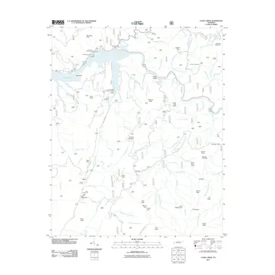
 1999 Caney Creek2001 Print · USGSPolk County at the close of the twentieth century shows a landscape shaped by hydroelectric power and the timber industry. Researchers can trace family history at Beckler Cem or follow the historic path of the Old Copper Road along the Ocoee River.
 - 2003 Map of Caney Creek, 2004 Print
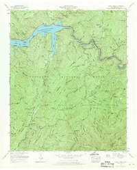
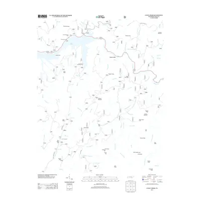
 2003 Caney Creek2004 Print · USGSThe Ocoee River corridor in the early 2000s reveals a mountain landscape defined by hydroelectric power and recreation. Trace local family history at Old Fairview Cem or explore the route of the Old Copper Road and the Benton MacKaye Trail.
 - 2011 Map of Caney Creek, 2011 Print
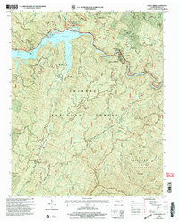
 2011 Caney Creek2011 Print · USGSCovers Caney Creek, including Sylco, Polk County, and other nearby areas
 - 2013 Map of Caney Creek, 2013 Print
 2013 Caney Creek2013 Print · USGSCovers Caney Creek, including Sylco, Polk County, and other nearby areas
 - 2016 Map of Caney Creek, 2016 Print
 2016 Caney Creek2016 Print · USGSCovers Caney Creek, including Sylco, Polk County, and other nearby areas
 - 2019 Map of Caney Creek, 2019 Print
 2019 Caney Creek2019 Print · USGSCovers Caney Creek, including Sylco, Polk County, and other nearby areas
 - 2022 Map of Caney Creek, 2022 Print
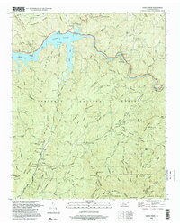
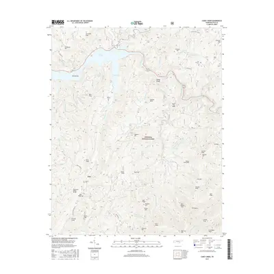
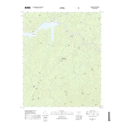
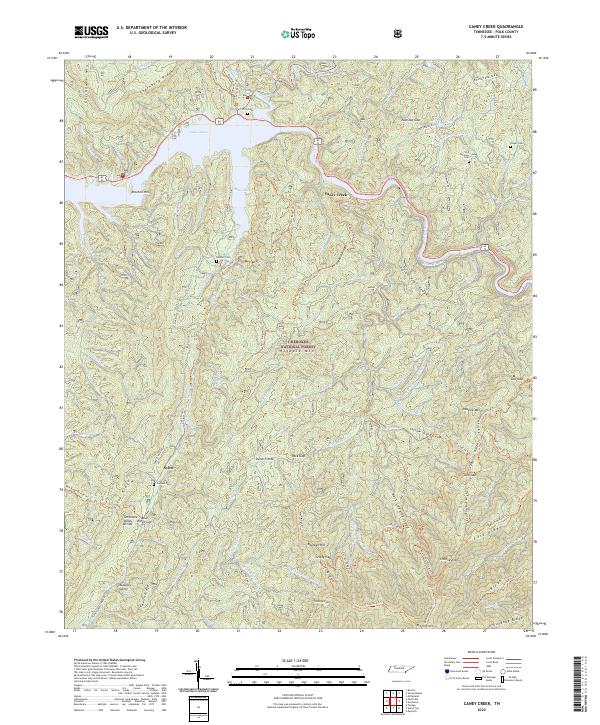 2022 Caney Creek2022 Print · USGSThe high ridges of the Cherokee National Forest meet the waters of Lake Ocoee in this recent survey of Polk County. Researchers can trace rural cemetery locations like Old Fairview Cem and Beckler Cem or follow the path of the unique Ocoee Flume.
End of results
Showing maps 1-20 of 20
Top cities near Caney Creek
- Etowah historical maps
- McCaysville historical maps
- Benton historical maps
- Blue Ridge historical maps
- Charleston historical maps
- Calhoun historical maps
See more
Frequently asked questions
- What are the different types of historical maps available for Caney Creek?
- What is the oldest map of Caney Creek?
- Where can I purchase historical maps of Caney Creek for my home or office?
- Where can I download high-res historical maps of Caney Creek?
- Are there historical topographic maps available for Caney Creek?
- Is there historical aerial imagery available for Caney Creek?
- Where are historical maps of Caney Creek sourced from?