Old Maps of Eagle Point, Tennessee for Genealogy
Trace your family roots with 18 historic maps of Eagle Point. These high-res maps reveal old neighborhoods, homesites, landmarks, and streets — helping you uncover where your ancestors lived and how the area evolved over time.
- Explore historic neighborhoods: Identify where your relatives may have lived in the 1800s or 1900s.
- Compare maps over time: Trace the changes in streets, buildings, and landmarks for multi-generational research.
- Perfect for genealogy & ancestry research: Used by family historians and researchers to map out lineage and migration.
These maps are an incredible resource for exploring your personal connection to Eagle Point's past.
Eagle Point, TN maps
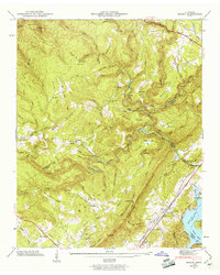
(18)- 1887 Map of Kingston
 1887 Kingston1887 Print · USGSCentral Tennessee in the late nineteenth century was a world of river landings and new rail lines. Genealogists can trace family roots through riverside sites like Sevier's Ferry or rural hubs like Bogges X Roads and Ten Mile Stand.
 - 1891 Map of Kingston
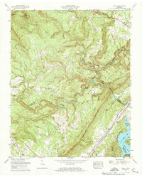
 1891 Kingston1891 Print · USGSEastern Tennessee in the 1890s reveals a river-driven economy at the edge of the Cumberland Plateau. Genealogists can trace early crossings and landings such as Mc Elwee's Ferry and Pinhook Landing, or locate vanished crossroads like Kemmers Old Stand.2 unique versions available
 - 1893 Map of Kingston, 1905 Print
 1893 Kingston1905 Print · USGSEastern Tennessee at the end of the nineteenth century is a landscape of mountain gaps and vital river landings. Researchers can trace early river crossings like Jackson Ferry, the path of the Cincinnati Southern Railroad, and settlements like Rhea Springs and Kingston.5 unique versions available
 - 1936 Map of Roddy
 1936 Roddy1936 Print · USGSThe Tennessee Valley meets the high ridges of the plateau in the 1930s, showing a landscape of small schools, relief camps, and early highways. Genealogists can locate family landmarks such as Gibson Inn, Dogwood School, and Mt Zion Cemetery.
 - 1946 Map of Roddy, 1960 Print
 1946 Roddy1960 Print · USGSThe Cumberland Plateau meets the Tennessee Valley just after the war, where rail lines and ridgeline gaps defined local travel. Researchers can trace family sites like Williams Cem or follow the old tracks of the Tennessee Central Railroad near Roddy.2 unique versions available
 - 1947 Map of Roddy, 1948 Print
 1947 Roddy1948 Print · USGSThe Cumberland Escarpment and Watts Bar Reservoir define this 1940s landscape on the borders of Rhea and Roane counties. Genealogists can trace family names at Williams Cem, locate the Big Sandy Sch, and find the old Gibson Inn.
 - 1953 Map of Chattanooga
 1953 Chattanooga1953 Print · USGSSoutheast Tennessee in the early fifties shows a landscape reshaped by river management and rail power. Trace the rail lines of the Southern Ry through riverside towns or locate the preserved grounds of the Chickamauga and Chattanooga National Military Park.
 - 1957 Map of Chattanooga, 1966 Print
 1957 Chattanooga1966 Print · USGSEast Tennessee in the mid-1960s shows a landscape of massive hydroelectric reservoirs and emerging industrial sites like the Atomic Energy Commission (Oak Ridge Area). Trace the rail networks of the Southern Ry through Chattanooga or locate family-named ridges across the Cumberland Plateau.3 unique versions available
 - 1959 Map of Chattanooga
 1959 Chattanooga1959 Print · USGSSoutheast Tennessee is shown here during a decade of industrial growth and hydroelectric development. Trace the regional rail networks of the Southern Ry and find landmark sites like Lookout Mountain, Fall Creek Falls State Park, and Chattanooga.
 - 1960 Map of Chattanooga
 1960 Chattanooga1960 Print · USGSSoutheast Tennessee and the southern Appalachians are shown here at the height of the river-management era. You can trace the valley rail lines and locate Lookout Mountain and the expansive waters of Chickamauga Reservoir.
 - 1964 Map of Chattanooga
 1964 Chattanooga1964 Print · USGSSoutheast Tennessee and the western Carolinas appear in the mid-sixties as a powerhouse of river-driven industry and mountain wilderness. Genealogists and historians can trace rail-town lineages along the Southern Ry or locate family landmarks near Watts Bar Lake and Tellico Plains.
 - 1973 Map of Roddy, 1974 Print
 1973 Roddy1974 Print · USGSThe Cumberland Escarpment meets the waters of Watts Bar Lake in the early seventies, where rail lines and highways navigate the gaps of Walden Ridge. Genealogists can trace family names at Dogwood Cem and Kelley Cem or locate the quiet grounds of Johnson Chapel.3 unique versions available
 - 1981 Map of Watts Bar Lake, 1984 Print
 1981 Watts Bar Lake1984 Print · USGSEast Tennessee's river valleys and industrial corridors are captured here during the expansion of the TVA power system in the early eighties. Researchers can trace the legacy of the Southern Railway and the development of Watts Bar Lake and Tellico Lake.2 unique versions available
 - 2010 Map of Roddy, 2010 Print
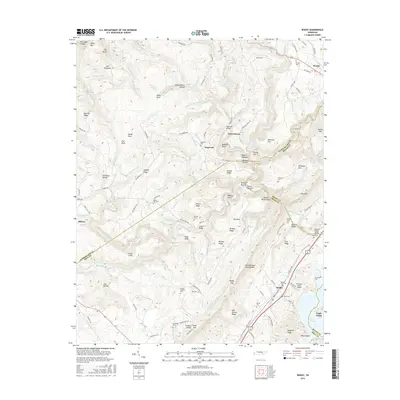
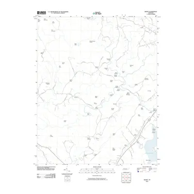 2010 Roddy2010 Print · USGSCovers Eagle Point, including Reid Camp, Roddy, and other nearby areas
 - 2013 Map of Roddy, 2013 Print
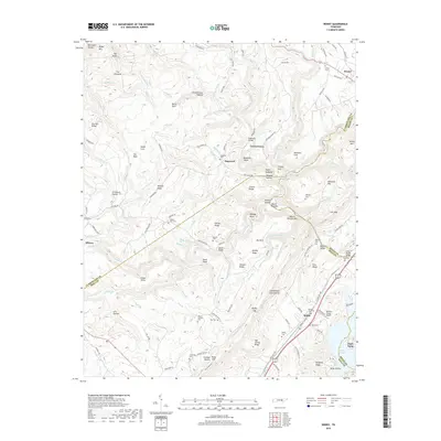
 2013 Roddy2013 Print · USGSCovers Eagle Point, including Reid Camp, Roddy, and other nearby areas
 - 2016 Map of Roddy, 2016 Print
 2016 Roddy2016 Print · USGSCovers Eagle Point, including Reid Camp, Roddy, and other nearby areas
 - 2019 Map of Roddy, 2019 Print
 2019 Roddy2019 Print · USGSCovers Eagle Point, including Reid Camp, Roddy, and other nearby areas
 - 2022 Map of Roddy, 2022 Print
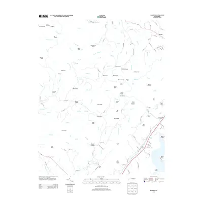
 2022 Roddy2022 Print · USGSThe Cumberland Plateau meets the Tennessee Valley in the early 2020s, showing a landscape of deep hollows and family-named ridges. Genealogists can locate several remote burial grounds like Mount Sulphur Cem and Treadway Cem or trace the early paths of the Dixie Lee Hwy.
End of results
Showing maps 1-18 of 18
Top cities near Eagle Point
- Crossville historical maps
- Fairfield Glade historical maps
- Kingston historical maps
- Harriman historical maps
- Rockwood historical maps
- Spring City historical maps
See more
Frequently asked questions
- What are the different types of historical maps available for Eagle Point?
- What is the oldest map of Eagle Point?
- Where can I purchase historical maps of Eagle Point for my home or office?
- Where can I download high-res historical maps of Eagle Point?
- Are there historical topographic maps available for Eagle Point?
- Is there historical aerial imagery available for Eagle Point?
- Where are historical maps of Eagle Point sourced from?