1940s Maps of Roane County, Tennessee
Explore 16 historic maps of Roane County from the 1940s. These maps offer a rare glimpse into what life looked like during the 1940s — showing old roads, neighborhoods, homes, and landmarks that have changed or disappeared over time.
Whether you're researching your family's past, planning a metal detecting trip, or studying how Roane County's landscape evolved across the 1940s, these high-resolution maps are a powerful tool for exploring the history of this region.
- Focus on a specific era: All maps on this page are from the 1940s, giving you a focused view of this time period.
- See what’s changed: Compare century-old streets, trails, and buildings to today's modern landscape using overlays and satellite layers.
- Research with precision: Use these maps for genealogy, historical research, land use analysis, or educational projects.
- View, download, or print: Maps are fully viewable online in high resolution, and can be downloaded or printed for your own records.
Start exploring Roane County's history through authentic maps from the 1940s. This is your window into the past.
Roane County, TN maps
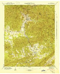
(16)- 1940 Map of Lenoir City
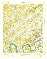 1940 Lenoir City1940 Print · USGSLoudon and Roane counties are captured here just as the Tennessee Valley Authority was reshaping the river landscape. Researchers can trace family-named sites like Brazeale Cem, old schoolhouses such as Oak Grove Sch, and historic river crossings at Bussell Ferry.2 unique versions available
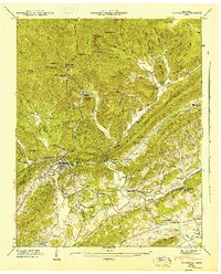
 - 1940 Map of Rockwood
 1940 Rockwood1940 Print · USGSThe Tennessee River valley at Rockwood is shown here during the transition to the reservoir era in the early 1940s. Genealogists can locate family sites like Odd Fellows Cem, trace the railroad to Glen Alice, or find old schools like New Hope Sch.
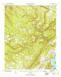
 - 1940 Map of Bacon Gap
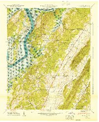
 1940 Bacon Gap1940 Print · USGSThe Roane County riverfront is captured here just before the Watts Bar Reservoir floodwaters arrived in the early 1940s. Genealogists can trace family-named sites like Barnardsville and Bacon Ridge or locate community anchors such as Fairview Sch and Caney Ford Ch.2 unique versions available
 - 1940 Map of Philadelphia
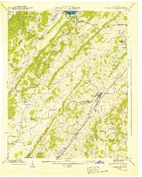 1940 Philadelphia1940 Print · USGSThe Tennessee Valley just before the height of the war era shows a landscape of ridge-top schools and creek-side settlements. Researchers can trace ancestral locations at Philadelphia, the Roberson Cem, and rural centers like New Hope Ch.
 - 1940 Map of Ten Mile
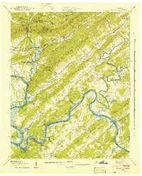
 1940 Ten Mile1940 Print · USGSMeigs and Roane counties are captured here just as the Tennessee Valley Authority was transforming the river landscape. Genealogists and local historians can trace rural family life through markers like Deatherage Cem, Euchee Sch, and the settlement at Ten Mile.
 - 1940 Map of Cave Creek
 1940 Cave Creek1940 Print · USGSThe Tennessee River valley stands on the brink of transformation in 1940 as the Watts Bar project prepares to reshape the landscape. Researchers can trace old routes like the Old Walton Road and find family landmarks such as Ladd Cem and Dogwood Sch.
 - 1940 Map of Pattie Gap
 1940 Pattie Gap1940 Print · USGSThe rural valleys of East Tennessee are captured here in 1940, showing a landscape of small farmsteads and family-named landmarks. Researchers can trace ancestral roots through sites like the Fuller Cem, Morrison Store, and Dry Fork Sch.
 - 1941 Map of Harriman
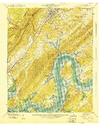
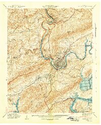 1941 Harriman1941 Print · USGSHarriman and the Emory River valley are captured here just as the landscape was transforming for the new reservoir system. Researchers can trace the convergence of three major railroads and find family landmarks like Delozier Cem, Woods Chapel, and Cardiff Sch.3 unique versions available
 - 1941 Map of Bethel Valley
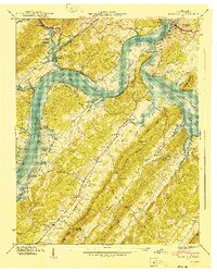
 1941 Bethel Valley1941 Print · USGSBethel Valley and the Clinch River are captured here in the early 1940s, just as the regional landscape began to shift. Genealogists and historians can locate early family landmarks like White Wing Ferry, the Wheat settlement, and the George Jones Memorial Ch.3 unique versions available
 - 1941 Map of Elverton
 1941 Elverton1941 Print · USGSThe Clinch and Emory Rivers meet at the dawn of the Tennessee Valley Authority era, just as the Watts Bar Reservoir began to fill. Local historians can trace the foundations of old Roane County through Smallman Mill, Gallaher Ferry, and the County Farm.3 unique versions available
 - 1946 Map of Cardiff
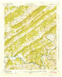
 1946 Cardiff1946 Print · USGSThe industrial corridor near Rockwood and Cardiff sits at the foot of Walden Ridge during the mid-1940s. Genealogists can trace family footprints across several rural schools and burial grounds, including Dry Hill Sch, Skidmore Cem, and Ault Cem.
 - 1946 Map of Petros, 1947 Print
 1946 Petros1947 Print · USGSMorgan County and the Cumberland Plateau are shown just after the war when coal and incarceration shaped the local landscape. Trace the footprint of Brushy Mountain State Prison and the rail-dependent camps at Coalfield Camp No 1 and Coalfield.2 unique versions available
 - 1946 Map of Windrock, 1947 Print
 1946 Windrock1947 Print · USGSThe mining and rail landscape of Anderson County comes into focus in the mid-1940s. Researchers can trace family sites at Robertsville and Frost Bottom, or locate old landmarks like Donovan Sch and the Oliver Springs Cem.2 unique versions available
 - 1946 Map of Roddy, 1960 Print
 1946 Roddy1960 Print · USGSThe Cumberland Plateau meets the Tennessee Valley just after the war, where rail lines and ridgeline gaps defined local travel. Researchers can trace family sites like Williams Cem or follow the old tracks of the Tennessee Central Railroad near Roddy.2 unique versions available
 - 1947 Map of Roddy, 1948 Print
 1947 Roddy1948 Print · USGSThe Cumberland Escarpment and Watts Bar Reservoir define this 1940s landscape on the borders of Rhea and Roane counties. Genealogists can trace family names at Williams Cem, locate the Big Sandy Sch, and find the old Gibson Inn.
 - 1949 Map of Cardiff
 1949 Cardiff1949 Print · USGSPost-war Roane and Morgan counties are shown here as the industrial valley meets the high plateau. Researchers can trace early rural life through family landmarks like Skidmore Cem, small institutions such as Hatley Sch, and the rail lines serving Rockwood.
End of results
Showing maps 1-16 of 16
Top cities of Roane County
Frequently asked questions
- What are the different types of historical maps available for Roane County?
- What is the oldest map of Roane County?
- Where can I purchase historical maps of Roane County for my home or office?
- Where can I download high-res historical maps of Roane County?
- Are there historical topographic maps available for Roane County?
- Is there historical aerial imagery available for Roane County?
- Where are historical maps of Roane County sourced from?