1900s (20th Century) Maps of Gatlinburg, Tennessee
Explore 17 historic maps of Gatlinburg from the 1900s (20th Century). These maps offer a rare glimpse into what life looked like during the 1900s — showing old roads, neighborhoods, homes, and landmarks that have changed or disappeared over time.
Whether you're researching your family's past, planning a metal detecting trip, or studying how Gatlinburg's landscape evolved across the 1900s, these high-resolution maps are a powerful tool for exploring the history of this region.
- Focus on a specific era: All maps on this page are from the 1900s, giving you a focused view of this time period.
- See what’s changed: Compare century-old streets, trails, and buildings to today's modern landscape using overlays and satellite layers.
- Research with precision: Use these maps for genealogy, historical research, land use analysis, or educational projects.
- View, download, or print: Maps are fully viewable online in high resolution, and can be downloaded or printed for your own records.
Start exploring Gatlinburg's history through authentic maps from the 1900s. This is your window into the past.
Gatlinburg, TN maps
(17)- 1901 Map of Knoxville
 1901 Knoxville1901 Print · USGSThe East Tennessee borderlands meet the high Smokies at the turn of the century. Genealogists can trace early homesteads and crossroads near Sevierville and Maryville, or find landmarks like Cade Cove and Gatlinburg before they became tourist hubs.5 unique versions available
 - 1912 Map of Mt Guyot
 1912 Mt Guyot1912 Print · USGSThe Tennessee and North Carolina borderlands come into focus in the early twentieth century, prior to the creation of the Great Smoky Mountains National Park. Trace ancestral locations like Cataloochee and Smokemont or follow the Southern RR to Newport.5 unique versions available
 - 1935 Map of English Mountain
 1935 English Mountain1935 Print · USGSSevier County and the foothills of the Smokies are seen here during the mid-thirties as the national park was taking shape. Genealogists can trace family roots through scores of rural institutions like Smoky Mtn Academy, Pittman Center, and the Crockettville Sch.
 - 1935 Map of Richardson Cove
 1935 Richardson Cove1935 Print · USGSSevier County communities appear here in the mid-1930s, nestled between the ridgelines of the Great Smokies. Genealogists can trace family landmarks and schools including Smoky Mtn Academy, Richardson Cove, and Oldham.
 - 1936 Map of Gatlinburg
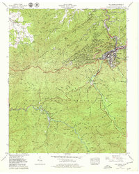
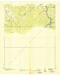 1936 Gatlinburg1936 Print · USGSGatlinburg and the northern Smokies appear here during the mid-1930s as the national park was being established. Genealogists can trace family homesteads near Starkeytown or locate landmarks like Husky Grove Ch and the Covemont Sch.
 - 1936 Map of Cartertown
 1936 Cartertown1936 Print · USGSSevier County communities sit along the edge of the newly established national park in the mid-1930s. Researchers can locate family landmarks like the Mc Carter Cem and Proffitt Cem or trace early school sites including Roaring Fork Sch.2 unique versions available
 - 1940 Map of Richardson Cove
 1940 Richardson Cove1940 Print · USGSSevier County mountain life is captured here in the early 1940s, showing a landscape defined by river-valley settlements and rural academies. Genealogists can trace family footprints through the Smoky Mtn Academy, Boogertown, and the Williams Cem.4 unique versions available
 - 1943 Map of Gatlinburg
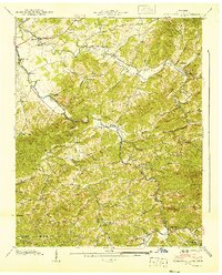
 1943 Gatlinburg1943 Print · USGSGatlinburg and its surrounding mountain coves were in the midst of a transformation during the 1940s as the national park expanded. Genealogists and local historians can locate family landmarks like Crowson Cem, the Jim Carr Mill, and the Valley View Ch.
 - 1955 Map of Knoxville
 1955 Knoxville1955 Print · USGSThe Southern Appalachians and the Smoky Mountains are shown here at a peak of mid-century development and conservation. Genealogists and historians can trace the early road networks connecting Gatlinburg, Waynesville, and the Cherokee Indian Reservation across the high ridges.
 - 1956 Map of Gatlinburg, 1957 Print
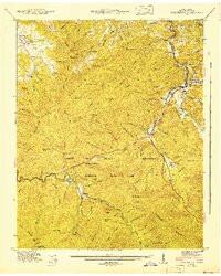
 1956 Gatlinburg1957 Print · USGSGatlinburg and the Smokies are shown here in the mid-fifties, capturing the early development of this gateway community and the national park. Researchers can trace historic sites like Elkmont, Banner Sch, and the Sugarlands Ranger Station.2 unique versions available
 - 1957 Map of Knoxville, 1966 Print
 1957 Knoxville1966 Print · USGSThe Southern Appalachians of Tennessee and North Carolina are mapped here during the mid-twentieth century as new highways reached the high country. Genealogists and historians can trace the topography between Knoxville and Asheville, locating family landmarks near Fontana Lake or along the Blue Ridge Parkway.4 unique versions available
 - 1960 Map of Knoxville
 1960 Knoxville1960 Print · USGSThe Southern Appalachians come alive in the 1950s, showing the intersection of new national park tourism and deep-rooted mountain industry. Trace old rail lines like the Clinchfield RR and find high-altitude landmarks from Mt Le Conte to the Cherokee Indian Reservation.2 unique versions available
 - 1964 Map of Knoxville
 1964 Knoxville1964 Print · USGSThe Southern Appalachians and Great Smokies are captured here during the mid-sixties, showing the rugged borderlands of Tennessee and North Carolina. Researchers can trace historic mountain routes like U S 441, the expanse of Pisgah National Forest, and the growing footprints of Asheville and Knoxville.
 - 1964 Map of Mount Le Conte, 1966 Print
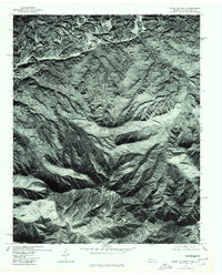
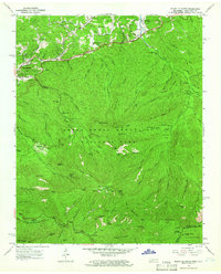 1964 Mount Le Conte1966 Print · USGSGatlinburg and the high peaks of the Smokies are captured here in the mid-sixties as the region evolved from a mountain community into a national park hub. Genealogists and hikers can trace family landmarks like the Alfred Reagan Place and Proffitt Cem alongside the Appalachian Trail and Le Conte Lodge.4 unique versions available
 - 1976 Map of Mount Le Conte, 1978 Print
 1976 Mount Le Conte1978 Print · USGSThe Tennessee and North Carolina borderlands come into sharp focus in this mid-1970s aerial survey. Trace the early footprint of Gatlinburg and find the forested slopes of Mount Le Conte and the State Line Divide.
 - 1979 Map of Gatlinburg
 1979 Gatlinburg1979 Print · USGSGatlinburg and the northern edge of the Smokies are captured here during a period of significant growth in the late seventies. Genealogists and hikers can trace old family landmarks like Huskey Grove Ch, Starkeytown, and Crowson Cem within the park boundary.3 unique versions available
 - 1983 Map of Knoxville, 1984 Print
 1983 Knoxville1984 Print · USGSThe Tennessee valley and the rising Smokies are captured here in the early eighties, showing the region as the tourism and transit hub of the Southern Appalachians. Researchers can trace the layout of the University of Tennessee or locate rural landmarks like Shady Grove Ch and Pleasant Hill Cem.
End of results
Showing maps 1-17 of 17
Top cities near Gatlinburg
- Knoxville historical maps
- Sevierville historical maps
- Newport historical maps
- Pigeon Forge historical maps
- Pittman Center historical maps
Top neighborhoods of Gatlinburg
Frequently asked questions
- What are the different types of historical maps available for Gatlinburg?
- What is the oldest map of Gatlinburg?
- Where can I purchase historical maps of Gatlinburg for my home or office?
- Where can I download high-res historical maps of Gatlinburg?
- Are there historical topographic maps available for Gatlinburg?
- Is there historical aerial imagery available for Gatlinburg?
- Where are historical maps of Gatlinburg sourced from?