2020s Maps of Cumberland City, Tennessee
Explore 4 historic maps of Cumberland City from the 2020s. These maps offer a rare glimpse into what life looked like during the 2020s — showing old roads, neighborhoods, homes, and landmarks that have changed or disappeared over time.
Whether you're researching your family's past, planning a metal detecting trip, or studying how Cumberland City's landscape evolved across the 2020s, these high-resolution maps are a powerful tool for exploring the history of this region.
- Focus on a specific era: All maps on this page are from the 2020s, giving you a focused view of this time period.
- See what’s changed: Compare century-old streets, trails, and buildings to today's modern landscape using overlays and satellite layers.
- Research with precision: Use these maps for genealogy, historical research, land use analysis, or educational projects.
- View, download, or print: Maps are fully viewable online in high resolution, and can be downloaded or printed for your own records.
Start exploring Cumberland City's history through authentic maps from the 2020s. This is your window into the past.
Cumberland City, TN maps
(4)- 2022 Map of Ellis Mills, 2022 Print
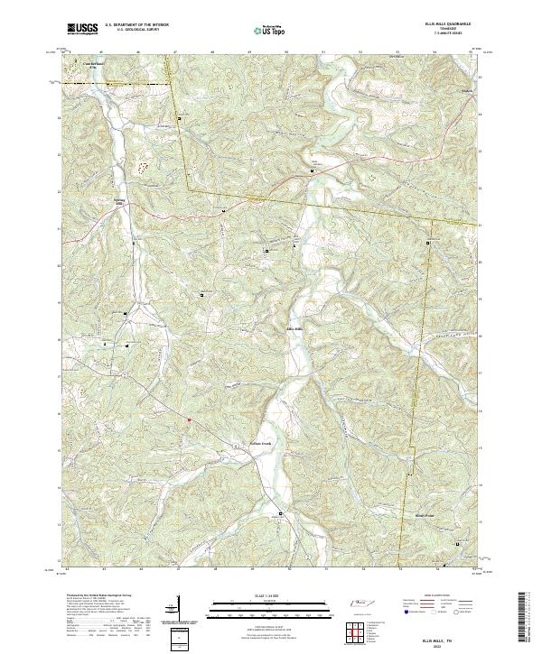 2022 Ellis Mills2022 Print · USGSThe rural borderlands where Houston, Montgomery, and Dickson counties meet are captured here in the early twenty-first century. Researchers can trace numerous family burial sites such as Bibbs - Wimberly Cem and Lyle Cem tucked away near Ellis Mills.
 - 2022 Map of Erin, 2022 Print
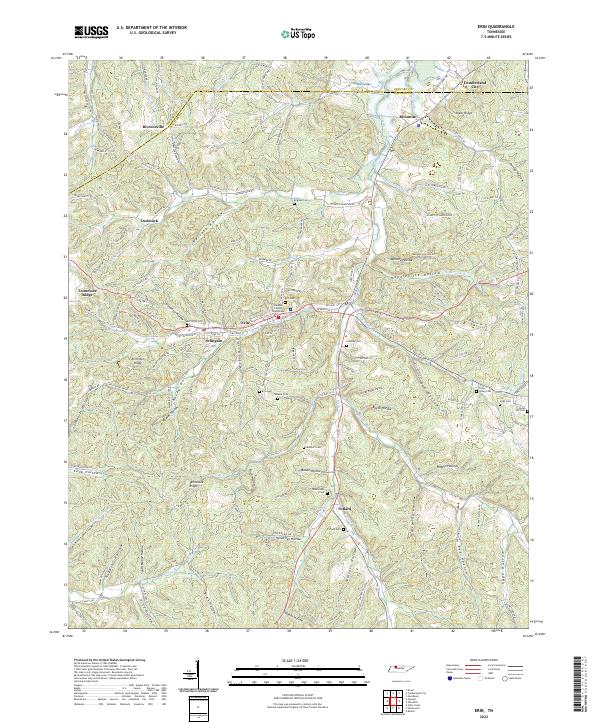 2022 Erin2022 Print · USGSThe steep valleys of Houston County are captured here in the early twenty-first century, centered on the community of Erin. Researchers can locate family landmarks like Alsobrooks Cem, Bratschi Cem, and the Houston County Courthouse.
 - 2022 Map of Needmore, 2022 Print
 2022 Needmore2022 Print · USGSThe Cumberland River winding through Montgomery County defines this rural Tennessee landscape as it appeared in the early twenty-first century. Researchers can trace ancestral sites at the Evergreen Missionary Baptist Church Cem, the settlement of Needmore, and landmarks like Yellow Creek Tow Head.
 - 2022 Map of Cumberland City, 2022 Print
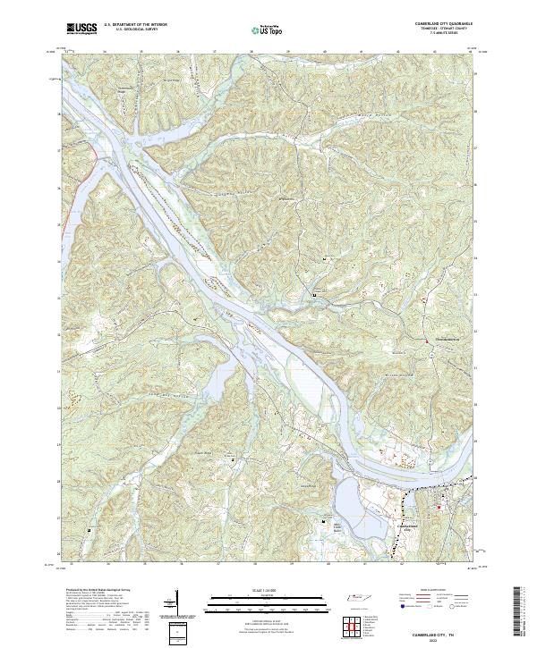 2022 Cumberland City2022 Print · USGSThe Cumberland River loops through Stewart County on this modern survey, highlighting the expansive Lake Barkley and Cumberland City. Researchers can locate several family cemeteries such as John Brake Cem and Graveyard Hill Cem, plus the settlement of Throckmorton.
End of results
Showing maps 1-4 of 4
Top cities near Cumberland City
- Clarksville historical maps
- Dover historical maps
- Erin historical maps
- Vanleer historical maps
- Slayden historical maps
Frequently asked questions
- What are the different types of historical maps available for Cumberland City?
- What is the oldest map of Cumberland City?
- Where can I purchase historical maps of Cumberland City for my home or office?
- Where can I download high-res historical maps of Cumberland City?
- Are there historical topographic maps available for Cumberland City?
- Is there historical aerial imagery available for Cumberland City?
- Where are historical maps of Cumberland City sourced from?