Old Maps of Unicoi County, Tennessee for Genealogy
Trace your family roots with 101 historic maps of Unicoi County. These high-res maps reveal old neighborhoods, homesites, landmarks, and streets — helping you uncover where your ancestors lived and how the area evolved over time.
- Explore historic neighborhoods: Identify where your relatives may have lived in the 1800s or 1900s.
- Compare maps over time: Trace the changes in streets, buildings, and landmarks for multi-generational research.
- Perfect for genealogy & ancestry research: Used by family historians and researchers to map out lineage and migration.
These maps are an incredible resource for exploring your personal connection to Unicoi County's past.
Unicoi County, TN maps
(101)- 1891 Map of Roan Mountain
 1891 Roan Mountain1891 Print · USGSThe Tennessee-North Carolina border country comes alive in the 1890s, when narrow-gauge railroads and mountain ferries still moved the region's goods. Genealogists and historians can trace early crossings like Shipley's Ferry, industrial sites at Embreeville, and high-country settlements like Cloudland.
 - 1892 Map of Greeneville
 1892 Greeneville1892 Print · USGSEast Tennessee in the late nineteenth century was a landscape of river-crossing ferries and mountain gaps centered on Greeneville. Genealogists and historians can trace the early rail corridor of the East Tennessee Virginia and Georgia R. R. and locate family-named sites like Britton Ferry and Evans X Rds.
 - 1894 Map of Asheville
 1894 Asheville1894 Print · USGSAsheville and the French Broad River valley are shown here in the 1890s, when rail travel was transforming the Southern Appalachians. Genealogists can locate family landmarks like Gudgers Mill, Pendletons Mill, and the early development of Biltmore.2 unique versions available
 - 1894 Map of Roan Mountain
 1894 Roan Mountain1894 Print · USGSNortheast Tennessee and Western North Carolina are mapped here in the late nineteenth century as the rail network expands through the Unaka Range. Trace early industrial footprints and family lands near Elizabethton, Terry Furnace, and the high summit at Cloudland.3 unique versions available
 - 1896 Map of Greeneville
 1896 Greeneville1896 Print · USGSUpper East Tennessee thrives in the late nineteenth century as a hub of rail travel and river commerce centered around the county seat. Genealogists can trace family roots through numerous crossroads and post offices like Chissolms P. O., Hawes X Roads, and Britton Ferry.2 unique versions available
 - 1900 Map of Mount Mitchell, 1963 Print
 1900 Mount Mitchell1963 Print · USGSWestern North Carolina at the turn of the century shows a landscape of high peaks and isolated river settlements before the arrival of modern highways. Genealogists and mountain historians can trace early homesteads along the Cane River or follow the Southern RR through Old Fort and Black Mountain.3 unique versions available
 - 1901 Map of Asheville
 1901 Asheville1901 Print · USGSWestern North Carolina at the turn of the century shows a mountain landscape adapting to the arrival of major railroads. Genealogists and historians can trace family-named peaks and early communities like Mars Hill, Hot Springs, and the estates at Biltmore.9 unique versions available
 - 1902 Map of Mount Mitchell, 1937 Print
 1902 Mount Mitchell1937 Print · USGSThe high peaks of Western North Carolina are captured here at the start of the twentieth century, showing the rail and river corridors that shaped the region. Trace early settlements like Burnsville, Montreat, and the winding Southern Railway.3 unique versions available
 - 1904 Map of Roan Mountain
 1904 Roan Mountain1904 Print · USGSUpper East Tennessee and Western North Carolina are documented here at a time when river fords and narrow-gauge railroads still connected mountain hollows. Trace the paths to Hodge Ore Bank, find old Poplar Ridge Church, or locate river crossings like Yoakley Ferry.4 unique versions available
 - 1904 Map of Greeneville
 1904 Greeneville1904 Print · USGSEast Tennessee at the turn of the century reveals a land of ridge-valley farms and early educational centers. Genealogists can trace family roots through historic settlements like Surgoinsville, early institutions like Washington College, and landmarks such as Bashors Mill.4 unique versions available
 - 1934 Map of Iron Mtn Gap
 1934 Iron Mtn Gap1934 Print · USGSThe Tennessee and North Carolina borderlands in the mid-1930s reveal a landscape of isolated mountain communities and early forest conservation. Genealogists can trace family names at Cochran Store and located remote school sites like Tiger Creek Sch or McKinney Sch.
 - 1935 Map of Chestoa
 1935 Chestoa1935 Print · USGSThe Tennessee and North Carolina borderlands come alive in the mid-1930s as the Clinchfield RR snakes through the Nolichucky River gorge. Researchers can trace rural life through numerous landmarks like Love Station, Raven Cliff Sch, and Newdale Ch.
 - 1935 Map of Erwin
 1935 Erwin1935 Print · USGSUnicoi County during the mid-1930s shows a landscape shaped by the Clinchfield railroad and the winding Nolichucky River. Genealogists and local historians can trace family-named sites like Jobes Cem, Lamar Sch, and the community of Embreeville.
 - 1935 Map of Huntdale
 1935 Huntdale1935 Print · USGSThe Nolichucky River valley comes alive in the mid-1930s as the Clinchfield RR winds through the mountains of Mitchell and Yancey Counties. Genealogists and historians can locate dozens of small community hubs including Huntdale, the Brummett Creek Sch, and Jacobs Mill.
 - 1935 Map of Bald Creek
 1935 Bald Creek1935 Print · USGSWestern North Carolina's high country is captured here in the mid-1930s, documenting the remote mountain valleys and ridge-top borders of Yancey County. Genealogists can trace family homes near Possumtrot, Bee Log, and rural schools like Horton Hill Sch.
 - 1935 Map of Unicoi
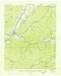 1935 Unicoi1935 Print · USGSThe Unicoi area in the mid-1930s reveals a mountain landscape of tight-knit valley settlements and extensive national forest trails. Researchers can trace the legacy of the Clinchfield and Ohio RR, the CCC Camp Cordell Hull, and family-named sites like Jones Chapel and Swingle Cem.
 - 1935 Map of Johnson City
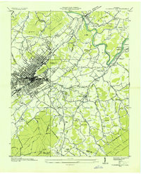 1935 Johnson City1935 Print · USGSJohnson City and the Watauga River valley thrive as a railroad and collegiate center in the years before the second world war. Genealogists and researchers can trace family landmarks like Simmons Cem, old schoolhouses such as Range Sch, and the early St John Landing Field.
 - 1936 Map of Sams Gap
 1936 Sams Gap1936 Print · USGSThe North Carolina and Tennessee borderlands come alive in the mid-1930s, showing a landscape of high ridges and deep hollows before modern development. Genealogists can trace family landmarks like Shelton Cem, English Bright Hope Sch, and the Flume Mill.
 - 1936 Map of Flag Pond
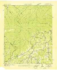 1936 Flag Pond1936 Print · USGSThe Tennessee and North Carolina borderlands come alive in the mid-1930s, showing a landscape of high ridges and secluded valley settlements. Researchers can trace the original path of the Appalachian Trail past family landmarks like Harris Mill and the Clearbranch Post Office.
 - 1936 Map of Telford
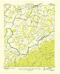 1936 Telford1936 Print · USGSIn the mid-1930s, the Nolichucky River valley supported a landscape of water-powered industry and mountain mining. Genealogists can trace family names through landmarks like Washington College, Broylesville Mill, and the Peach Orchard Mine.
 - 1939 Map of Erwin
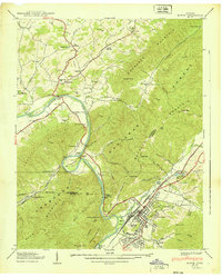 1939 Erwin1939 Print · USGSBefore the onset of the 1940s, this Unicoi County landscape was defined by the Clinchfield railroad and the Embree Iron Co mining works. Genealogists can trace family names at Jobs Cem or Bumpass Cove Cem and locate rural landmarks like Bethel Ch and Lamar Sch.5 unique versions available
 - 1939 Map of Bald Creek
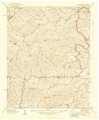 1939 Bald Creek1939 Print · USGSThe North Carolina and Tennessee borderlands appear here in the late 1930s, showing a rugged landscape of high peaks and river-valley settlements. Genealogists can locate family landmarks like Cane River (P.O.), Piney Grove Sch, and Robinson Cem during an era when the Appalachian Trail was newly established.7 unique versions available
 - 1939 Map of Telford
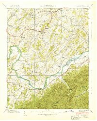 1939 Telford1939 Print · USGSThe Nolichucky River valley in the late 1930s reveals a landscape of established colleges and river-bend farms before modern development. Genealogists can trace family landmarks and rural centers like Washington College, Telford, and the Peach Orchard Mine.4 unique versions available
 - 1939 Map of Unicoi
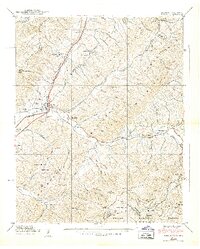 1939 Unicoi1939 Print · USGSThe Unicoi area at the start of the 1940s is a rugged landscape of rail-connected valleys and high mountain gaps. Genealogists and hikers can trace the original Appalachian Trail through Low Gap or locate family sites like Peterson Cem and CCC Camp Cordell Hull.4 unique versions available
 - 1939 Map of Chestoa
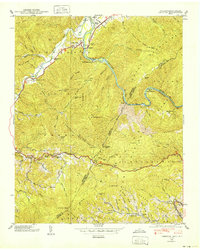 1939 Chestoa1939 Print · USGSThe Tennessee and North Carolina borderlands in the late thirties were defined by the deep gorge of the Nolichucky River and the winding Clinchfield RR. Genealogists and hikers can trace old mountain routes like the Appalachian Trail past Lost Cove and schools like Temple Hill Sch.5 unique versions available
Showing maps 1-25 of 101
Top cities of Unicoi County
Frequently asked questions
- What are the different types of historical maps available for Unicoi County?
- What is the oldest map of Unicoi County?
- Where can I purchase historical maps of Unicoi County for my home or office?
- Where can I download high-res historical maps of Unicoi County?
- Are there historical topographic maps available for Unicoi County?
- Is there historical aerial imagery available for Unicoi County?
- Where are historical maps of Unicoi County sourced from?