2020s Maps of White County, Tennessee
Explore 14 historic maps of White County from the 2020s. These maps offer a rare glimpse into what life looked like during the 2020s — showing old roads, neighborhoods, homes, and landmarks that have changed or disappeared over time.
Whether you're researching your family's past, planning a metal detecting trip, or studying how White County's landscape evolved across the 2020s, these high-resolution maps are a powerful tool for exploring the history of this region.
- Focus on a specific era: All maps on this page are from the 2020s, giving you a focused view of this time period.
- See what’s changed: Compare century-old streets, trails, and buildings to today's modern landscape using overlays and satellite layers.
- Research with precision: Use these maps for genealogy, historical research, land use analysis, or educational projects.
- View, download, or print: Maps are fully viewable online in high resolution, and can be downloaded or printed for your own records.
Start exploring White County's history through authentic maps from the 2020s. This is your window into the past.
White County, TN maps
(14)- 2022 Map of Pleasant Hill, 2022 Print
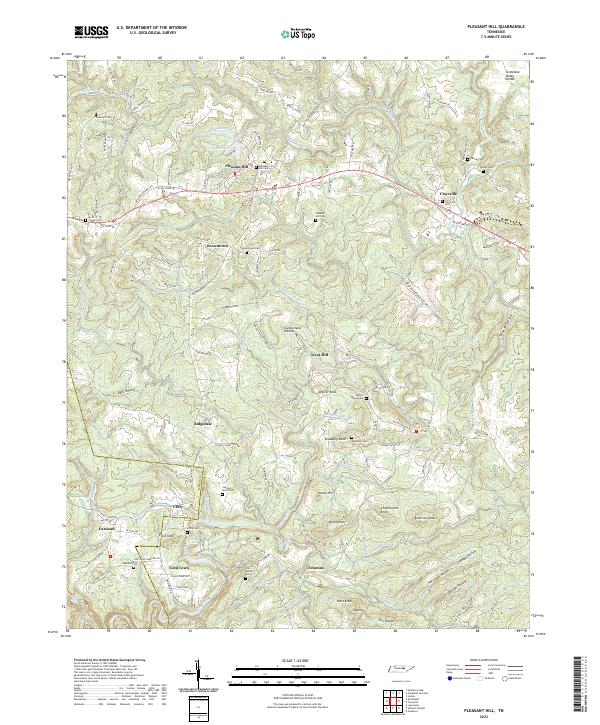 2022 Pleasant Hill2022 Print · USGSThe Cumberland Plateau west of Crossville comes into focus during this modern era, highlighting the rugged divide between the Caney Fork and northern watersheds. Trace family roots and local history through numerous rural burial grounds like Smith Chapel Cem and vanished rail paths along Old Railroad Grade Rd.
 - 2022 Map of Sparta, 2022 Print
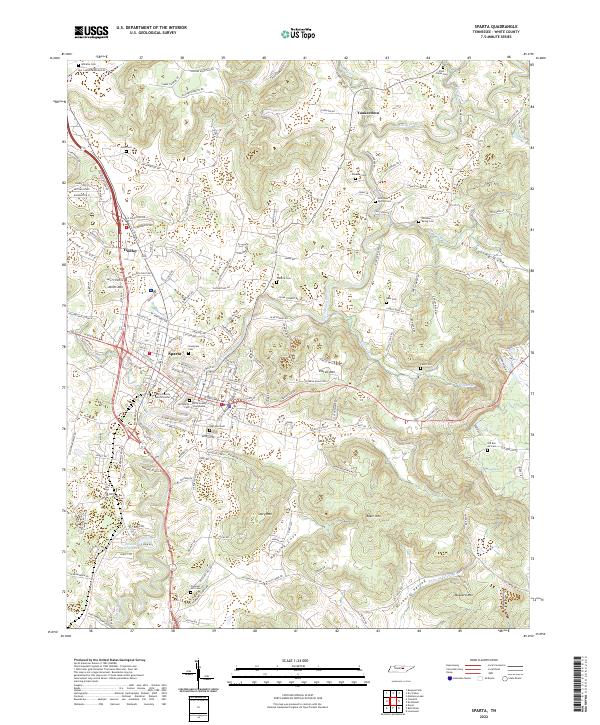 2022 Sparta2022 Print · USGSThe town of Sparta and the surrounding Highland Rim are documented here in the early twenty-first century. Genealogists can trace family names through numerous burial sites like Snodgrass Cem and Pleasant Hill Cem while following the valley of the Calfkiller River.
 - 2022 Map of Campaign, 2022 Print
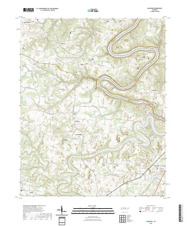 2022 Campaign2022 Print · USGSThe rural borderlands of DeKalb, Warren, and White counties are captured here in the early twenty-first century. Researchers can trace family history through numerous remote burial grounds like Javis Cantrell Cem and Salem Cem, or locate landmarks in Greens Crossroad and Campaign.
 - 2022 Map of Cassville, 2022 Print
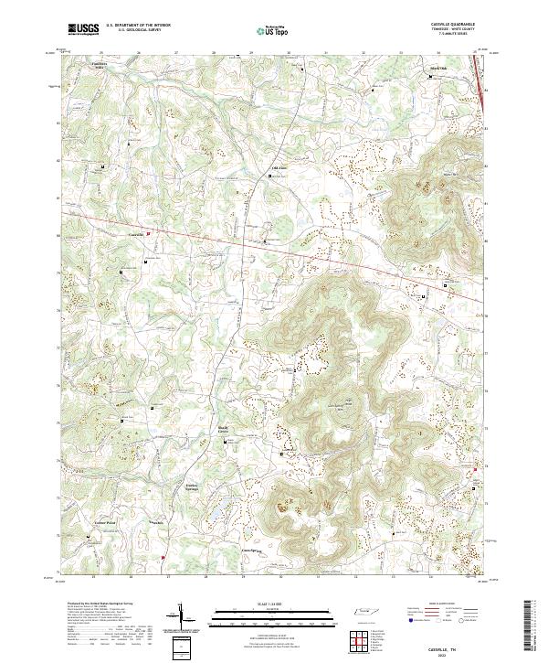 2022 Cassville2022 Print · USGSWhite County, Tennessee, retains its traditional rural character in the early twenty-first century, centered on small hamlets and historic family lands. Genealogists can trace family lines through numerous burial sites like Old Philadelphia Cem, Liberty Cem, and the settlement at Darkey Springs.
 - 2022 Map of De Rossett, 2022 Print
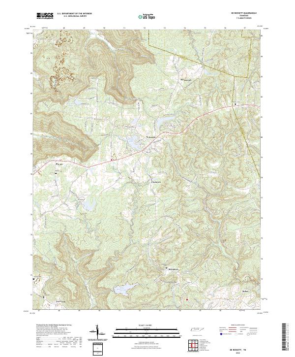 2022 De Rossett2022 Print · USGSThe Cumberland Plateau terrain of White County is revealed in this modern survey of the high coves and ridges. Genealogists can locate family landmarks like McKinney Cem and Anderson Cem or trace the early paths through Blue Spring Cove and Geer Cove.
 - 2022 Map of Bald Knob, 2022 Print
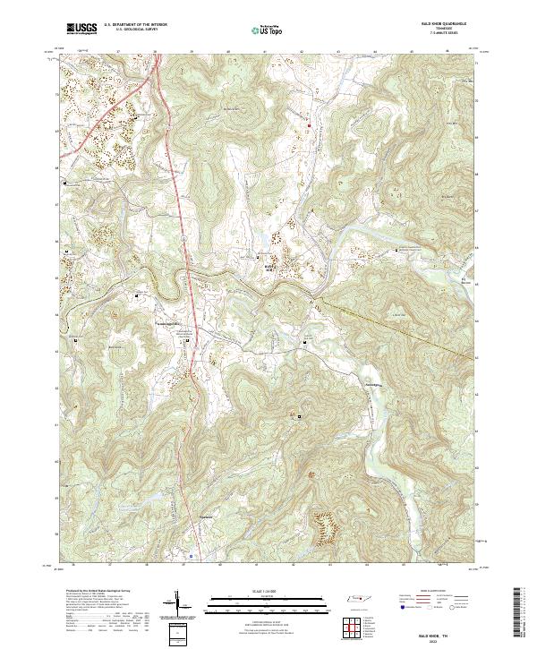 2022 Bald Knob2022 Print · USGSThe rural uplands of Van Buren and White counties are captured here in the early twenty-first century as agricultural traditions met modern infrastructure. Genealogists can trace family footprints through Sparkman Cem, Gravel Hill Cem, and the community at Cummingsville.
 - 2022 Map of Lonewood, 2022 Print
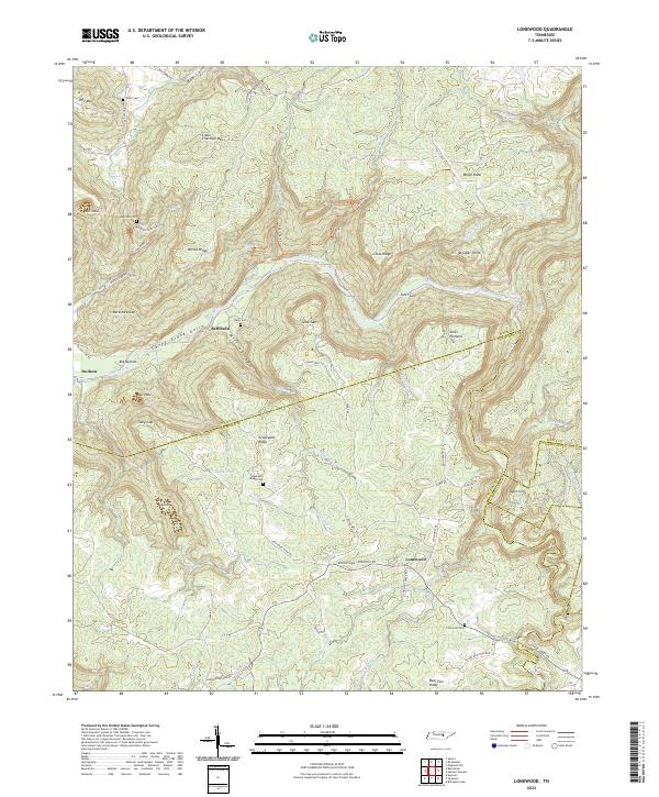 2022 Lonewood2022 Print · USGSThe Cumberland Plateau landscape near the White and Van Buren county line is captured here in a moment of modern preservation and rural quiet. Researchers can trace remote family landmarks and old mountain settlements like Bethesda, Lonewood, and Graveyard Ridge Cem.
 - 2022 Map of Herbert Domain, 2022 Print
 2022 Herbert Domain2022 Print · USGSThe Cumberland Plateau south of Crossville comes into focus in this recent survey of rural Tennessee. Genealogists can locate family landmarks like Akin Cem, Swallows Cem, and the old settlement at Thomas Springs.
 - 2022 Map of Sligo Bridge, 2022 Print
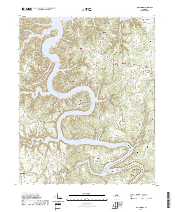 2022 Sligo Bridge2022 Print · USGSThe Caney Fork river valley in DeKalb County is shown here in the 2020s, highlighting the dramatic shoreline of Center Hill Lake. Family history researchers can locate numerous small burial grounds including George Estes Cem, Vaughn Cem, and Jones Cem.
 - 2022 Map of Doyle, 2022 Print
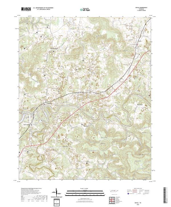 2022 Doyle2022 Print · USGSThe convergence of the Caney Fork and Collins River defines this Middle Tennessee landscape in the early twenty-first century. Genealogists and local historians can trace family sites at Anderson Cem Number 02, Bone Cave, and Spring Hill Ch.
 - 2022 Map of Dry Valley, 2022 Print
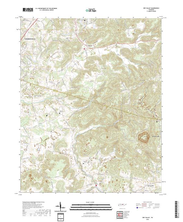 2022 Dry Valley2022 Print · USGSThe Tennessee highlands of White and Putnam Counties come into focus in this contemporary survey, showing the intricate coves and peaks east of Cookeville. Researchers can trace family history through numerous local sites like Bartlett Graveyard, Goffton, and the Cherry Creek Cem.
 - 2022 Map of Burgess Falls, 2022 Print
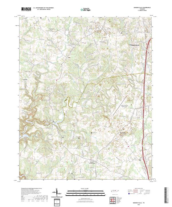 2022 Burgess Falls2022 Print · USGSWhite and Putnam counties meet along the Falling Water River in this recent survey of the Tennessee plateau. Local historians can trace the rural communities of Macedonia and Ditty, or locate family burial sites like Rhea Cem and Hitchcock Cem.
 - 2022 Map of Monterey Lake, 2022 Print
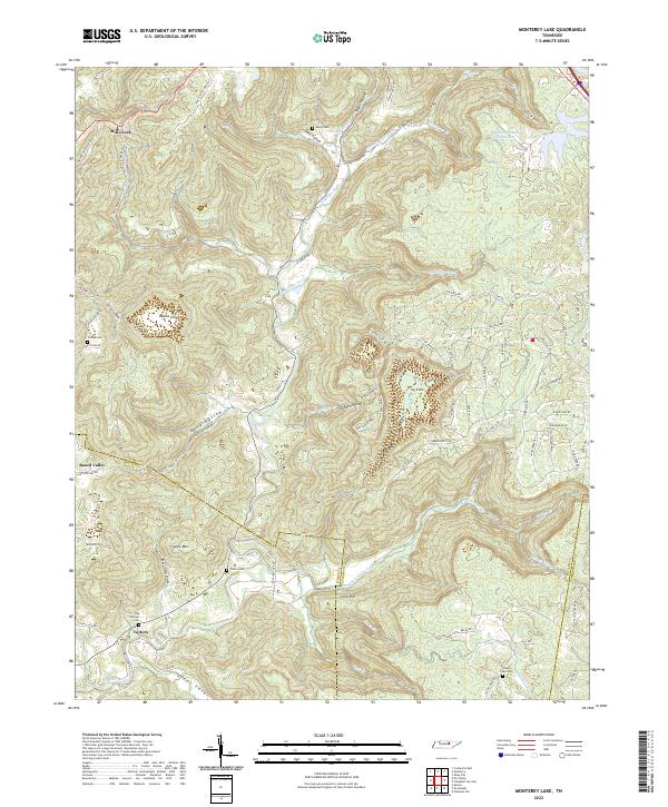 2022 Monterey Lake2022 Print · USGSUpper Cumberland heritage is preserved in this modern look at the rugged Putnam and White County borders. Researchers can locate ancestral landmarks like Henry Cem and France Cem along the winding Calfkiller River and its many tributary coves.
 - 2022 Map of Silver Point, 2022 Print
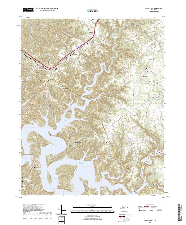 2022 Silver Point2022 Print · USGSThe Tennessee hills surrounding Center Hill Lake appear here in their modern form, showing a landscape defined by ridges and inundated valleys. Researchers can trace family-named landmarks and rural settlements like Williams Crossroads, Silver Point, and the Judd Cem.
End of results
Showing maps 1-14 of 14
Top cities of White County
Frequently asked questions
- What are the different types of historical maps available for White County?
- What is the oldest map of White County?
- Where can I purchase historical maps of White County for my home or office?
- Where can I download high-res historical maps of White County?
- Are there historical topographic maps available for White County?
- Is there historical aerial imagery available for White County?
- Where are historical maps of White County sourced from?