1950s Maps of White County, Tennessee
Explore 16 historic maps of White County from the 1950s. These maps offer a rare glimpse into what life looked like during the 1950s — showing old roads, neighborhoods, homes, and landmarks that have changed or disappeared over time.
Whether you're researching your family's past, planning a metal detecting trip, or studying how White County's landscape evolved across the 1950s, these high-resolution maps are a powerful tool for exploring the history of this region.
- Focus on a specific era: All maps on this page are from the 1950s, giving you a focused view of this time period.
- See what’s changed: Compare century-old streets, trails, and buildings to today's modern landscape using overlays and satellite layers.
- Research with precision: Use these maps for genealogy, historical research, land use analysis, or educational projects.
- View, download, or print: Maps are fully viewable online in high resolution, and can be downloaded or printed for your own records.
Start exploring White County's history through authentic maps from the 1950s. This is your window into the past.
White County, TN maps
(16)- 1953 Map of Chattanooga
 1953 Chattanooga1953 Print · USGSSoutheast Tennessee in the early fifties shows a landscape reshaped by river management and rail power. Trace the rail lines of the Southern Ry through riverside towns or locate the preserved grounds of the Chickamauga and Chattanooga National Military Park.
 - 1954 Map of De Rossett, 1955 Print
 1954 De Rossett1955 Print · USGSWhite County life in the mid-1950s centered on the plateau ridge and its surrounding coves. Genealogists and historians can trace family locations in Stringtown and Mobra, or find industrial sites like the Strip Mine near Ravenscroft.5 unique versions available
 - 1954 Map of Sparta, 1955 Print
 1954 Sparta1955 Print · USGSSparta and the surrounding White County coves are captured here during the mid-1950s as the regional landscape balanced river-valley farming with growing civic industry. Researchers can pinpoint ancestral sites like Snodgrass Cem, follow the ST LOUIS AND SAN FRANCISCO rail line, or locate landmarks like the Rockhouse State Memorial.3 unique versions available
 - 1954 Map of Lonewood, 1955 Print
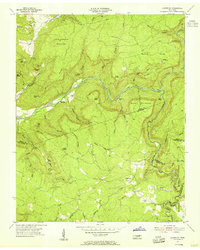 1954 Lonewood1955 Print · USGSThe Cumberland Plateau uplands come into focus mid-century, showing the isolated communities of Lonewood and Bethesda. Researchers can trace old family burial sites like Davis Cem or explore the rugged karst landscape of Virgin Falls and Dodson Cave.4 unique versions available
 - 1955 Map of Monterey Lake, 1956 Print
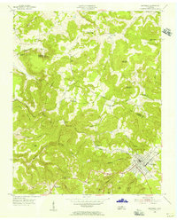 1955 Monterey Lake1956 Print · USGSThe Putnam County plateau comes into focus in the mid-fifties, centered on the railroad town of Monterey. Researchers can trace the winding Tennessee Central tracks through a landscape of family-named landmarks like Stamps Cem, Lee Sch, and Bee Rock.
 - 1956 Map of Burgess Falls, 1957 Print
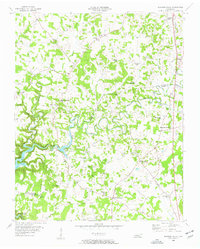 1956 Burgess Falls1957 Print · USGSThe Tennessee highlands on the Putnam and White county line appear here in the mid-fifties, centered on the Falling Water River. Researchers can trace rural life through dozens of local landmarks like Taylors Seminary, Burgess Falls, and Macedonia.4 unique versions available
 - 1956 Map of Dry Valley, 1957 Print
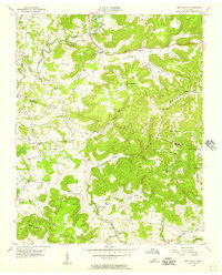 1956 Dry Valley1957 Print · USGSWhite and Putnam counties in the mid-1950s feature a landscape of highland ridges and deep valley sinks. Genealogists and local historians can trace rural family-named landmarks like Goffton, Stone Seminary, and Phifer Mountain Ch across this detailed terrain.3 unique versions available
 - 1956 Map of Monterey Lake, 1957 Print
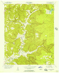 1956 Monterey Lake1957 Print · USGSThe Cumberland Plateau in the mid-1950s is defined by its deep coves and the winding Calfkiller River. Researchers can trace rural family life through landmarks like Big Spring Sch, Johnson Ch, and the Crouse Cem.3 unique versions available
 - 1956 Map of Silver Point, 1957 Print
 1956 Silver Point1957 Print · USGSPutnam and De Kalb counties appear here during the mid-fifties, as the filling of the Center Hill Reservoir transformed the local landscape. Researchers can trace the routes of the Tennessee Central railroad and locate rural landmarks like Carrs Chapel Sch and Williams Crossroads.4 unique versions available
 - 1956 Map of Bald Knob, 1957 Print
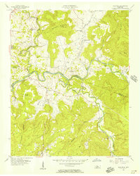 1956 Bald Knob1957 Print · USGSThe Van Buren and White County borderlands are shown here in the mid-1950s, where the winding Caney Fork meets the Calfkiller River. Researchers can locate rural landmarks like Hickory Valley Sch, Spencer, and Cane Creek Ch.3 unique versions available
 - 1956 Map of Pleasant Hill, 1958 Print
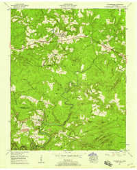 1956 Pleasant Hill1958 Print · USGSThe mid-century Cumberland Plateau comes alive through the development of Pleasant Hill and Clifty as modern highways begin to carve through the terrain. Researchers can trace family history at Van Winkle Cem or Eastland Cem and locate landmarks like West Mill.3 unique versions available
 - 1956 Map of Herbert Domain, 1958 Print
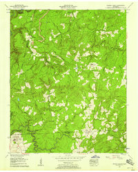 1956 Herbert Domain1958 Print · USGSCumberland Plateau life in the mid-1950s is preserved here, showing a landscape of high ridges and deep creek hollows. Genealogists can locate family burial sites like Akin Cemetery and Thomas Springs Cemetery or trace the early operations at Hale Mill.3 unique versions available
 - 1956 Map of Corbin, 1966 Print
 1956 Corbin1966 Print · USGSThe Kentucky and Tennessee borderlands are captured here in the mid-fifties, showing the region's shift toward modern interstate travel and reservoir development. Genealogists and historians can trace old community lines near Albany and Monticello or locate early rail junctions along the Southern and Tennessee Central lines.3 unique versions available
 - 1957 Map of Chattanooga, 1966 Print
 1957 Chattanooga1966 Print · USGSEast Tennessee in the mid-1960s shows a landscape of massive hydroelectric reservoirs and emerging industrial sites like the Atomic Energy Commission (Oak Ridge Area). Trace the rail networks of the Southern Ry through Chattanooga or locate family-named ridges across the Cumberland Plateau.3 unique versions available
 - 1958 Map of Corbin
 1958 Corbin1958 Print · USGSThe Upper Cumberland borderlands appear in the late 1950s as massive reservoirs and early atomic-era growth reshape the region. Trace family roots and vanished landmarks near Lake Cumberland, Oak Ridge, and the Cumberland National Forest.
 - 1959 Map of Chattanooga
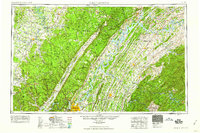 1959 Chattanooga1959 Print · USGSSoutheast Tennessee is shown here during a decade of industrial growth and hydroelectric development. Trace the regional rail networks of the Southern Ry and find landmark sites like Lookout Mountain, Fall Creek Falls State Park, and Chattanooga.
End of results
Showing maps 1-16 of 16
Top cities of White County
Frequently asked questions
- What are the different types of historical maps available for White County?
- What is the oldest map of White County?
- Where can I purchase historical maps of White County for my home or office?
- Where can I download high-res historical maps of White County?
- Are there historical topographic maps available for White County?
- Is there historical aerial imagery available for White County?
- Where are historical maps of White County sourced from?