Old Maps of Monterey, Texas for Hiking & Exploration
Hike through history with 14 historic maps of Monterey. Explore old trails, ghost towns, and forgotten backroads — perfect for outdoor adventurers and local explorers.
- Rediscover forgotten places: Map out old mining camps, roads, and footpaths that no longer exist on modern maps.
- Layer with modern tools: Combine with LiDAR or satellite views to plan hikes through historical terrain.
- Made for exploration: Popular among hikers, overlanders, and local history lovers.
Use these maps to find adventure and explore the hidden past of Monterey.
Monterey, TX maps
(14)- 1931 Map of Zavalla
 1931 Zavalla1931 Print · USGSEast Texas river life and rail expansion meet in the late 1920s at the junction of the Neches River and the Beaumont Southern Pacific. Researchers can trace old river crossings like Rockland Ferry and Rock Ford or locate vanished school sites like Saron Sch.2 unique versions available
 - 1953 Map of Palestine, 1964 Print
 1953 Palestine1964 Print · USGSEast Texas was defined by its deep pine forests and burgeoning energy sector in the mid-1950s. Genealogists and historians can trace the rail-and-river economy through settlements like Tennessee Colony and Pollok or explore the early footprints of the Cayuga Oil Field and Davy Crockett National Forest.2 unique versions available
 - 1957 Map of Palestine
 1957 Palestine1957 Print · USGSEast Texas in the mid-fifties reveals a landscape of deep pine forests and winding river valleys before the era of massive reservoir construction. Researchers can trace the legacy of the timber and rail industries through labels for the Missouri Pacific RR, Davy Crockett National Forest, and Nacogdoches.
 - 1958 Map of Zavalla, 1959 Print
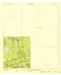
 1958 Zavalla1959 Print · USGSEast Texas piney woods and the Neches River valley are captured here just before the landscape-altering creation of the Sam Rayburn Reservoir. Genealogists can trace family-named sites like Dunkin Cem, the Barium Mill, and the site of Fort Teran.3 unique versions available
 - 1984 Map of Zavalla
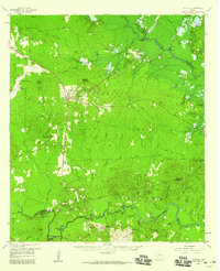
 1984 Zavalla1984 Print · USGSThe town of Zavalla sits amidst the timberlands of the Angelina National Forest during the mid-eighties. Genealogists and local historians can trace the landscape near Sam Rayburn Reservoir and locate family landmarks like Blue Spring or Pophers.
 - 1984 Map of Palestine
 1984 Palestine1984 Print · USGSEast Texas in the mid-eighties reveals a landscape of massive reservoirs and protected timberlands between Palestine and Nacogdoches. Researchers can trace old routes like the Missouri Pacific RR and locate rural communities such as Tennessee Colony, Latexo, and Etoile.3 unique versions available
 - 1986 Map of Lufkin
 1986 Lufkin1986 Print · USGSDeep in the Piney Woods during the mid-eighties, this map documents a landscape shaped by vast national forests and the waters of the Sam Rayburn Reservoir. Researchers can trace the legacy of timber and rail through settlements like Diboll, Herty, and Ewing alongside the St Louis Southwestern railroad.
 - 1992 Map of Lufkin
 1992 Lufkin1992 Print · USGSThe Piney Woods of East Texas are captured here in the early nineties, centered on the growing industrial hub of Lufkin. Local researchers can trace the rail networks of the Angelina & Neches River RR and locate rural landmarks like Shady Grove Ch and Manning.
 - 2003 Map of Zavalla, 2004 Print
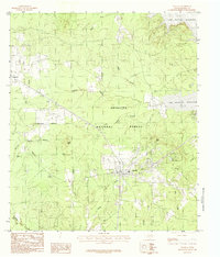
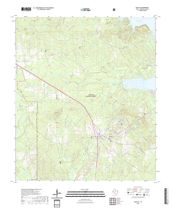
 2003 Zavalla2004 Print · USGSZavalla and the Angelina National Forest are captured here in the early 2000s, where the piney woods meet the Sam Rayburn Reservoir. Genealogists and local historians can locate family burial sites at Townsend Cem and Ozias Cem or trace rural routes like Dead Man Road.
 - 2010 Map of Zavalla, 2010 Print
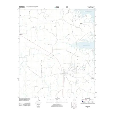 2010 Zavalla2010 Print · USGSCovers Monterey, including Zavalla, Boynton, and other nearby areas
 - 2013 Map of Zavalla, 2013 Print
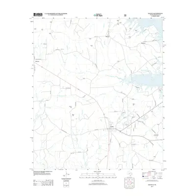 2013 Zavalla2013 Print · USGSCovers Monterey, including Zavalla, Boynton, and other nearby areas
 - 2016 Map of Zavalla, 2016 Print
 2016 Zavalla2016 Print · USGSCovers Monterey, including Zavalla, Boynton, and other nearby areas
 - 2019 Map of Zavalla, 2019 Print
 2019 Zavalla2019 Print · USGSCovers Monterey, including Zavalla, Boynton, and other nearby areas
 - 2022 Map of Zavalla, 2022 Print
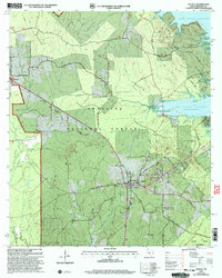
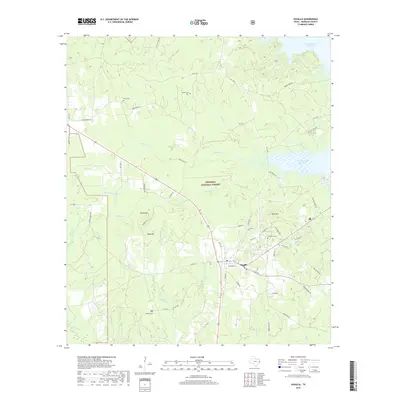
 2022 Zavalla2022 Print · USGSZavalla and the surrounding East Texas piney woods are captured here during a period of modern forest management and lakefront development. Genealogists and local historians can pinpoint several rural burial sites, including Ozias Cem and Poland Cem, or trace the winding course of Shawnee Cr.
End of results
Showing maps 1-14 of 14
Top cities near Monterey
Frequently asked questions
- What are the different types of historical maps available for Monterey?
- What is the oldest map of Monterey?
- Where can I purchase historical maps of Monterey for my home or office?
- Where can I download high-res historical maps of Monterey?
- Are there historical topographic maps available for Monterey?
- Is there historical aerial imagery available for Monterey?
- Where are historical maps of Monterey sourced from?