Old Maps of Aransas Pass, Texas
Explore 39 old maps of Aransas Pass, spanning from 1925 to today. These high-resolution historic maps reveal how streets, neighborhoods, landmarks, and natural features evolved over time — perfect for genealogy, metal detecting, research, and local history exploration.
What you can do with these maps:
- See how Aransas Pass changed over time: Compare historical maps to modern-day views to trace roads, homesites, rail lines & more.
- View detailed metadata: Each map includes creators, publishers, year, scale, and archive source.
- Overlay maps with satellite & LiDAR: Visualize the past alongside modern tools to explore terrain & human change.
- Trusted historical sources: Maps sourced from the USGS, Library of Congress, and other archives.
- Access maps your way: View online, download high-res files, or order prints for personal or research use.
Start exploring old maps of Aransas Pass to uncover forgotten places, hidden landmarks, and the deep history beneath your feet.
Aransas Pass, TX maps
(39)- 1925 Map of Aransas Pass
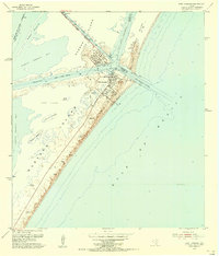
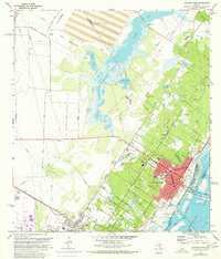
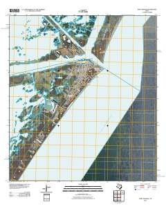
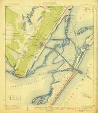 1925 Aransas Pass1925 Print · USGSThe Texas Gulf Coast comes to life in the mid-1920s, showing the early railroad developments and barrier island geography of the coastal bend. Trace the original footprints of Aransas Pass, the Aransas Pass Lighthouse, and local landmarks like Mc Campbell School.3 unique versions available
 - 1950 Map of Corpus Christi, 1953 Print
 1950 Corpus Christi1953 Print · USGSThe South Texas coast comes into focus during the early fifties, showing the interplay between booming oil fields and expansive ranching operations. Genealogists and historians can trace the Texas Mexican rail line through Kingsville or locate heritage sites like Chapman Ranch and Riviera Beach.
 - 1954 Map of Aransas Pass, 1956 Print
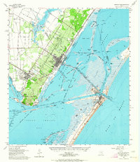
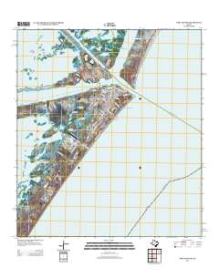
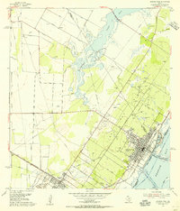 1954 Aransas Pass1956 Print · USGSMid-century Aransas Pass and Ingleside are documented here during a period of significant industrial and maritime growth along the Texas coast. Researchers can trace the layout of the Aransas Pass Oil Field, locate Kleberg Sch, and identify old sites like the Tarpon Drive-in Theater.2 unique versions available
 - 1954 Map of Port Ingleside, 1956 Print
 1954 Port Ingleside1956 Print · USGSThe Texas coast near Corpus Christi is captured here in the mid-1950s during a period of significant industrial and maritime expansion. Researchers can trace early energy infrastructure at the Tank Farm and follow the old Southern Pacific line near Ingleside.
 - 1954 Map of Estes, 1956 Print
 1954 Estes1956 Print · USGSThe Aransas coast in the mid-fifties reveals a landscape of barrier islands and early industrial sites like the Carbon Black Plant. Trace historical rail lines through Estes or locate the San Antonio Cem and the Old Terminal.
 - 1954 Map of Port Aransas, 1956 Print
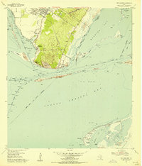
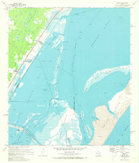
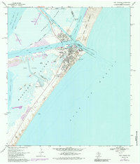
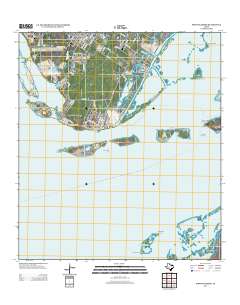
 1954 Port Aransas1956 Print · USGSCoastal Texas in the mid-fifties is captured here as a landscape of barrier islands, dredging projects, and maritime industry. Genealogists and historians can trace the early streets of Port Aransas, the location of the Port Aransas Cemetery, and the remote Grant Ranch on Mustang Island.
 - 1954 Map of Aransas Pass, 1964 Print
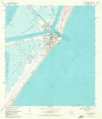
 1954 Aransas Pass1964 Print · USGSThe Texas Gulf Coast comes alive in the mid-fifties, showing the growth of Aransas Pass and Port Aransas alongside vital rail and shipping corridors. Trace old routes like the Toll Road on Mustang Island and locate sites such as Prairie View Cem or the Coast Guard Station.2 unique versions available
 - 1956 Map of Corpus Christi
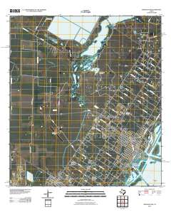
 1956 Corpus Christi1956 Print · USGSThe South Texas coast and the burgeoning port of Corpus Christi are captured here during the mid-fifties. Genealogists and historians can trace the rail-and-oil economy through labels like Robstown Airpark, Chapman Ranch, and the Missouri Pacific railroad.
 - 1960 Map of Corpus Christi
 1960 Corpus Christi1960 Print · USGSCoastal South Texas and the Nueces County hinterlands are detailed in this mid-century survey. Genealogists and historians can trace early settlement patterns and rural landmarks like Casa Blanca during a period of steady regional growth.
 - 1966 Map of Corpus Christi
 1966 Corpus Christi1966 Print · USGSThe Texas Coastal Bend in the mid-1960s reveals a landscape where massive cattle empires and strategic military bases meet the Gulf. Trace the vast reaches of King Ranch or locate aviation history at the Corpus Christi Air Station and Kingsville Air Station.
 - 1968 Map of Port Ingleside, 1971 Print
 1968 Port Ingleside1971 Print · USGSThe industrial and maritime growth of San Patricio County is captured here in the late sixties as the energy sector reshaped the coast. Genealogists and historians can trace the footprint of Ingleside, the waterfront at Port Ingleside, and the many offshore oil wells.2 unique versions available
 - 1968 Map of Port Aransas, 1972 Print
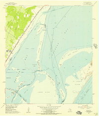
 1968 Port Aransas1972 Print · USGSPort Aransas and its surrounding barrier islands are shown in detail during the late 1960s maritime era. Researchers can trace coastal development through the Mustang Beach Landing Strip, the Royal Palm Cem, and the Aransas Pass Lighthouse.2 unique versions available
 - 1971 Map of Estes, 1973 Print
 1971 Estes1973 Print · USGSCoastal Texas in the early seventies reveals a landscape of industrial infrastructure and emerging shorefront communities along the Aransas County line. Trace the rail-and-water economy at the Carbon Black Plant or locate local landmarks like San Antonio Cem and City-by-the-Sea.3 unique versions available
 - 1971 Map of Aransas Pass, 1977 Print
 1971 Aransas Pass1977 Print · USGSThe Texas coastal landscape near Aransas Pass comes alive in the early seventies, showcasing a period of maritime and industrial growth. Researchers can trace family roots through Prairie View Cem or locate old neighborhood schools like Keiberger Sch.
 - 1975 Map of Port Aransas, 1985 Print
 1975 Port Aransas1985 Print · USGSCoastal Texas near the mid-seventies reveals a thriving maritime community and research hub on the barrier islands. Genealogists and researchers can trace local landmarks like Royal Palm Cem, the Aransas Pass Lighthouse, and the Horace Caldwell Pier.
 - 1984 Map of Corpus Christi
 1984 Corpus Christi1984 Print · USGSThe Texas Coastal Bend in the 1980s reveals a landscape defined by deep-water ports and sprawling ranchlands. Researchers can trace the rail lines of the Texas Mexican railroad or locate historical landmarks like the Chapman Ranch and Seaside Memorial Cem.
 - 1989 Map of Corpus Christi, 1991 Print
 1989 Corpus Christi1991 Print · USGSCoastal South Texas and its deep bays are captured here in the late eighties, showcasing a landscape of military aviation and barrier island preservation. Researchers can trace family roots in Petronila or Vattmannville and locate landmarks like Cabaniss Field and Baffin.
 - 2010 Map of Estes, 2010 Print
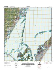
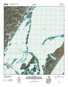 2010 Estes2010 Print · USGSCovers Aransas Pass, including Corpus Christi, Rockport, and other nearby areas
 - 2010 Map of Port Ingleside, 2010 Print
 2010 Port Ingleside2010 Print · USGSCovers Aransas Pass, including Corpus Christi, Ingleside, and other nearby areas
 - 2010 Map of Port Aransas, 2010 Print
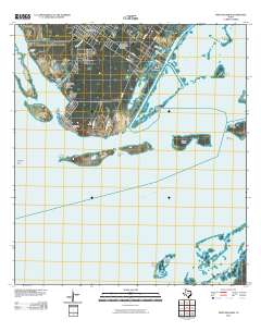
 2010 Port Aransas2010 Print · USGSCovers Aransas Pass, including Corpus Christi, Port Aransas, and other nearby areas
 - 2010 Map of Aransas Pass, 2010 Print
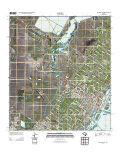
 2010 Aransas Pass2010 Print · USGSCovers Aransas Pass, including Corpus Christi, Ingleside, and other nearby areas
 - 2013 Map of Port Ingleside, 2013 Print
 2013 Port Ingleside2013 Print · USGSCovers Aransas Pass, including Corpus Christi, Ingleside, and other nearby areas
 - 2013 Map of Port Aransas, 2013 Print
 2013 Port Aransas2013 Print · USGSCovers Aransas Pass, including Corpus Christi, Port Aransas, and other nearby areas
 - 2013 Map of Aransas Pass, 2013 Print
 2013 Aransas Pass2013 Print · USGSCovers Aransas Pass, including Corpus Christi, Ingleside, and other nearby areas
 - 2013 Map of Estes, 2013 Print
 2013 Estes2013 Print · USGSCovers Aransas Pass, including Corpus Christi, Rockport, and other nearby areas
Showing maps 1-25 of 39
Top cities near Aransas Pass
- Corpus Christi historical maps
- Portland historical maps
- Rockport historical maps
- Ingleside historical maps
- Port Aransas historical maps
- Gregory historical maps
See more
Top neighborhoods of Aransas Pass
Frequently asked questions
- What are the different types of historical maps available for Aransas Pass?
- What is the oldest map of Aransas Pass?
- Where can I purchase historical maps of Aransas Pass for my home or office?
- Where can I download high-res historical maps of Aransas Pass?
- Are there historical topographic maps available for Aransas Pass?
- Is there historical aerial imagery available for Aransas Pass?
- Where are historical maps of Aransas Pass sourced from?