Old Maps of Windthorst, Texas for Academic Research
Study the evolution of Windthorst with 9 high-resolution historic maps. Whether you're teaching, researching, or modeling changes in land use, these maps provide essential visual documentation of urban, environmental, and geographic change.
- Analyze long-term change: Track patterns in development, transportation, and natural features.
- Ideal for environmental or urban studies: Support academic projects with primary historical map data.
- Use in the classroom or lab: Educators and researchers rely on these maps to bring historical context to life.
These maps are a powerful tool for teaching, research, and visualizing how Windthorst has changed over the decades.
Windthorst, TX maps
(9)- 1954 Map of Wichita Falls, 1966 Print
 1954 Wichita Falls1966 Print · USGSNorth Texas in the mid-fifties is captured here as a landscape of expanding oil fields and vital rail corridors. Genealogists and historians can trace family roots through rural landmarks like Bacon Chapel and the rail-side growth of Seymour and Archer City.3 unique versions available
 - 1958 Map of Wichita Falls
 1958 Wichita Falls1958 Print · USGSNorth Texas during the late fifties reveals a landscape defined by the booming petroleum industry and established rail hubs. Researchers can trace the development of Wichita Falls and discover rural landmarks like Barton's Chapel or the Hull-Silk Oil Field.
 - 1962 Map of Windthorst, 1964 Print
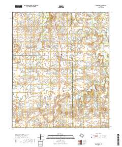
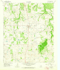 1962 Windthorst1964 Print · USGSWindthorst and the surrounding Archer County ranch lands are captured here in the early sixties, showing a landscape defined by cattle and crude oil. Trace family roots at St Mary Ch or locate mid-century industrial markers like the Transcontinental Pipeline and Bridwell Ranch.
 - 1985 Map of Wichita Falls
 1985 Wichita Falls1985 Print · USGSWichita Falls and the surrounding North Texas oil patches are captured here during a period of established energy production and military importance. Genealogists and historians can trace family-named sites and regional hubs like Sheppard Air Force Base, Electra, and Lake Arrowhead State Park.2 unique versions available
 - 2010 Map of Windthorst, 2010 Print
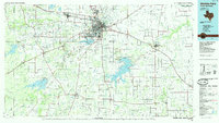
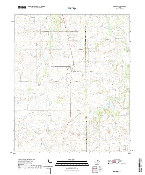
 2010 Windthorst2010 Print · USGSCovers Windthorst, including Clay County, Archer County, and other nearby areas
 - 2012 Map of Windthorst, 2012 Print
 2012 Windthorst2012 Print · USGSCovers Windthorst, including Clay County, Archer County, and other nearby areas
 - 2016 Map of Windthorst, 2016 Print
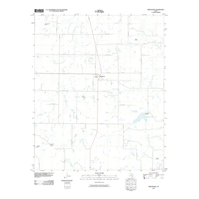
 2016 Windthorst2016 Print · USGSCovers Windthorst, including Clay County, Archer County, and other nearby areas
 - 2019 Map of Windthorst, 2019 Print
 2019 Windthorst2019 Print · USGSCovers Windthorst, including Clay County, Archer County, and other nearby areas
 - 2022 Map of Windthorst, 2022 Print
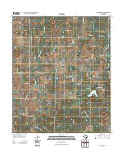
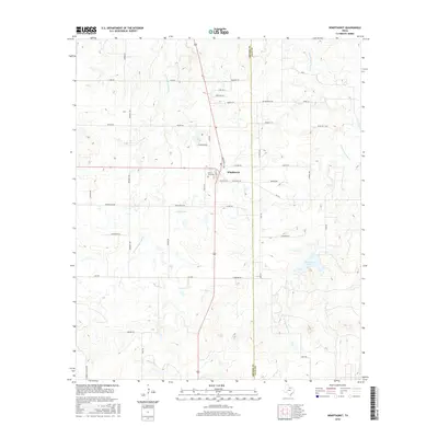
 2022 Windthorst2022 Print · USGSWindthorst and the surrounding plains of Archer and Clay counties appear in this recent survey of North Texas farm country. Genealogists and local historians can trace family-named landmarks and homesteads along Weinzappel Loop, Saint Marys Cem, and Windthorst Lake.
End of results
Showing maps 1-9 of 9
Top cities near Windthorst
Frequently asked questions
- What are the different types of historical maps available for Windthorst?
- What is the oldest map of Windthorst?
- Where can I purchase historical maps of Windthorst for my home or office?
- Where can I download high-res historical maps of Windthorst?
- Are there historical topographic maps available for Windthorst?
- Is there historical aerial imagery available for Windthorst?
- Where are historical maps of Windthorst sourced from?