Old Maps of Bandera County, Texas for Genealogy
Trace your family roots with 144 historic maps of Bandera County. These high-res maps reveal old neighborhoods, homesites, landmarks, and streets — helping you uncover where your ancestors lived and how the area evolved over time.
- Explore historic neighborhoods: Identify where your relatives may have lived in the 1800s or 1900s.
- Compare maps over time: Trace the changes in streets, buildings, and landmarks for multi-generational research.
- Perfect for genealogy & ancestry research: Used by family historians and researchers to map out lineage and migration.
These maps are an incredible resource for exploring your personal connection to Bandera County's past.
Bandera County, TX maps
(144)- 1954 Map of San Antonio, 1964 Print
 1954 San Antonio1964 Print · USGSSan Antonio and the Texas Hill Country are captured here in the mid-fifties, showing a landscape defined by massive military air bases and the rising Canyon Reservoir. Trace family ties through historic rail towns like D'Hanis and Castroville or explore the Cold War footprint of Lackland AFB and Randolph AFB.3 unique versions available
 - 1956 Map of Tarpley
 1956 Tarpley1956 Print · USGSThe Texas Hill Country around Tarpley comes into focus in this mid-century survey, showing the transition from family ranches to early industrial infrastructure. Trace old property lines and landmarks like Old Montell Camp, the German Settlement, and the Humble Pipeline.
 - 1956 Map of Comfort
 1956 Comfort1956 Print · USGSThe Guadalupe River valley in the mid-fifties shows a landscape of rural schools and Hill Country retreats. Genealogists can trace family landmarks like the Hermann Sons Home, Camp Idlewilde, and the Union Valley School along the rail lines.
 - 1956 Map of Tuff
 1956 Tuff1956 Print · USGSTexas Hill Country ranching and river life are captured in the mid-fifties, showing the rugged divide between Kerr and Bandera counties. Researchers can trace historic family holdings like Dryden Ranch and small, forgotten communities such as Lima and Tuff.
 - 1956 Map of Bandera
 1956 Bandera1956 Print · USGSThe Texas Hill Country comes alive in the mid-1950s as a landscape of remote ranches and critical waterholes. Genealogists and historians can trace family holdings like Hanson Ranch or locate unique landmarks such as the Line Walkers Shanty and Bat Cave.
 - 1956 Map of Utopia
 1956 Utopia1956 Print · USGSThe Sabinal and Frio River valleys are mapped here during the mid-twentieth century, showcasing a transition from pioneer homesteads to established ranching. Genealogists and historians can trace family locations like Paterson Ranch or find vanished landmarks like Thompsons Mill and Taylor School.
 - 1956 Map of Medina Lake
 1956 Medina Lake1956 Print · USGSMedina Lake and the surrounding Texas highlands are captured here in the 1920s and early 1930s. Genealogists and local historians can trace family properties like Kallison Ranch and the Granieri Hotel, or locate landmarks such as the Mico P.O. and Toll Gate.
 - 1956 Map of Center Point
 1956 Center Point1956 Print · USGSTexas Hill Country ranching and river life are captured here in the mid-fifties, centered on the Center Point valley. Genealogists can locate named homesteads like Jacksons Ranch and M Hopkins while tracing the Old Spanish Trail and Bandera Pass.
 - 1957 Map of San Antonio
 1957 San Antonio1957 Print · USGSSan Antonio and the Texas Hill Country are shown here during the mid-fifties, capturing the region's expanding post-war military and transportation footprint. Genealogists and local historians can trace the early residential boundaries of Alamo Heights or locate rural landmarks like St Hedwig and Medina Lake.
 - 1964 Map of Sabinal Canyon, 1967 Print
 1964 Sabinal Canyon1967 Print · USGSTexas Hill Country ranching and river drainage are documented in the 1960s along the Real and Bandera county line. Historians can locate family-named landmarks like Wedgeworth, the Post Oak Waterhole, and Flatrock Spring.2 unique versions available
 - 1964 Map of Well Hollow, 1967 Print
 1964 Well Hollow1967 Print · USGSThe headwaters of the Guadalupe and Medina rivers meet at the Kerr and Bandera county line during the mid-sixties. Researchers can trace the rugged drainage of Well Hollow, find a remote Landing Strip, and locate early water infrastructure like the Water Tank.
 - 1964 Map of Diamond S Ranch, 1967 Print
 1964 Diamond S Ranch1967 Print · USGSThe Texas Hill Country along the Kerr and Bandera county line is shown here in the mid-1960s, dominated by large private ranching estates. You can trace the boundaries and features of the Diamond S Ranch, Lynxhaven Lodge, and the Landing Strip along the South Fork Guadalupe River.2 unique versions available
 - 1964 Map of Echo Hill Ranch, 1967 Print
 1964 Echo Hill Ranch1967 Print · USGSThe Texas Hill Country of the 1960s is defined here by sprawling family estates and the intricate drainage of the Medina River. Researchers can trace the boundaries of the Echo Hill Ranch, locate the Medina Childrens Home, or find family-named sites like the Porter Ranch.
 - 1964 Map of Bandera, 1967 Print
 1964 Bandera1967 Print · USGSBandera sits at a prominent bend in the Medina River in the mid-sixties, serving as a quintessential Hill Country hub. Local historians can trace family-named landmarks like Kindla Spring and Potato Flats, or locate institutional anchors such as St Joseph Sch.2 unique versions available
 - 1964 Map of Love Creek, 1967 Print
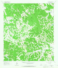 1964 Love Creek1967 Print · USGSBandera County ranch land is captured here in the mid-sixties, where the river forks meet among dozens of spring-fed hollows. Family researchers can locate the Hillman Cem and Adams Cem or trace the early boundaries of the Rock Chimney Ranch.2 unique versions available
 - 1964 Map of Timber Creek, 1967 Print
 1964 Timber Creek1967 Print · USGSThe Texas Hill Country at the edge of the Balcones Escarpment is mapped here during the 1960s. Genealogists and historians can trace old property boundaries near Medina Lake or locate remote landmarks like One Horn Mountain and Indian Spring.
 - 1964 Map of Rock Cliff Reservoir, 1967 Print
 1964 Rock Cliff Reservoir1967 Print · USGSBandera County and Kerr County are captured in the mid-sixties as the Hill Country landscape balanced traditional ranching with new water reservoirs. Genealogists and historians can trace the foundations of Medina, local landmarks like Camp Sionito, and family burial grounds at the Cem.2 unique versions available
 - 1964 Map of A Bar A Ranch, 1967 Print
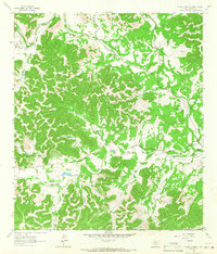 1964 A Bar A Ranch1967 Print · USGSBandera County ranching culture is on full display in the mid-1960s as cattle operations and family homesteads line the river forks. Genealogists and historians can locate remote burial sites like Means Cem or trace private aviation at the Circle R Sky Ranch.2 unique versions available
 - 1964 Map of Medina Lake, 1968 Print
 1964 Medina Lake1968 Print · USGSMedina Lake and its jagged limestone shoreline are captured here in the early sixties as recreational communities began to flourish. Researchers can trace family sites near Lake Hills, find the Medina Dam, or locate the St Victors Chapel.2 unique versions available
 - 1964 Map of Ranger Creek, 1968 Print
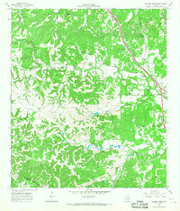 1964 Ranger Creek1968 Print · USGSCentral Kendall County is captured in the mid-sixties, showing a landscape of limestone hills and creek-fed valleys. Genealogists and researchers can trace the Southern Pacific line near Spanish Pass or locate Frederick and Lake Oz.2 unique versions available
 - 1964 Map of Turkey Knob, 1968 Print
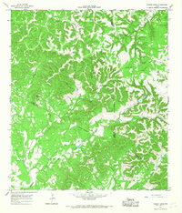 1964 Turkey Knob1968 Print · USGSThe Texas Hill Country at the triple junction of Bandera, Kerr, and Kendall Counties is captured here during the mid-sixties. Researchers can locate family landmarks such as the Polly Cem, Privilege Sch, and Rodriquez Ch among the limestone ridges.2 unique versions available
 - 1964 Map of Tarpley, 1968 Print
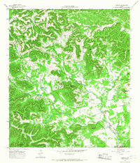 1964 Tarpley1968 Print · USGSTarpley and the surrounding ranch lands of the Texas Hill Country are captured here in the mid-1960s. Genealogists and historians can trace old homesteads and landmarks like Garrison, Tarpley Gem Spring, and family-named features such as Winans Creek.2 unique versions available
 - 1964 Map of Fall Creek, 1968 Print
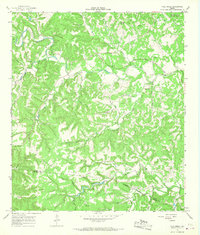 1964 Fall Creek1968 Print · USGSThe Texas Hill Country at the Kerr and Bandera county line in the mid-sixties reveals a landscape of isolated camps and family homesteads. Genealogists can locate family-named sites like Real Cem and Habecker Cem or trace the drainage of Turtle Creek and Verde Creek.2 unique versions available
 - 1964 Map of Tarpley Pass, 1968 Print
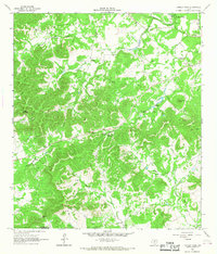 1964 Tarpley Pass1968 Print · USGSBandera and Medina counties come together in the Texas Hill Country during the mid-1960s, showing a rugged landscape of ranching and riverfront. Researchers can trace historical water sources and landmarks like Pear Tree Spring, El Paraiso Ranch, and the Tarpley Pass.3 unique versions available
 - 1964 Map of Bandera Pass, 1968 Print
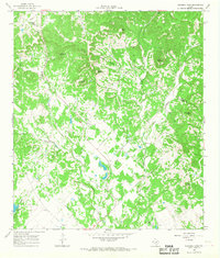 1964 Bandera Pass1968 Print · USGSThe Texas Hill Country at the Bandera and Kerr county line is shown here in the mid-1960s as a landscape of isolated summits and ranching outposts. Researchers can trace land use through features like the Purple Sage Ranch, the historic Bandera Pass, and remote family landmarks like Duffys Mtn.3 unique versions available
Showing maps 1-25 of 144
Top cities of Bandera County
Frequently asked questions
- What are the different types of historical maps available for Bandera County?
- What is the oldest map of Bandera County?
- Where can I purchase historical maps of Bandera County for my home or office?
- Where can I download high-res historical maps of Bandera County?
- Are there historical topographic maps available for Bandera County?
- Is there historical aerial imagery available for Bandera County?
- Where are historical maps of Bandera County sourced from?