Old Maps of Villa Cavazos, Brownsville for Genealogy
Trace your family roots with 10 historic maps of Villa Cavazos. These high-res maps reveal old neighborhoods, homesites, landmarks, and streets — helping you uncover where your ancestors lived and how the area evolved over time.
- Explore historic neighborhoods: Identify where your relatives may have lived in the 1800s or 1900s.
- Compare maps over time: Trace the changes in streets, buildings, and landmarks for multi-generational research.
- Perfect for genealogy & ancestry research: Used by family historians and researchers to map out lineage and migration.
These maps are an incredible resource for exploring your personal connection to Villa Cavazos's past.
Villa Cavazos, Brownsville maps
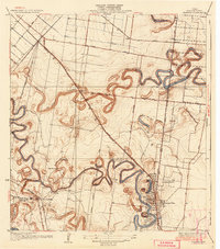
(10)- 1930 Map of Barreda
 1930 Barreda1930 Print · USGSCovers Villa Cavazos, including Brownsville, San Benito, and other nearby areas
 - 1936 Map of Barreda
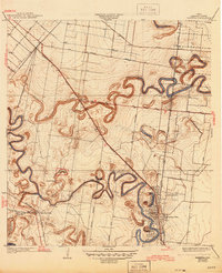
 1936 Barreda1936 Print · USGSCovers Villa Cavazos, including Brownsville, San Benito, and other nearby areas2 unique versions available
 - 1945 Map of Olmito
 1945 Olmito1945 Print · USGSCovers Villa Cavazos, including Brownsville, San Benito, and other nearby areas
 - 1953 Map of Brownsville
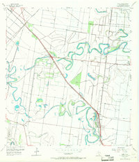
 1953 Brownsville1953 Print · USGSCovers Villa Cavazos, including Matamoros, Brownsville, and other nearby areas
 - 1956 Map of Olmito, 1957 Print
 1956 Olmito1957 Print · USGSCovers Villa Cavazos, including Brownsville, San Benito, and other nearby areas5 unique versions available
 - 1956 Map of Brownsville, 1969 Print
 1956 Brownsville1969 Print · USGSCovers Villa Cavazos, including Matamoros, Brownsville, and other nearby areas2 unique versions available
 - 1956 Map of Port Isabel, 1983 Print
 1956 Port Isabel1983 Print · USGSCovers Villa Cavazos, including Brownsville, Harlingen, and other nearby areas
 - 1962 Map of Brownsville
 1962 Brownsville1962 Print · USGSCovers Villa Cavazos, including Matamoros, Brownsville, and other nearby areas
 - 1992 Map of Harlingen
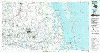 1992 Harlingen1992 Print · USGSCovers Villa Cavazos, including Brownsville, Harlingen, and other nearby areas
 - 2022 Map of Olmito, 2022 Print
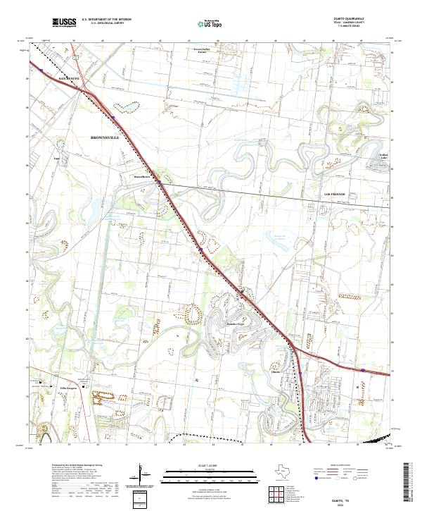 2022 Olmito2022 Print · USGSCovers Villa Cavazos, including Brownsville, San Benito, and other nearby areas
End of results
Showing maps 1-10 of 10
Top cities near Villa Cavazos
- Brownsville historical maps
- Harlingen historical maps
- San Benito historical maps
- La Feria historical maps
- Cameron Park historical maps
- Los Fresnos historical maps
See more
Frequently asked questions
- What are the different types of historical maps available for Villa Cavazos?
- What is the oldest map of Villa Cavazos?
- Where can I purchase historical maps of Villa Cavazos for my home or office?
- Where can I download high-res historical maps of Villa Cavazos?
- Are there historical topographic maps available for Villa Cavazos?
- Is there historical aerial imagery available for Villa Cavazos?
- Where are historical maps of Villa Cavazos sourced from?