Old Maps of Cameron County, Texas
Explore 112 old maps of Cameron County, spanning from 1929 to today. These high-resolution historic maps reveal how streets, neighborhoods, landmarks, and natural features evolved over time — perfect for genealogy, metal detecting, research, and local history exploration.
What you can do with these maps:
- See how Cameron County changed over time: Compare historical maps to modern-day views to trace roads, homesites, rail lines & more.
- View detailed metadata: Each map includes creators, publishers, year, scale, and archive source.
- Overlay maps with satellite & LiDAR: Visualize the past alongside modern tools to explore terrain & human change.
- Trusted historical sources: Maps sourced from the USGS, Library of Congress, and other archives.
- Access maps your way: View online, download high-res files, or order prints for personal or research use.
Start exploring old maps of Cameron County to uncover forgotten places, hidden landmarks, and the deep history beneath your feet.
Cameron County, TX maps
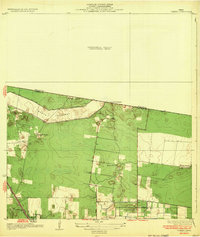
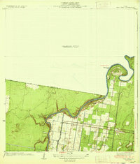
(112)- 1929 Map of Rio Hondo
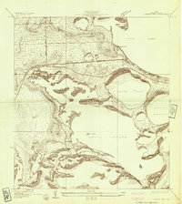
 1929 Rio Hondo1929 Print · USGSCoastal South Texas is captured here in the late twenties, showing the intricate water systems and rail lines of the Lower Rio Grande Valley. Genealogists and historians can trace local landmarks like Rio Hondo, the Mexican Christian Ch, and the San Jose Sch.
 - 1929 Map of La Coma
 1929 La Coma1929 Print · USGSThe Texas coast near Laguna Madre comes into focus in the late twenties, showing the intricate resaca systems of the Rio Grande delta. Trace early ranching and rail history through La Coma Ranch, the settlement of Abney, and the San Benito and Rio Grande Valley line.
 - 1929 Map of Palmito Hill
 1929 Palmito Hill1929 Print · USGSThe southern tip of Texas meets the gulf in the late 1920s, where the winding river forms the border with Tamaulipas. Researchers can trace the early road network and remote outposts like Palmito Ranch, Los Sauces Ranch, and the Boca Chica Highway.
 - 1929 Map of Point Isabel
 1929 Point Isabel1929 Print · USGSCoastal Texas life in the late twenties centered on the rail-to-sea connection at the tip of the Laguna Madre. Genealogists and historians can trace early infrastructure like the Plank Road on Padre Island and the Rio Grande Valley Railway depot at Point Isabel.
 - 1929 Map of Harlingen
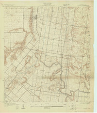
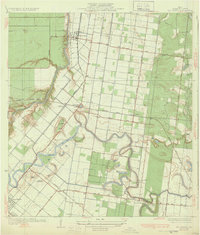
 1929 Harlingen1929 Print · USGSHarlingen and San Benito appear as thriving rail centers in the late 1920s as the Rio Grande Valley’s citrus industry took hold. Trace family roots and early farmsteads near Lake Harlingen, the Palmetal Sch, and the winding Arroyo Colorado.
 - 1929 Map of Santa Rosa
 1929 Santa Rosa1929 Print · USGSCoastal South Texas is captured here in the late twenties as the rail-driven agricultural boom reshaped the Rio Grande Valley. Researchers can trace family estates like Santa Rita Ranch or locate the Asadon Cem near the Southern Pacific RR tracks.
 - 1929 Map of Santa Maria
 1929 Santa Maria1929 Print · USGSThe Lower Rio Grande Valley in the late twenties was a hub of river-driven irrigation and ranching. Researchers can trace the layout of early pumping plants and traditional settlements like Santa Maria, Bluetown, and the remote Galveston Ranch along the river's edge.
 - 1929 Map of Buena Vista
 1929 Buena Vista1929 Print · USGSThe South Texas coast near the Laguna Madre is captured here in the late twenties, showing the region's ranching roots and tidal geography. Researchers can locate the Buena Vista Ranch and trace the original shorelines of Laguna Atascosa and the Three Islands.
 - 1929 Map of Laguna Vista
 1929 Laguna Vista1929 Print · USGSThe Cameron County coastline in the late twenties is defined by a maze of lagoons and ridges as the region began to modernize. Trace early transit routes like Vara Crossing and the Rio Grande Valley RR near Laguna Vista.
 - 1929 Map of La Feria
 1929 La Feria1929 Print · USGSThe Rio Grande Valley near the Hidalgo and Cameron County line is captured in the late twenties as a thriving rail and agricultural corridor. Genealogists can trace family roots near La Feria, Bixby, and rural schools like Wilson Sch.
 - 1929 Map of La Paloma
 1929 La Paloma1929 Print · USGSCoastal South Texas is depicted here in the late twenties as the agricultural valley relied on the irrigation of the old river resacas. Genealogists and historians can trace the early rail stops and schools like Rangerville Sch, Carricitos Siding, and the riverside village of La Paloma.
 - 1930 Map of Padre Island No. 1
 1930 Padre Island No. 11930 Print · USGSThe South Texas coast in 1930 appears as a quiet landscape of shifting sands and tidal reaches. Researchers can trace the early topography of Padre Island, the vast Laguna Madre shoreline, and the curious site of an (Abandoned Hotel).
 - 1930 Map of Los Fresnos
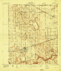
 1930 Los Fresnos1930 Print · USGSCameron County's agricultural and rail landscape is captured here in the early thirties. Genealogists can trace early homesteads near Los Fresnos or locate landmarks like the Palo Alto Battlefield Monument and White House Sch.
 - 1930 Map of West Brownsville
 1930 West Brownsville1930 Print · USGSThe Texas-Mexico border landscape is captured here in the early twentieth century as the river winds through Cameron County. Genealogists and historians can trace family-named lands like Carmen Ranch and landmarks such as Barreda Sch and the International Bridge.
 - 1930 Map of Barreda
 1930 Barreda1930 Print · USGSCoastal South Texas is seen here during the irrigation boom of the early thirties, showing the intricate oxbows and ranch lands. Researchers can trace the St Louis Brownsville and Mexico Railway past Barreda and the Old Military Road.
 - 1930 Map of La Leona
 1930 La Leona1930 Print · USGSCoastal Texas ranching and tidal waterways are frozen in time during this pre-war survey of the Rio Grande Valley. Genealogists and historians can trace the footprint of early holdings like La Leona Ranch and Los Coyotes Ranch along the Arroyo Colorado.
 - 1930 Map of Padre Island No. 2
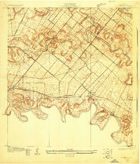
 1930 Padre Island No. 21930 Print · USGSThe Texas coast near Cameron County appears in its raw state in the early thirties, before major coastal development reached these shores. Researchers can study the primitive shoreline of Padre Island and the expansive Mud Flats bordering the Laguna Madre.
 - 1930 Map of Laguna Atascosa
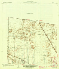
 1930 Laguna Atascosa1930 Print · USGSDeep in South Texas in the early thirties, this survey reveals a landscape of working cattle ranches and coastal lagoons. Genealogists and historians can trace family holdings like El Alazan Ranch and San Pedro Ranch or locate the old San Jose settlement.
 - 1930 Map of East Brownsville
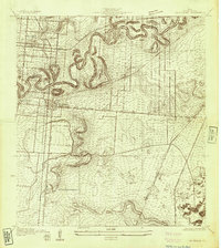
 1930 East Brownsville1930 Print · USGSBrownsville and the Rio Grande borderlands are captured here just as early flight and rail were transforming the South Texas landscape. Researchers can locate Fort Brown, trace the winding Resaca de la Palma, and find old rural schools like Jardin Sch.
 - 1932 Map of Combes
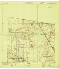
 1932 Combes1932 Print · USGSThe lower Rio Grande Valley comes into focus in the early 1930s, showing a landscape of family ranches and new flood control infrastructure. Genealogists and historians can trace the Missouri Pacific No 96 rail line through Combes and find rural landmarks like Briggs Coleman Sch and La India Ranch.2 unique versions available
 - 1932 Map of Rio Hondo
 1932 Rio Hondo1932 Print · USGSCoastal Texas ranching and rail commerce meet in the early 1930s as irrigation begins to reshape the landscape around Rio Hondo. Genealogists and historians can trace family-named landmarks and rural hubs like Las Yescas Ranch, Lozano, and the Mexican Christian Ch.3 unique versions available
 - 1932 Map of Harlingen
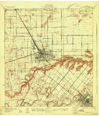
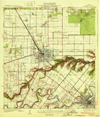 1932 Harlingen1932 Print · USGSThe Rio Grande Valley comes into focus as a bustling agricultural and rail hub in the early thirties. Trace family roots and old property lines near Harlingen, San Benito, and the Palmetal Sch along the Arroyo Colorado.3 unique versions available
 - 1933 Map of Santa Rosa
 1933 Santa Rosa1933 Print · USGSThe Rio Grande Valley landscape comes into focus in the early thirties as irrigation and flood control reshape the coastal plain. Researchers can trace the footprints of family estates like Santa Rita Ranch and the vital paths of the Missouri Pacific railroad.3 unique versions available
 - 1933 Map of Paso Real
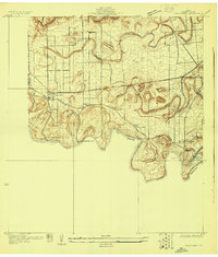
 1933 Paso Real1933 Print · USGSDeep in the Rio Grande Valley in the early 1930s, this area shows a landscape shaped by the Arroyo Colorado. Genealogists and historians can trace the Ferry at Paso Real, the Missouri Pacific railroad line, and old settlements like Fernando.2 unique versions available
 - 1934 Map of Port Isabel
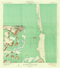 1934 Port Isabel1934 Print · USGSCoastal Cameron County in the early thirties reveals a burgeoning maritime hub at the edge of the Laguna Madre. Trace the early infrastructure of Port Isabel, from the Rio Grande Valley RR terminus to the Plank Road on Padre Island.2 unique versions available
Showing maps 1-25 of 112
Top cities of Cameron County
- Brownsville historical maps
- Harlingen historical maps
- San Benito historical maps
- La Feria historical maps
- Cameron Park historical maps
- Los Fresnos historical maps
See more
Frequently asked questions
- What are the different types of historical maps available for Cameron County?
- What is the oldest map of Cameron County?
- Where can I purchase historical maps of Cameron County for my home or office?
- Where can I download high-res historical maps of Cameron County?
- Are there historical topographic maps available for Cameron County?
- Is there historical aerial imagery available for Cameron County?
- Where are historical maps of Cameron County sourced from?