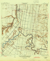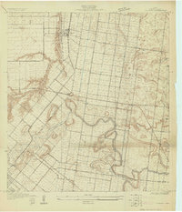
1929 Map of Rio Hondo
USGS Topo · Published 1929About this map
Rio Hondo serves as the focal point of this 1929 Cameron County survey, situated along the winding banks of the Arroyo Colorado. The landscape is defined by the intricate meanders of the Resaca Los Fresnos, illustrating the complex hydrology of the Rio Grande Valley before modern drainage systems were fully realized. This map reveals a distributed rural community connected by significant early transportation arteries, including the St Louis Brownsville and Mexico RR and the Southern Pacific RR. Small settlements and social centers such as Lozano, Lantana, and Fresnal appear alongside local educational and religious landmarks like the San Jose Ranch Sch and the Mexican Christian Ch. The survey detail captures the transition of the South Texas brushland into an irrigated agricultural network, marked by numerous smaller ranch holdings like the Las Yescas Ranch.
Find a feature on this map
27 named features on this map. Tap any name to fly to it.
Don’t see what you’re looking for? This feature index may not catch every label — zoom into the map to look around manually.
Map Details
Editions of this 1929 Rio Hondo Map
This is the sole edition of this map. No revisions or reprints were ever made.
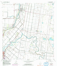
Historical Maps of Brownsville Through Time
8 maps found