Old Maps of Rusk, Texas
Explore 18 old maps of Rusk, spanning from 1943 to today. These high-resolution historic maps reveal how streets, neighborhoods, landmarks, and natural features evolved over time — perfect for genealogy, metal detecting, research, and local history exploration.
What you can do with these maps:
- See how Rusk changed over time: Compare historical maps to modern-day views to trace roads, homesites, rail lines & more.
- View detailed metadata: Each map includes creators, publishers, year, scale, and archive source.
- Overlay maps with satellite & LiDAR: Visualize the past alongside modern tools to explore terrain & human change.
- Trusted historical sources: Maps sourced from the USGS, Library of Congress, and other archives.
- Access maps your way: View online, download high-res files, or order prints for personal or research use.
Start exploring old maps of Rusk to uncover forgotten places, hidden landmarks, and the deep history beneath your feet.
Rusk, TX maps
(18)- 1943 Map of Rusk, 1961 Print
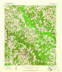 1943 Rusk1961 Print · USGSEast Texas in the early 1940s reveals a landscape of rural communities anchored by local schools and the intersection of major railroads. Trace family roots through specific landmarks like Iron Hill Sch, Earl Chapel, and the vast grounds of the State Hospital.
 - 1945 Map of Rusk
 1945 Rusk1945 Print · USGSCherokee County at the close of World War II shows a landscape deeply connected by the Southern Pacific and Missouri Pacific railroads. Researchers can trace rural life through dozens of local landmarks like Henry Cem, Bagley Chapel, and the community at Dialville.2 unique versions available
 - 1953 Map of Palestine, 1964 Print
 1953 Palestine1964 Print · USGSEast Texas was defined by its deep pine forests and burgeoning energy sector in the mid-1950s. Genealogists and historians can trace the rail-and-river economy through settlements like Tennessee Colony and Pollok or explore the early footprints of the Cayuga Oil Field and Davy Crockett National Forest.2 unique versions available
 - 1957 Map of Palestine
 1957 Palestine1957 Print · USGSEast Texas in the mid-fifties reveals a landscape of deep pine forests and winding river valleys before the era of massive reservoir construction. Researchers can trace the legacy of the timber and rail industries through labels for the Missouri Pacific RR, Davy Crockett National Forest, and Nacogdoches.
 - 1973 Map of Atoy, 1976 Print
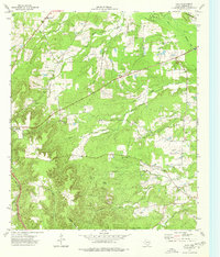 1973 Atoy1976 Print · USGSEast Texas rural life in the 1970s centers on timbered hills and quiet settlements like Atoy and Circle. Genealogists and historians can trace family locations through Walker Cem and Cornelius Cem, or locate landmarks like Jim Hogg State Park.
 - 1973 Map of Rusk, 1977 Print
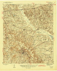
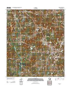
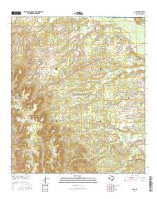
 1973 Rusk1977 Print · USGSCherokee County in the early seventies centers on the intersection of the St Louis Southwestern and Texas State Railroad. Researchers can trace old family burial sites like Ford Cem and Weems Cem or explore the vast grounds of the Rusk State Hospital.
 - 1981 Map of Palestine
 1981 Palestine1981 Print · USGSEast Texas was a crossroads of timber, rail, and energy in the early eighties, centered on the bustling junction at Palestine. Researchers can trace family roots through rural landmarks like Old Pioneer Cem, Lynch Academy, and Hudson Chapel.
 - 1984 Map of Palestine
 1984 Palestine1984 Print · USGSEast Texas in the mid-eighties reveals a landscape of massive reservoirs and protected timberlands between Palestine and Nacogdoches. Researchers can trace old routes like the Missouri Pacific RR and locate rural communities such as Tennessee Colony, Latexo, and Etoile.3 unique versions available
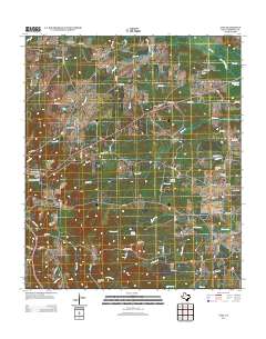
 - 2010 Map of Rusk, 2010 Print
 2010 Rusk2010 Print · USGSCovers Rusk, including Dialville, Delmer, and other nearby areas
 - 2010 Map of Atoy, 2010 Print
 2010 Atoy2010 Print · USGSCovers Rusk, including Circle, Elm Grove, and other nearby areas
 - 2013 Map of Rusk, 2013 Print
 2013 Rusk2013 Print · USGSCovers Rusk, including Dialville, Delmer, and other nearby areas
 - 2013 Map of Atoy, 2013 Print
 2013 Atoy2013 Print · USGSCovers Rusk, including Circle, Elm Grove, and other nearby areas
 - 2016 Map of Atoy, 2016 Print
 2016 Atoy2016 Print · USGSCovers Rusk, including Circle, Elm Grove, and other nearby areas
 - 2016 Map of Rusk, 2016 Print
 2016 Rusk2016 Print · USGSCovers Rusk, including Dialville, Delmer, and other nearby areas
 - 2019 Map of Rusk, 2019 Print
 2019 Rusk2019 Print · USGSCovers Rusk, including Dialville, Delmer, and other nearby areas
 - 2019 Map of Atoy, 2019 Print
 2019 Atoy2019 Print · USGSCovers Rusk, including Circle, Elm Grove, and other nearby areas
 - 2022 Map of Rusk, 2022 Print
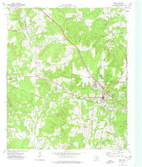
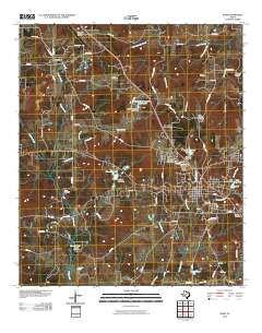
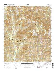
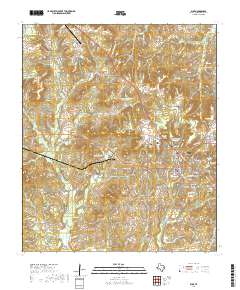
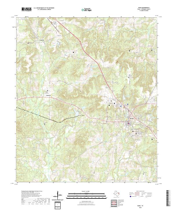 2022 Rusk2022 Print · USGSRusk and its surrounding timberlands are documented here in the early twenty-first century. Genealogists can locate family burial sites like Kilgore Family Cem and Weems Cem or trace the grounds of the State Hospital Cem.
 - 2022 Map of Atoy, 2022 Print
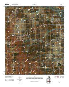
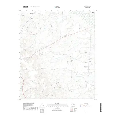
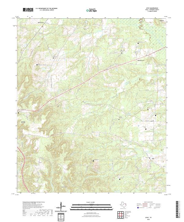 2022 Atoy2022 Print · USGSCherokee County, Texas, remains a landscape of deeply rooted rural settlements and family burial grounds in the early twenty-first century. Genealogists and local historians can trace legacy sites like Walker Cem, Meredith Cem, and the old community at Atoy.
End of results
Showing maps 1-18 of 18
Top cities near Rusk
- Jacksonville historical maps
- Alto historical maps
- New Summerfield historical maps
- Gallatin historical maps
Frequently asked questions
- What are the different types of historical maps available for Rusk?
- What is the oldest map of Rusk?
- Where can I purchase historical maps of Rusk for my home or office?
- Where can I download high-res historical maps of Rusk?
- Are there historical topographic maps available for Rusk?
- Is there historical aerial imagery available for Rusk?
- Where are historical maps of Rusk sourced from?