Old Maps of Pleasant Valley Estates, Texas for Genealogy
Trace your family roots with 12 historic maps of Pleasant Valley Estates. These high-res maps reveal old neighborhoods, homesites, landmarks, and streets — helping you uncover where your ancestors lived and how the area evolved over time.
- Explore historic neighborhoods: Identify where your relatives may have lived in the 1800s or 1900s.
- Compare maps over time: Trace the changes in streets, buildings, and landmarks for multi-generational research.
- Perfect for genealogy & ancestry research: Used by family historians and researchers to map out lineage and migration.
These maps are an incredible resource for exploring your personal connection to Pleasant Valley Estates's past.
Pleasant Valley Estates, TX maps
(12)- 1925 Map of Hunter No 3
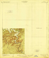
 1925 Hunter No 31925 Print · USGSThe Comal County backcountry comes into focus during the mid-twenties as the Guadalupe River winds through a complex network of creeks. Researchers can locate early homesteading landmarks such as Sattler, Fischer Store, and the route of the Blanco New Braunfels Road.
 - 1929 Map of Hunter
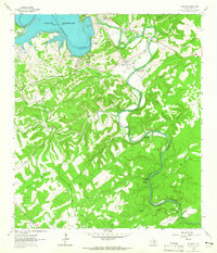
 1929 Hunter1929 Print · USGSComal County was a landscape of deep limestone valleys and winding river bends in the late twenties. Genealogists and local historians can trace the early layout of Sattler or locate family landmarks near Waco Spring and Mountain Creek.2 unique versions available
 - 1954 Map of San Antonio, 1964 Print
 1954 San Antonio1964 Print · USGSSan Antonio and the Texas Hill Country are captured here in the mid-fifties, showing a landscape defined by massive military air bases and the rising Canyon Reservoir. Trace family ties through historic rail towns like D'Hanis and Castroville or explore the Cold War footprint of Lackland AFB and Randolph AFB.3 unique versions available
 - 1957 Map of San Antonio
 1957 San Antonio1957 Print · USGSSan Antonio and the Texas Hill Country are shown here during the mid-fifties, capturing the region's expanding post-war military and transportation footprint. Genealogists and local historians can trace the early residential boundaries of Alamo Heights or locate rural landmarks like St Hedwig and Medina Lake.
 - 1963 Map of Sattler, 1965 Print
 1963 Sattler1965 Print · USGSThe Comal County backcountry underwent a massive transformation in the early sixties as the Canyon Reservoir was established along the Guadalupe River. Researchers can trace the legacy of local settlements like Sattler and Canyon City, or locate specific landmarks like the Mountain Valley Sch and Slumber Falls.4 unique versions available
 - 1985 Map of New Braunfels
 1985 New Braunfels1985 Print · USGSThe Texas Hill Country meets the growing San Antonio suburbs in the mid-1980s, showing a landscape of river-fed towns and military grounds. Trace family roots in historic Gruene or Boerne, and locate landmarks like Canyon Lake and Randolph Air Force Base.
 - 1992 Map of New Braunfels
 1992 New Braunfels1992 Print · USGSThe San Antonio and New Braunfels corridor was expanding rapidly in the early nineties, balancing heavy military presence with Hill Country recreation. Trace the footprint of CAMP BULLIS MILITARY RESERVATION or locate old railroad stops along the Southern Pacific and Missouri Pacific lines.2 unique versions available
 - 2010 Map of Sattler, 2010 Print
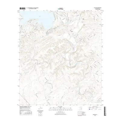
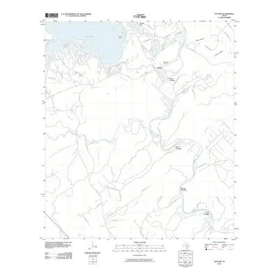 2010 Sattler2010 Print · USGSCovers Pleasant Valley Estates, including Circle S Estates, Sattler, and other nearby areas
 - 2013 Map of Sattler, 2013 Print
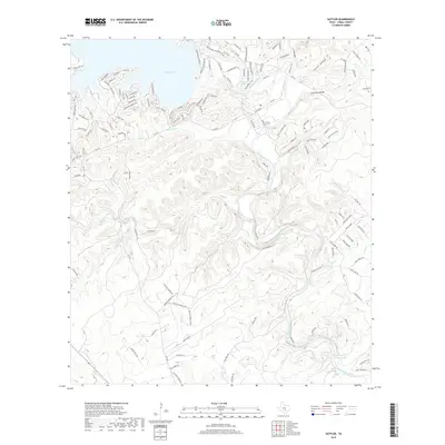
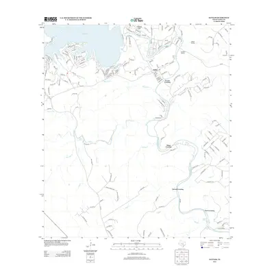 2013 Sattler2013 Print · USGSCovers Pleasant Valley Estates, including Circle S Estates, Sattler, and other nearby areas
 - 2016 Map of Sattler, 2016 Print
 2016 Sattler2016 Print · USGSCovers Pleasant Valley Estates, including Circle S Estates, Sattler, and other nearby areas
 - 2019 Map of Sattler, 2019 Print
 2019 Sattler2019 Print · USGSCovers Pleasant Valley Estates, including Circle S Estates, Sattler, and other nearby areas
 - 2022 Map of Sattler, 2022 Print
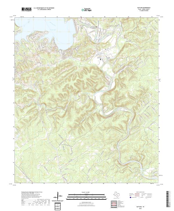 2022 Sattler2022 Print · USGSThe Guadalupe River valley and Canyon Lake shoreline are captured in this recent survey of Comal County. Genealogists can locate family sites at Nowotny Cem and Mountain Valley Cem, or trace landmarks like Hueco Springs and Slumber Falls.
End of results
Showing maps 1-12 of 12
Top cities near Pleasant Valley Estates
- San Antonio historical maps
- New Braunfels historical maps
- San Marcos historical maps
- Schertz historical maps
- Seguin historical maps
- Universal City historical maps
See more
Frequently asked questions
- What are the different types of historical maps available for Pleasant Valley Estates?
- What is the oldest map of Pleasant Valley Estates?
- Where can I purchase historical maps of Pleasant Valley Estates for my home or office?
- Where can I download high-res historical maps of Pleasant Valley Estates?
- Are there historical topographic maps available for Pleasant Valley Estates?
- Is there historical aerial imagery available for Pleasant Valley Estates?
- Where are historical maps of Pleasant Valley Estates sourced from?